Ürümqi
| Ürümqi 乌鲁木齐市 • ئۈرۈمچى شەھىرى | |
|---|---|
| Prefecture-level city | |
|
| |
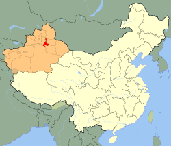 Ürümqi (red) in Xinjiang (orange) | |
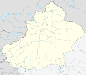 Ürümqi Location of the city centre in Xinjiang | |
| Coordinates: 43°49′30″N 87°36′00″E / 43.82500°N 87.60000°ECoordinates: 43°49′30″N 87°36′00″E / 43.82500°N 87.60000°E | |
| Country |
|
| Region | Xinjiang |
| County-level divisions | 8 |
| Government | |
| • CPC Committee Secretary | Li Xuejun |
| • Mayor | Ilham Sabir |
| Area | |
| • Prefecture-level city | 14,577 km2 (5,628 sq mi) |
| • Urban | 9,575.7 km2 (3,697.2 sq mi) |
| • Metro | 4,816.6 km2 (1,859.7 sq mi) |
| Population (2010 census) | |
| • Prefecture-level city | 3,112,559 |
| • Density | 210/km2 (550/sq mi) |
| • Urban | 3,029,372 |
| • Urban density | 320/km2 (820/sq mi) |
| • Metro | 2,988,715 |
| • Metro density | 620/km2 (1,600/sq mi) |
| Time zone |
De jure: China Standard (UTC+8) De facto: Ürümqi Time (UTC+6) |
| Postal code | 830000 |
| Area code(s) | 991 |
| License plate prefixes | 新A |
| GDP (2013) |
CNY 240 billion US $38.63 billion |
| GDP per capita |
CNY 68,691 US $11,057 |
| ISO 3166-2 | CN-65-01 |
| Website | www.urumqi.gov.cn (Chinese) |
| Ürümqi | |||||||||||||||
|
"Ürümqi" in Simplified Chinese (top), Traditional Chinese (middle), and Uighur Arabic (bottom) characters | |||||||||||||||
| Chinese name | |||||||||||||||
|---|---|---|---|---|---|---|---|---|---|---|---|---|---|---|---|
| Simplified Chinese | 乌鲁木齐 | ||||||||||||||
| Traditional Chinese | 烏魯木齊 | ||||||||||||||
| Postal | Urumtsi | ||||||||||||||
| Literal meaning | "beautiful pasture" (in Oirat) | ||||||||||||||
| |||||||||||||||
| Dihua | |||||||||||||||
| Chinese | 迪化 | ||||||||||||||
| Postal | Tihwa | ||||||||||||||
| Literal meaning | "to enlighten" | ||||||||||||||
| |||||||||||||||
| Mongolian name | |||||||||||||||
| Mongolian Cyrillic | Өрөмч | ||||||||||||||
| Mongolian script | ᠥᠷᠥᠮᠴᠢ | ||||||||||||||
| Uyghur name | |||||||||||||||
| Uyghur |
ئۈرۈمچى | ||||||||||||||
| |||||||||||||||
.svg.png)
Ürümqi (Chinese: 乌鲁木齐; pinyin: Wūlǔmùqí, Uyghur: ئۈرۈمچى; from Oirat "beautiful pasture") is the capital of the Xinjiang Uyghur Autonomous Region of the People's Republic of China[1] in Northwest China. Ürümqi was a major hub on the Silk Road during China's Tang dynasty, and developed its reputation as a leading cultural and commercial center during the Qing dynasty.
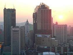
With a built-up (or metro) population of 2,988,715 as of 2010 census (6 urban and suburban districts but Dabancheng not yet urbanized) and 3.03 million in 7 urban and suburban districts,[2] Ürümqi is the largest city in China's western interior. Since the 1990s Ürümqi has developed economically and serves as a regional transport node, cultural, and commercial center.
History
Early period
Although Ürümqi is situated near the northern route of the Silk Road, the present city is a relatively young city. It was not called Urumqi until the time of the Dzungar Khanate. An older settlement was located nearby – according to Chinese scholars, during the 22nd year of Emperor Taizong's reign in the Tang dynasty, AD 648, the Tang government set up the town of Luntai in the ancient town seat of Urabo,[3] 10 kilometres (6 miles) from the southern suburb of present-day Ürümqi in the Tang dynasty's Protectorate General to Pacify the West which controlled Xinjiang. Ancient Luntai Town was a seat of local government, and collected taxes from the caravans along the northern route of the Silk Road. After the Tang retreated from the Western Regions, the region came under the control of the Uyghurs of the Khaganate and Gaochang/Qocho. Between the Tang until the Qing, there was little information about the Ürümqi area, and there appeared to be no permanent settlement here for some time. The Mongols referred to the wider area as Bishbalik meaning five cities, referring to the five towns that surrounded the present-day Ürümqi area.[4]
Dzungar period
The Oirats Dzungar tribes that formed the Dzungar Khanate were the last major power to control Ürümqi before the Manchus gained control of Xinjiang, and their language gave Ürümqi its modern-day name. In the Ming dynasty, there was a record of a place at Jiujiawan 5 kilometres (3 miles) to the west of present Ürümqi, which may have been the Dzunghar town that was later destroyed during the Qing conquest. The Mongolians also used the area as herding ground in this period.[4] Steppe peoples had used the location, the pass between the Bogda Shan to the east and the Tian Shan to the west, connecting the Dzungar Basin to the north and the Turpan Depression to the south.
Ürümqi remained a small town, and less important than the oasis and Silk Road trade center Turpan 200 km (120 mi) to the southeast. Fighting for the control of Dzungaria led to the Khoshuuts (now classified as Mongols) leaving Ürümqi for Qinghai and Tibet in the 1620s an 1630s.[5] The Uyghurs were introduced into the Ürümqi area in the 18th century by the Dzunghars who moved them from the west Tarim region to be taranchis or farmers in Ürümqi.[6]
Qing rule
In the 18th century, the Qing went to war against the Dzungar Khanate. Ürümqi was taken by the Qing in 1755, and the Dzungars of the region were eliminated in the Dzungar genocide. One writer, Wei Yuan, described the resulting desolation in what became northern Xinjiang as "an empty plain for a thousand li, with no trace of man". A fort was built (either in 1755 or 1758 depending on sources), and the Qing then established garrisons of Manchu and Mongol bannermen and Han Chinese troops at Ürümqi.[7] "After 1759 state farms were also established in the vicinity of Urumchi, where there was fertile, well-watered land and few people."[8]
The Manchus began to construct a walled city in 1763 to the south of the first fort, and it was completed in 1767.[4] The Qianlong Emperor had named the new settlement "Dihua" (Chinese: 迪化; pinyin: Díhuà; Manchu: Wen de dahabure fu), meaning "to enlighten".[9][10] In 1771, another city named Gongning Cheng (鞏寧城) was built to the northwest to house Manchu bannermen, and this would become the seat of government.[4] The bannermen settlement to the west was commonly referred to as Mancheng (滿城, Manchu City), while Dihua to the east became a Han Chinese town commonly called Hancheng (Han City).[11] The Ürümqi of the early period was therefore a twin-city, with Gongning Cheng the administrative center while Dihua grew into Xinjiang's commercial and financial center.[12]
Chinese Hui Muslims from Gansu and Shaanxi, Han Chinese from all over China began to move into Dihua.[13] By 1762, more than 500 shops had already been opened by Chinese migrants to the area of modern-day Ürümqi. Those Qing literati who visited Dihua were impressed by its cultural sophistication and similarity to eastern China. The writer Ji Xiaolan compared Dihua to Beijing, in that both had numerous wine shops which offered daily performances of Chinese music and dance.[14] The origin of Hui in Urumqi is often indicated by the names of their Mosques.[15]
The Battle of Ürümqi took place in 1870 between the Turkic Muslim forces of Yaqub Beg against the Dungan Muslim forces of Tuo Ming (Daud Khalifa). With the help of Xu Xuegong's Han Chinese militia, Yaqub Beg's forces defeated the Dungans.[16][17][18][19] Gongning Cheng was captured, its Qing administrator killed, and the city burnt to the ground and abandoned.[20] The Qing later regained control of Ürümqi. In 1884, the Guangxu Emperor established Xinjiang as a Province, with Dihua as its capital.[21]
Republican era
After the collapse of the Qing dynasty, Xinjiang was ruled from Ürümqi by a succession of warlords: Yang Zengxin (1911–1928), Jin Shuren (1928–1933), and Sheng Shicai (1933–1942), finally Zhang Zhizhong as governor of Xinjiang in 1942–1949. Of these, Yang and Zheng were considered capable rulers.[22]
During the Kumul Rebellion the Battle of Ürümqi (1933) and the Battle of Ürümqi (1933–34) took place between the forces of Ma Zhongying's 36th Division (National Revolutionary Army) and Jin Shuren and Sheng Shicai's provincial forces. At the second battle Ma was assisted by the Han Chinese General Zhang Peiyuan.
People's Republic era
Following the founding of the People's Republic of China, on 1 February 1954, the city's name was officially changed back to its Dzungar Oirat name Ürümqi, meaning "beautiful pasture" in the Oirat language of the Dzungar people.[23]
In the late 1970s, Deng Xiaoping relaxed China's tight control over Xinjiang, which led to a boom of Ürümqi from the development of oil and gas industry in Xinjiang.[24]
New, big mosques have been financially assisted in being built by the Chinese government in Urumqi.[25] While in southern Xinjiang China implements strong rules regarding religion, in Urumqi, China treats the Uyghurs and religion lax and permissively.[26]
The city suffered from a series of unrest, In May 1989, unrest in Ürümqi resulted in 150 injuries. In February 1997, bombings in Ürümqi following the Ghulja incident resulted in 20 deaths and scores of injuries.[27]
July 2009 riots and subsequent unrest
In the largest eruption of ethnic violence in China in decades, major rioting broke out in July 2009 between ethnic Han Chinese and Uyghurs. The New York Times reporter covering the riot described the violence as "clashes with riot police and Uighurs rampaging through the city and killing Han civilians. Then, for at least three days, bands of Han vigilantes roamed Urumqi, attacking and killing Uighurs."[28] Before the riot broke out, young Uighurs had marched through the city "to protest a case of judicial discrimination".[28] According to official figures, most of the 197 killed in the riot were Han, a statement disputed by Uighurs.[28][29]
Geography
The largest city in western China, Ürümqi has earned a place in the Guinness Book of Records as the most remote city from any sea in the world. It is about 2,500 kilometres (1,600 mi) from the nearest coastline as Ürümqi is the closest major city to the Eurasian pole of inaccessibility, although Karamay and Altay, both in Xinjiang, are closer.[30] The city has an administrative area of 10,989 square kilometres (4,243 sq mi) and has an average elevation of 800 metres (2,600 ft).
The location 43°40′52″N 87°19′52″E / 43.68111°N 87.33111°E in the southwestern suburbs of Ürümqi (Ürümqi County) was designated by local geography experts as the "center point of Asia" in 1992, and a monument to this effect was erected there in the 1990s. The site is a local tourist attraction.[31]
Water supply
Although surrounded by deserts (the Gurbantünggüt in the north and the Taklamakan in the south), the Ürümqi area is naturally watered by a number of small rivers flowing from the snow-capped Tian Shan mountains: the main range of the Tian Shan in south of the city (Ürümqi County), and the Bogda Shan east of the city (Dabancheng District). A network of small reservoirs and canals redistribute the water throughout the extensively irrigated area along the foothills of the mountain ranges.
As the Ürümqi region's population and economy is growing, the water demand exceeds the natural supply. To alleviate water shortages, the Irtysh–Ürümqi Canal was constructed in the first decade of the 21st century. The canal's main trunk terminates in the so-called "Reservoir 500" ("500"水库; 44°12′00″N 87°49′00″E / 44.20000°N 87.81667°E) in the far north-eastern suburbs of the city (on the border of Ürümqi's suburban Midong District and Fukang City). A new industrial area, called Ganquanbao Industrial Park (甘泉堡工业园), or Industrial New City 500 (500工业新城) was being developed in 2009, west of the reservoir, relying on it for water supply.[32][33] From the reservoir area water is further distributed over a network of canals throughout the lower Midong District.
Climate
In Ürümqi a semi-arid climate (Köppen climate classification BSk) prevails, with very large differences between summer and winter, warm summers, with a July daily average of 23.7 °C (74.7 °F), and very cold winters, with a January daily average of −12.6 °C (9.3 °F). The annual average temperature is 6.90 °C (44.4 °F). The city is semi-arid, with its summers slightly wetter than its winters, yet sunny weather is much more likely in the warmer months, and relative humidity is the lowest during summer. With monthly percent possible sunshine ranging from 30 percent in December to 70 percent in August and September, the city receives 2,523 hours of bright sunshine annually. Its annual precipitation is about 290 millimetres (11.4 in). Extremes since 1951 have ranged from −41.5 °C (−43 °F) on 27 February 1951 to 42.1 °C (108 °F) on 1 August 1973.[34][35]
| Climate data for Ürümqi | |||||||||||||
|---|---|---|---|---|---|---|---|---|---|---|---|---|---|
| Month | Jan | Feb | Mar | Apr | May | Jun | Jul | Aug | Sep | Oct | Nov | Dec | Year |
| Record high °C (°F) | 9.9 (49.8) |
13.5 (56.3) |
23.7 (74.7) |
32.5 (90.5) |
37.0 (98.6) |
40.9 (105.6) |
41.0 (105.8) |
42.1 (107.8) |
37.0 (98.6) |
30.5 (86.9) |
19.2 (66.6) |
15.6 (60.1) |
42.1 (107.8) |
| Average high °C (°F) | −7.4 (18.7) |
−4.7 (23.5) |
2.7 (36.9) |
16.1 (61) |
23.1 (73.6) |
27.6 (81.7) |
30.1 (86.2) |
29.0 (84.2) |
23.1 (73.6) |
13.2 (55.8) |
2.0 (35.6) |
−4.4 (24.1) |
12.5 (54.6) |
| Daily mean °C (°F) | −12.6 (9.3) |
−9.8 (14.4) |
−1.7 (28.9) |
10.0 (50) |
16.7 (62.1) |
21.5 (70.7) |
23.7 (74.7) |
22.4 (72.3) |
16.7 (62.1) |
7.7 (45.9) |
−2.5 (27.5) |
−9.3 (15.3) |
6.9 (44.4) |
| Average low °C (°F) | −16.6 (2.1) |
−13.7 (7.3) |
−5.4 (22.3) |
4.8 (40.6) |
11.2 (52.2) |
16.1 (61) |
18.2 (64.8) |
16.7 (62.1) |
11.2 (52.2) |
3.1 (37.6) |
−5.9 (21.4) |
−12.9 (8.8) |
2.2 (36.0) |
| Record low °C (°F) | −34.1 (−29.4) |
−41.5 (−42.7) |
−33.4 (−28.1) |
−14.9 (5.2) |
−2.4 (27.7) |
4.6 (40.3) |
8.8 (47.8) |
5.0 (41) |
−5.0 (23) |
−12.4 (9.7) |
−36.6 (−33.9) |
−38.3 (−36.9) |
−41.5 (−42.7) |
| Average precipitation mm (inches) | 10.4 (0.409) |
10.0 (0.394) |
18.5 (0.728) |
32.3 (1.272) |
38.9 (1.531) |
36.2 (1.425) |
30.4 (1.197) |
23.3 (0.917) |
26.2 (1.031) |
26.3 (1.035) |
19.1 (0.752) |
14.6 (0.575) |
286.2 (11.266) |
| Average precipitation days (≥ 0.1 mm) | 9.2 | 7.2 | 7.2 | 6.8 | 6.8 | 8.0 | 8.4 | 6.3 | 5.0 | 5.5 | 6.9 | 9.6 | 86.9 |
| Average relative humidity (%) | 78 | 77 | 72 | 48 | 43 | 43 | 43 | 41 | 44 | 58 | 74 | 78 | 58.3 |
| Mean monthly sunshine hours | 101.6 | 128.8 | 180.5 | 248.0 | 283.3 | 282.7 | 298.7 | 301.0 | 262.6 | 224.4 | 127.4 | 84.3 | 2,523.3 |
| Percent possible sunshine | 35 | 44 | 49 | 62 | 63 | 61 | 64 | 70 | 70 | 66 | 44 | 30 | 57 |
| Source: China Meteorological Administration | |||||||||||||
Air quality and pollution
According to the National Environmental Analysis released by Tsinghua University and the Asian Development Bank in January 2013, Urumqi is among the top ten cities in the world with the most air pollution. According to this report, seven of these cities are in China, including Taiyuan, Beijing, Lanzhou, Chongqing, Jinan, and Shijiazhuang (besides Ürümqi).[36]
Blacksmith Institute mentioned Urumqi in 2007 World’s Worst Polluted Places caused by air pollution along with Linfen and Lanzhou, all in China.[37] In 2008, Toronto Star listed Ürümqi as one of the Top Ten worst places to live in the world due to sulphurous pollution.[38] Heavy haze is extremely common in winter, which frequently affects air traffic. Officials believed that severe winter air pollution in Ürümqi is mainly caused by energy-heavy industries and the outdated coal-firing winter heating system.[39] According to a report by Department of Environmental Science and Engineering of Fudan University, the average PM2.5 and TSP concentrations in the winter of 2007 were 12 times higher than USA standard for PM2.5 and 3 times the National Ambient Air Quality Standard of China for TSP.[40] The sulfur dioxide from industrial emissions mixed with the local anthropogenic aerosol with the transported soil dust from outside the city was the main sources of the high concentration of sulfate, one of the main factors causing the heavy air pollution over Urumqi.[40]
Timing of sunrise
Because of the use of a single time zone for all of China, in Ürümqi which is at a far western location in China, the sun is 2 hours and 10 minutes behind China Standard Time (CST = UTC+8). During early January the sun does not rise until 09:45 and it sets between 18:45 and 19:10 local time. In September and March the sun rises around 08:00, and sets around 19:45. However, in June the sun rises at about 06:25 and does not set until 21:45.
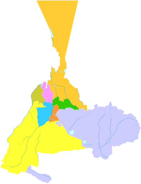
Administrative divisions
Ürümqi currently comprises 8 county-level subdivisions: 7 districts and 1 county.
| Map | ||||||||
|---|---|---|---|---|---|---|---|---|
| Name | Simplified Chinese | Hanyu Pinyin | Uyghur (UEY) | Uyghur Latin (ULY) | Population (2010)[41] | Area (km2) | Density (/km2) | |
| City proper | ||||||||
| Tianshan District | 天山区 | Tiānshān Qū | تىيانشان رايونى | Tiyanshan Rayoni | 696,277 | 171 | 4071.79 | |
| Saybagh District | 沙依巴克区 | Shāyībākè Qū | سايباغ رايونى | Saybagh Rayoni | 664,716 | 422 | 1575.15 | |
| Xinshi District | 新市区 | Xīnshì Qū | يېڭىشەھەر رايونى | Yëngisheher Rayoni | 730,307 | 143 | 5107.04 | |
| Shuimogou District | 水磨沟区 | Shuǐmògōu Qū | شۇيموگۇ رايونى | Shuymogu Rayoni | 390,943 | 92 | 4249.38 | |
| Suburban | ||||||||
| Toutunhe District | 头屯河区 | Tóutúnhé Qū | تۇدۇڭخابا رايونى | Tudungxaba Rayoni | 172,796 | 276 | 626.07 | |
| Dabancheng District | 达坂城区 | Dábǎnchéng Qū | داۋانچىڭ رايونى | Dawanching Rayoni | 40,657 | 5,188 | 7.83 | |
| Midong District | 米东区 | Mǐdōng Qū | مىدوڭ رايونى | Midong Rayoni | 333,676 | 3,594 | 92.84 | |
| Rural | ||||||||
| Ürümqi County | 乌鲁木齐县 | Wūlǔmùqí Xiàn | ئۈرۈمچى ناھىيىسى | Ürümchi Nahiyisi | 83,187 | 4,332 | 19.20 | |
Demographics
Ürümqi has been a multi-ethnic city from the time of the Qing conquest; in the early years, the Manchus lived in Gongning Cheng, Han Chinese in Dihua, and various other ethnic groups such as the Hui, Uyghurs and others in the suburban districts.[42] The Muslims settled to the south of the walled-city of Dihua, and although the walls have since been demolished, the Muslims are still concentrated there.[43] A census of in 1787 showed that there were 114,348 Hui and Han in the prefectures of Zhenxi (which included Barköl and Hami) and Ürümqi.[44] In Ürümqi city itself, there were 39,000 people in the 1880s, and by the early 20th century, 50,000 people.[42] Ürümqi in 1908 was said to have been inhabited by Uyghurs (then called Turkis), Chinese, Manchus and a few Mongols, with the Uyghurs estimated to comprise a quarter of the population.[45]
In the People's Republic era, an active program to resettle Han population in Xinjiang was initiated.[46] In 1960, there were 76,496 Uyghurs and 477,321 Han in Urumqi.[47]
According to the 2000 census, Ürümqi had 2,081,834 inhabitants, with a population density of 174.53 inhabitants/km2 (452.3 inhabitants/sq. mi.).[48]
In the 2010 census, the population was recorded as 3,112,559. Part of the increase is due to boundary changes, for example, Miquan was merged into Midong District and became part of Ürümqi in 2007.[49]
- Population by ethnicity
| Census | 2000[48] | 2010[50] | ||
|---|---|---|---|---|
| Ethnicity | Population | % | Population | % |
| Han | 1,567,562 | 75.30 | 2,331,654 | 74.91 |
| Uyghur | 266,342 | 12.79 | 387,878 | 12.46 |
| Hui | 167,148 | 8.03 | 280,186 | 9.00 |
| Kazakhs | 48,772 | 2.34 | 68,076 | 2.19 |
| Manchu | 7,682 | 0.37 | 8,541 | 0.27 |
| Mongol | 7,252 | 0.35 | 10,454 | 0.34 |
| Xibe | 3,674 | 0.18 | 4,820 | 0.15 |
| Russian | 2,603 | 0.13 | 3,010 | 0.10 |
| Tu | 1,613 | 0.08 | 2,869 | 0.09 |
| Kyrgyz | 1,436 | 0.07 | ||
| Uzbek | 1,406 | 0.07 | ||
| Zhuang | 878 | 0.04 | ||
| Tatar | 767 | 0.04 | ||
| Tibetan | 665 | 0.03 | ||
| Dongxiang | 621 | 0.03 | 2,333 | 0.07 |
| Miao | 620 | 0.03 | ||
| Korean | 588 | 0.03 | ||
| Other | 2,205 | 0.09 | 12,738 | 0.41 |
| Total | 2,081,834 | 3,112,559 | ||
Economy

Ürümqi is a major industrial center within Xinjiang. Ürümqi, together with Karamay and Korla, account for 64.5 percent of the total industrial output of Xinjiang. Ürümqi is also the largest consumer center in the region, recording ¥41.9 billion retail sales of consumer goods in 2008, an increase of 26 percent from 2007. The GDP per capita reached US$6,222 in 2008.[51] According to statistics, Urumqi ranked 7th in 2008 by the disposable income for urban residents among cities in Western China.[52] Ürümqi has been a central developmental target for the China Western Development project that the Central Government is pursuing.
The Urumqi Foreign Economic Relations and Trade Fair (Chinese: 乌洽会) has been held annually since 1991 and has been upgraded into the first China-Eurasia Expo in 2011. Its purpose is to promote domestic and foreign markets. The 17th Fair has attracted participants from the Ministry of Commerce and the China Council for Promotion of International Trade.[53]
Xinjiang Guanghui Group (新疆广汇集团) is the largest real estate enterprise and most powerful privately owned company in Xinjiang and is currently engaged in energy and automobile. China CITIC Bank Mansion (中信银行大厦), headquarters of Guanghui, located in one of the CBDs in North Xinhua Road, is the tallest building in Urumqi and Xinjiang; with a height of 229 metres, it is also the tallest in Northwestern China and Central Asia. Zhongshan Road (Sun Yat-sen Road, Chinese: 中山路) has been one of the ten most famous commercial streets in China since 2005. Zhongshan Road has always been the hub of consumer electronics in the city, with the largest computer, mobile phone and consumer electronics market in Xinjiang, including Baihuacun, Cyber Digital Plaza and Fountain Plaza.
As the economic center in Xinjiang, Urumqi has expanded its urban area since the 1990s. The CBDs in the city increased rapidly all around the major districts. Despite the old city areas being primarily in the south, the development in the north part began since the late 1980s. The completion of the new office tower for Urumqi Municipal Government in 2003 at Nanhu Square (南湖广场) in Nanhu Road marked a shift of the city center to the north. Lacking a subway, the city commenced the construction of viaducts for Outer Ring Road (外环路) since 2003, which considerably facilitates transport. Youhao Road (友好路) and surrounding neighborhood, is the commercial center for business, shopping and amusement. Youhao Group (友好集团), the namesake local enterprise, owns a major market share of retails. Maison Mode Urumqi (乌鲁木齐美美百货), open since 2008, became one of the few notable department stores for luxury merchandise in the city.[54] The Urumqi Economic and Technological Development Zone (UETD) located in the northern Toutunhe District, has been a leading base for steel, machinery manufacturing, biochemistry and other industrial innovations.
Tourism
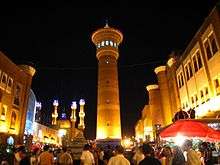
- Grand Bazaar, a bazaar on South Jiefang Road (解放南路).
- Hong Shan (Red Mountain) is the symbol of Urumqi, located in Hongshan Park.
- People's Park, south of Hongshan Park.
- Glacier No. 1 (一号冰川), origin of Urumqi River, is the largest glacier near a major city in China.
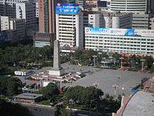
- People's Square
- Nanhu Square (南湖广场)
- Xinjiang Uygur Autonomous Region Museum (新疆维吾尔自治区博物馆), which was completely rebuilt in the early 2000s.[55]
- Heavenly Lake Scenic Area, a popular park with some of China's most famous alpine scenery, a little more than two hours outside Urumqi.
- Shuimogou Hot Springs (水磨沟温泉) is located 5 km (3.1 mi) northeast of Urumqi.
- Xinjiang Silk Road Museum (新疆丝绸之路博物馆) is located right next to the Grand Bazaar at No. 160 Shengli Road. It is located on the fourth and fifth floor of a very large European style building which houses a shopping complex as well. Most of the exhibits have English names as well and some of their guides speak some English.
- Ürümqi City Museum (乌鲁木齐博物馆) is located at South Nanhu Road 123 (南湖南路123号).
- Urumqi Tartar Mosque (乌鲁木齐塔塔尔寺清真寺) is a luxuriously furbished mosque located on Jiefang Road. The mosque is open to female and male visitors unlike other mosques. However, permission must have been obtained prior to visiting the mosque.[56]
- The monument at the Geographical Center of Asian Continent, in Yongfeng Township, Ürümqi County
- Xinjiang International Grand Bazaar in Urumqi City Tianshan District, which is currently the country's largest bazaar. The architectural style of the Grand Bazaar grand scale and very Islamic style, bazaar inside the market characteristics of ethnic minorities commodity dazzling, rich and exquisite. International Grand Bazaar in Urumqi in most ethnic customs, visitors came to Urumqi play will come to see
Education and science
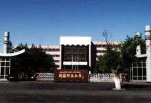
Urumqi has many educational campuses including Xinjiang University, Xinjiang Normal University, Xinjiang Agricultural University, Xinjiang Medical University and many others.
Universities
- Xinjiang University (新疆大学)
- Xinjiang Normal University (新疆师范大学)[57]
- Xinjiang Agricultural University (新疆农业大学)
- Xinjiang Arts Institute (新疆艺术学院)
- Xinjiang University of Finance and Economics (新疆财经大学)
- Ürümqi Vocational University (乌鲁木齐职业大学)
- Xinjiang Vocational and Technical Institute (新疆交通职业技术学院)
- Xinjiang Medical University (新疆医科大学)
High schools
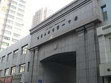
- Ürümqi No.1 High School
- Bingtuan No.2 Middle School
- Bayi Senior High School of Ürümqi
- No.70 Senior High School of Ürümqi
- No.8 Senior High School of Ürümqi
Research institutes
- Xinjiang Astronomical Observatory
- The Xingjiang Technical Institute of Physics & Chemistry.CAS
- Xingjiang Institute of Ecology and Geography.CAS
Transportation

Air
Ürümqi is served by the Ürümqi Diwopu International Airport. It is a hub for China Southern Airlines. Ürümqi Diwopu International Airport is the largest airport in Xinjiang.
Rail
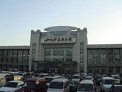
Ürümqi is Xinjiang's main rail hub with two primary railway stations, the long-standing Ürümqi South Railway Station (formerly the Urumqi Railway Station) and Ürümqi Railway Station opened in July 2016. The a high-speed rail line connects both stations, running from Ürümqi to Lanzhou which has been in operation since the end of 2014.
The city is served by several conventional rail lines. Ürümqi is the western terminus of the Lanzhou–Xinjiang (Lanxin) and Ürümqi–Dzungaria (Wuzhun) Railway, and the eastern terminus of the Northern Xinjiang (Beijiang) and the Second Ürümqi–Jinghe Railway. The Beijiang and the Lanxin Lines form part of the Trans-Eurasian Continental Railway, which runs from Rotterdam through the Alataw Pass on the Kazakhstan border to Ürümqi and on to Lanzhou and Lianyungang.
Road
Many roads to the north and west typically shut down by early October, remaining closed until the end of winter.
Metro
The Ürümqi Metro is under construction with plans submitted for 7 lines totalling 211.9 kilometres (131.7 miles) in length with an estimated cost of 31.24 billion yuan.[58]
Since 20 March 2014 Line 1 has been under construction and is expected to open in 2019. The line will connect Ürümqi Diwopu Airport through downtown Ürümqi and end at the Southern Long Distance Bus Station (南郊客运站) with a total length of 26.5 kilometres (16.5 miles) and 21 stations (16 underground, 5 elevated).[59]
Bus rapid transit
The Ürümqi BRT bus service was launched in August 2011 after an investment of 930 million yuan in an effort to improve urban traffic.[60] There are currently four routes operated, BRT1, BRT2, BRT3, and BRT5 mainly along the north-to-south downtown major roads.[61]
Media
The Xinjiang Networking Transmission Limited operates the Urumqi People's Broadcasting Station and the Xinjiang People Broadcasting Station, broadcasting in the Mandarin, Uyghur, Kazakh, Mongolian, Russian and the Kyrgyz languages.
The Xinjiang Television Station (XJTV), located in Urumqi, is the major TV broadcasting station in the Xinjiang Uyghur Autonomous Region. The local television station for Urumqi city is Urumqi Television Station (UTV)(乌鲁木齐电视台).
Sport
- Xinjiang Flying Tigers or Guanghui Flying Tigers is a major basketball team that is part of the Chinese Basketball Association, based in Ürümqi, Xinjiang. Its corporate sponsor is Xinjiang Guanghui Group
- Xinjiang Tianshan Leopard F.C. is a local football team in the China League One
China started a bandy development programme by organising educational days in Ürümqi in June 2009.[62]
In 2015 an indoor speed skating arena was opened.[63]
Twin towns and sister cities
Ürümqi is twinned with:
^1 Almaty is a state-level city of Kazakhstan
References
Citations
- ↑ "Illuminating China's Provinces, Municipalities and Autonomous Regions". PRC Central Government Official Website. Retrieved 2014-05-17.
- ↑ "GeoHive - China, Xinjiang population statistics".
- ↑ "Urumqi". Chinatoday.com.cn. 1 February 1954. Retrieved 19 February 2010.
- 1 2 3 4 Piper Rae Gaubatz (31 March 1996). Beyond the Great Wall: Urban Form and Transformation on the Chinese Frontiers. Stanford University Press. pp. 70–72. ISBN 978-0804723992.
- ↑ James A. Millward (2007). Eurasian Crossroads: A History of Xinjiang. Columbia University Press. p. 89. ISBN 978-0-231-13924-3.
- ↑ James A. Millward (2007). Eurasian Crossroads: A History of Xinjiang. Columbia University Press. pp. 92–93. ISBN 978-0-231-13924-3.
- ↑ James A. Millward (2007). Eurasian Crossroads: A History of Xinjiang. Columbia University Press. p. 99. ISBN 978-0-231-13924-3.
- ↑ Millward (2007), pp. 95, 104
- ↑ Holdstock, Nick (30 May 2015). China's Forgotten People: Xinjiang, Terror and the Chinese State. I.B.Tauris. ISBN 978-1784531409.
- ↑ Zhao, Gang (January 2006). "Reinventing China Imperial Qing Ideology and the Rise of Modern Chinese National Identity in the Early Twentieth Century". 32 (Number 1). Sage Publications: 25. doi:10.1177/0097700405282349. JSTOR 20062627. Archived (PDF) from the original on 2014-03-25. Retrieved 17 April 2014.
- ↑ Jeong Su-il. "Urumqi". The Silk Road Encyclopedia. ISBN 9781624120763.
- ↑ Millward, James A. (1998). Beyond the Pass: Economy, Ethnicity, and Empire in Qing Xinjiang, 1758-1864. Stanford University Press. pp. 131–134.
- ↑ James Millward (1 June 1998). Beyond the Pass: Economy, Ethnicity, and Empire in Qing Central Asia, 1759-1864. Stanford University Press. pp. 133–. ISBN 978-0-8047-9792-4.
- ↑ Jia, Jianfei (2011). "Whose Xinjiang? The Transition in Chinese Intellectuals' Imagination of the "New Dominion" During the Qing Dynasty". Harvard-Yenching Institute Working Paper Series.
- ↑ Millward, James A. (1998). Beyond the Pass: Economy, Ethnicity, and Empire in Qing Central Asia, 1759-1864 (illustrated ed.). Stanford University Press. p. 169. ISBN 0804729336. Retrieved 24 April 2014.
- ↑ James A. Millward (2007). Eurasian Crossroads: a history of Xinjiang. New York, NY: Columbia University Press. pp. 119–120. ISBN 0-231-13924-1. Retrieved 28 June 2010.
- ↑ Ho-dong Kim (2004). Holy War in China: the Muslim rebellion and state in Chinese Central Asia, 1864-1877. Stanford, Calif.: Stanford University Press. p. 96. ISBN 0-8047-4884-5. Retrieved 28 June 2010.
- ↑ John King Fairbank; Kwang-ching Liu; Denis Crispin Twitchett (1980). Late Ch'ing, 1800-1911. Cambridge, UK: Cambridge University Press. pp. 223–224. ISBN 0-521-22029-7. Retrieved 28 June 2010.
- ↑ Cyril E. Black; Louis Dupree; Elizabeth Endicott-West; Eden Naby (1991). The Modernization of Inner Asia. M. E. Sharpe. p. 45. ISBN 0-87332-779-9. Retrieved 28 November 2010.
- ↑ Piper Rae Gaubatz (31 March 1996). Beyond the Great Wall: Urban Form and Transformation on the Chinese Frontiers. Stanford University Press. p. 72. ISBN 978-0804723992.
- ↑ "Online Encyclopædia Britannica". Britannica.com. 31 January 2007. Retrieved 19 February 2010.
- ↑ Wiener, Calla. S. Frederick Starr, ed. Xinjiang: China's Muslim Borderland. Routledge. pp. 166–167. ISBN 9781317451372.
- ↑ "The Historical and Geographical Role of Urumchi, Capital of Chinese Central Asia." Herold J. Wiens. Annals of the Association of American Geographers, Vol. 53, No. 4 (Dec., 1963), p. 447.
- ↑ Starr, S. Frederick. Xinjiang: China's Muslim Borderland. Routledge. p. 4. ISBN 9781317451372.
- ↑ Joanne N. Smith Finley (9 September 2013). The Art of Symbolic Resistance: Uyghur Identities and Uyghur-Han Relations in Contemporary Xinjiang. BRILL. pp. 238–. ISBN 978-90-04-25678-1.
- ↑ Joanne N. Smith Finley (9 September 2013). The Art of Symbolic Resistance: Uyghur Identities and Uyghur-Han Relations in Contemporary Xinjiang. BRILL. pp. 240–. ISBN 978-90-04-25678-1.
- ↑ Gladney, Dru C. S. Frederick Starr, ed. Xinjiang: China's Muslim Borderland. Routledge. pp. 379–380. ISBN 9781317451372.
- 1 2 3 "Rumbles on the Rim of China's Empire". New York Times. 11 July 2009.
- ↑ "China's Great Game: New frontier, old foes". Financial Times. 14 October 2015.
- ↑ "Google Maps".
- ↑ "DCP: Geographic Center of Asia (visit #1)".
- ↑ 解决米东新区建设项目供水紧缺问题的方向, (Approaches to solving water supply problems for the development projects in the Midong New Area) 2009-01-13
- ↑ 高新区(新市区)甘泉堡工业园基本概况--乌鲁木齐高新技术产业开发区(新市区) (High-tech zone Ganquanbao Industrial Park Facts - Urumqi High-tech Industrial Development Zone (new city)) (Chinese), 2012-05-21
- ↑ http://cdc.cma.gov.cn/dataSetLogger.do?changeFlag=dataLogger
- ↑ "Extreme Temperatures Around the World". Retrieved 1 December 2010.
- ↑ "WEATHER & EXTREME EVENTS 7 of 10 Most Air-Polluted Cities Are in China". JAN 16, 2013. Imaginechina/Corbis. http://news.discovery.com. Retrieved 1 September 2014.
- ↑ "THE WORLD'S WORST POLLUTED PLACESThe Top Ten(of The Dirty Thirty)" (PDF). Retrieved 18 February 2012.
- ↑ "Winter in Urumqi, one of the world's most polluted cities Alison Bate". The Star. Toronto. 31 December 2008. Retrieved 18 February 2012.
- ↑ "Urumqi to invest heavily to cut air pollution - People's Daily Online". Retrieved 18 February 2012.
- 1 2 Li, Juan Li; Guoshun Zhuanga; Kan Huanga; Yanfen Lina; Chang Xua; Shulong Yub (2008). "Characteristics and sources of air-borne particulate in Urumqi, China, the upstream area of Asia dust" (PDF). Atmospheric Environment. 42: 776–787. doi:10.1016/j.atmosenv.2007.09.062. Retrieved 18 February 2012.
- ↑ "CHINA: Ürümqi / 乌鲁木齐市". City Population.
- 1 2 Piper Rae Gaubatz (31 March 1996). Beyond the Great Wall: Urban Form and Transformation on the Chinese Frontiers. Stanford University Press. pp. 73–75. ISBN 978-0804723992.
- ↑ Toops, Stanley W. S. Frederick Starr, ed. Xinjiang: China's Muslim Borderland. Routledge. p. 244. ISBN 9781317451372.
- ↑ James A. Millward (2007). Eurasian Crossroads: A History of Xinjiang. Columbia University Press. pp. 306–307. ISBN 978-0-231-13924-3.
- ↑ Louis Richard, M. Kennelly (1908). L. Richard's Comprehensive Geography of the Chinese Empire and Dependencies. p. 532.
- ↑ Wiener, Calla. S. Frederick Starr, ed. Xinjiang: China's Muslim Borderland. Routledge. pp. 168–169. ISBN 9781317451372.
- ↑ James A. Millward (2007). Eurasian Crossroads: A History of Xinjiang. Columbia University Press. p. 260. ISBN 978-0-231-13924-3.
- 1 2 2000年人口普查中国民族人口资料,民族出版社,2003/9 (ISBN 7-105-05425-5)
- ↑ "WŪLŬMÙQÍ SHÌ (Prefecture-level City)". City Population.
- ↑ 新疆维吾尔自治区人民政府人口普查领导小组办公室 (August 2012). 《新疆维吾尔自治区2010年人口普查资料》. 中国统计出版社. ISBN 978-7-5037-6516-2.
- ↑ "hktdc.com – Profiles of China Provinces, Cities and Industrial Parks". Tdctrade.com. Retrieved 19 February 2010.
- ↑ "乌鲁木齐人均可支配收入增长居西部十省第8位".
- ↑ "17th Urumqi Trade Fair opens – CCTV International". CCTV.com.
- ↑ "MAISON MODE · 美美".
- ↑ A TALE OF TWO CITIES: NEW MUSEUMS FOR YINING AND URUMQI. CHINA HERITAGE NEWSLETTER, No. 3, September 2005
- ↑ "Urumqi Tartar Mosque - Mosques in China - muslim2china.com".
- ↑ Xinjiang Normal University official website
- ↑ 刘若涵إذا سحارةليو (2012-04-20). "新疆乌鲁木齐市投资312.4亿元建设两条轨道交通". 天山网. Retrieved 2012-10-24.
- ↑ 张亚庆 (2012-09-14). "乌鲁木齐市地铁一号线沿线勘查开始招标". 天山网. Retrieved 2012-10-24.
- ↑ "NW China's Xinjiang launches BRT bus service CCTV News - CNTV English". CNTV. Retrieved 17 February 2012.
- ↑ "Urumqi BRT". chinabrt.org. Retrieved 17 February 2012.
- ↑ China on the way into the bandy family
- ↑ "Xinjiang Ice Sports Center (CHUQ) - Rink - SpeedSkatingNews".
- ↑ Yi Yanjun (2 September 2014). "Twin Towns and Sister Cities (Abroad)". Hong Shan. Archived from the original on 21 December 2015. Retrieved 21 December 2015.
Sources
- Journal article
- Owen Lattimore. (1973) "Return to China's Northern Frontier." The Geographical Journal, Vol. 139, No. 2 (Jun., 1973), pp. 233–242.
Further reading
- Zang, Xiaowei. "Ethnic variation in network composition in Ürümchi: do state policies matter?." Ethnic and Racial Studies. 2013. Volume 36, Issue 1. DOI: 10.1080/01419870.2011.644313. p. 179-198.
External links
| Wikimedia Commons has media related to Urumqi. |
| Wikivoyage has a travel guide for Ürümqi. |
|  | |