Upleta
| Upleta | |
|---|---|
| city | |
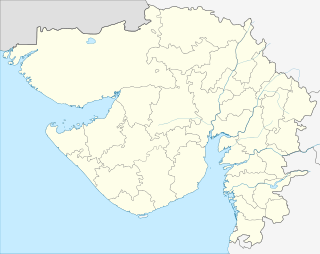 Upleta  Upleta Location in Gujarat, India | |
| Coordinates: 21°44′N 70°17′E / 21.73°N 70.28°ECoordinates: 21°44′N 70°17′E / 21.73°N 70.28°E | |
| Country |
|
| State | Gujarat |
| District | Rajkot |
| Elevation | 39 m (128 ft) |
| Population (2011)[1] | |
| • Total | 80,105 |
| Languages | |
| • Official | Gujarati, Hindi, English |
| Time zone | IST (UTC+5:30) |
| PIN | 360 490 |
| Telephone code | 2826 |
| Vehicle registration | GJ 3 |
| Website |
gujaratindia |
Upleta is a city and municipality in the Rajkot district of the state of Gujarat, India.
Geography
Upleta is located at 21°44′N 70°17′E / 21.73°N 70.28°E.[2] It is about 19 kilometres (12 mi) from Dhoraji, in the Rajkot district of Gujarat, on the banks of the Moj river. With its high fort wall, huge bastions, gates, small ghats and skyline, Upleta is quite picturesque. The Jain temple, mosque and the temple of Mojeshwar Mahadev are some of the attractions in Upleta. It is famous for its water-supply tank in old Darbargadh, because it is unique to its era. The Darbargadh is enclosed within a fortified campus.
In the middle of the city, there is a statue of Maharaja Bhagvadsinghji. This area is called "bapu na bavla chowk" ("બાપુના બાવલા ચોક").
History
Along with Gondal, Upleta is one of the major towns in Gujarat.
Demographics
As of the 2001 India census,[3] Upleta had a population of 56,354. The population is mainly a mixture of Hindus and Muslims. 51% of the population was male and 49% female. Upleta has an average literacy rate of 71%, higher than the national average of 59.5%. The male literacy rate is 76% and the female literacy rate is 65%. In Upleta, 11% of the population is under 6 years of age.
Education
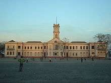
- Upleta features the Municipal College for Arts and Commerce, also known as Manchali by Students.[4]
Transport
Air
Rajkot, Keshod and Porbandar are the nearest airports.Jamnagar is also near by airport around 100 km.
Road
Residents of Upleta have easy access to a nearby highway, National Highway 8B. It connects the cities of Upleta with Rajkot, Porbandar, Jamnagar, Gondal and Jetpur. The State Transport Corporation and private bus operators provide bus services between the cities.
Railway
The Upleta railway station lies on the Wansjaliya-Jetalsar railway line that connects with Rajkot, the nearest large city. Wansjaliya railway junction is west of Upleta and connects with Porbandar, Jamnagar, Okha and Dwarka. Dhoraji railway station and Jetalsar railway junction are east of Upleta and connect with Rajkot. The railway line was metre gauge like all other tracks in Saurashtra and converted to broad gauge in 2011.
References
- ↑ http://www.censusindia.gov.in/pca/SearchDetails.aspx?Id=524098
- ↑ Falling Rain Genomics, Inc – Upleta
- ↑ "Census of India 2001: Data from the 2001 Census, including cities, villages and towns (Provisional)". Census Commission of India. Archived from the original on 2004-06-16. Retrieved 2008-11-01.
- ↑ "Upleta Municipal College". Retrieved 1 July 2013.