Una, Himachal Pradesh
This article is about the municipality in India. For its namesake district, see Una district.
| Una | |
|---|---|
| Town | |
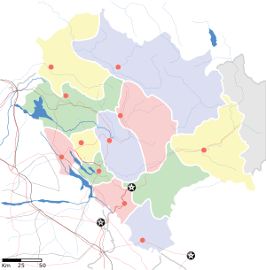 Una Location in Himachal Pradesh, India | |
| Coordinates: 31°28′05″N 76°16′16″E / 31.468°N 76.271°ECoordinates: 31°28′05″N 76°16′16″E / 31.468°N 76.271°E | |
| Country |
|
| State | Himachal Pradesh |
| District | Una |
| Elevation | 369 m (1,211 ft) |
| Population (2011) | |
| • Total | 18,722(12th) |
| Languages | |
| • Official | Hindi |
| • Other spoken | Pahari, Hindi |
| Time zone | IST (UTC+5:30) |
| Website |
hpuna |
Una is a city and a municipal council in Una district in the Indian state of Himachal Pradesh.
Geography and climate
Una is located at 31°29′N 76°17′E / 31.48°N 76.28°E.[1] It has an average elevation of 369 metres (1,210 feet).
| Climate data for Una (1985–2000) | |||||||||||||
|---|---|---|---|---|---|---|---|---|---|---|---|---|---|
| Month | Jan | Feb | Mar | Apr | May | Jun | Jul | Aug | Sep | Oct | Nov | Dec | Year |
| Record high °C (°F) | 31.0 (87.8) |
34.2 (93.6) |
39.4 (102.9) |
43.2 (109.8) |
45.2 (113.4) |
45.2 (113.4) |
42.2 (108) |
38.4 (101.1) |
38.6 (101.5) |
35.6 (96.1) |
33.4 (92.1) |
28.2 (82.8) |
45.2 (113.4) |
| Average high °C (°F) | 19.5 (67.1) |
22.2 (72) |
26.6 (79.9) |
33.2 (91.8) |
37.2 (99) |
37.8 (100) |
33.5 (92.3) |
32.4 (90.3) |
32.5 (90.5) |
30.6 (87.1) |
27.0 (80.6) |
21.9 (71.4) |
29.5 (85.1) |
| Average low °C (°F) | 4.0 (39.2) |
5.8 (42.4) |
9.6 (49.3) |
13.8 (56.8) |
18.8 (65.8) |
21.9 (71.4) |
23.0 (73.4) |
22.8 (73) |
21.0 (69.8) |
14.1 (57.4) |
8.5 (47.3) |
4.4 (39.9) |
14.0 (57.2) |
| Record low °C (°F) | −5.8 (21.6) |
−1.6 (29.1) |
3.0 (37.4) |
6.7 (44.1) |
8.6 (47.5) |
14.7 (58.5) |
17.0 (62.6) |
16.3 (61.3) |
13.4 (56.1) |
5.1 (41.2) |
1.8 (35.2) |
−2.4 (27.7) |
−5.8 (21.6) |
| Average rainfall mm (inches) | 38.9 (1.531) |
43.2 (1.701) |
43.1 (1.697) |
23.6 (0.929) |
42.0 (1.654) |
86.5 (3.406) |
397.2 (15.638) |
333.0 (13.11) |
189.7 (7.469) |
16.7 (0.657) |
14.4 (0.567) |
28.4 (1.118) |
1,256.6 (49.472) |
| Average rainy days | 2.4 | 3.8 | 3.6 | 1.4 | 3.2 | 5.1 | 11.3 | 11.5 | 5.7 | 1.1 | 1.1 | 1.5 | 51.6 |
| Source: India Meteorological Department [2][3] | |||||||||||||
Demographics
As of 2011 India census,[4] In 2011, Una had population of 5,21,789 . Town touches its border with the state of Punjab.
References
- ↑ Falling Rain Genomics, Inc - Una
- ↑ "Ahmedabad Climatological Table Period: 1985–2000". India Meteorological Department. Retrieved April 18, 2016.
- ↑ "Ever recorded Maximum and minimum temperatures up to 2010". India Meteorological Department. Archived from the original on May 21, 2013. Retrieved April 18, 2016.
- ↑ "Census of India 2001: Data from the 2001 Census, including cities, villages and towns (Provisional)". Census Commission of India. Archived from ?stad=A&state5=999 the original Check
|url=value (help) on 2004-06-16. Retrieved 2008-11-01.
This article is issued from Wikipedia - version of the 11/12/2016. The text is available under the Creative Commons Attribution/Share Alike but additional terms may apply for the media files.