Umuahia
| Umuahia Umuhu-na-Okaiuga Umuahia Ibeku | |
|---|---|
| City | |
|
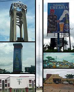
Top left: Abia tower. Mid Left: Umuahia Clock Tower. Bottom Left: Federal High Court, Umuahia. Center: BCA Radio Tower. Top Right: Star Beer sponsored welcome Billboard. Mid Right: Umuahia Market. Bottom Right: Umuahia Police Station. | |
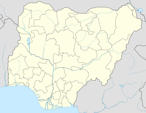 Umuahia Location in Nigeria | |
| Coordinates: 5°32′N 7°29′E / 5.533°N 7.483°E | |
| Country |
|
| State | Abia State |
| LGA | Umuahia North, Umuahia South |
| Population (2006)[1] | |
| • Total | 642,339 |
| Time zone | WAT (UTC+1) |
| Postcode | 440... |
| Area code(s) | 088 |
| Climate | Am |
Umuahia (pronounced [ʊmʊaːhiaː]) is the capital city of Abia State in southeastern Nigeria.[2][3][4] Umuahia is located along the rail road that lies between Port Harcourt to Umuahia's south and Enugu city to its north. Umuahia has a population of 359,230 according to the 2006 Nigerian census. Umuahia's indigenous ethnic group are the Igbo.
Umuahia is well known as being an agricultural market center since 1916. It is also a railway collecting point for crops such as yams, cassava, corn (maize), taro, citrus fruits, and palm oil and kernels. There are several breweries in Umuahia, and there is also a palm-oil-processing plant. Nigeria's National Root Crops Research Institute, at Umudike, is adjacent to the town. Umuahia also has several colleges including Trinity College (theological) and several hospitals.
Umuahia comprises two local government areas: Umuahia North and Umuahia South. These local governments are also composed of clans such as the Umuopara, Ibeku, Olokoro, Ubakala and Ohuhu communities. Umuahia town is traditionally owned by the Ibeku after early British administrators based the town in their lands.
History
Umuahia is a city composed of five clans who each have their own origins of how they came to settle at the place later named Umuahia. Umuahia was established by the British colonial administration of Nigeria in the early 20th century. Umuahia was declared the second capital of the short-lived nation of the Republic of Biafra on 28 September 1967 after the first capital, Enugu was captured by Nigerian troops. On June 28, 1968 Umuahia was captured by Nigerian troops during Operation OAU but was re-captured by Biafran troops on July 23 that same year. On April 22, 1969 Umuahia was occupied and nearly taken by Nigerian troops but they were forced to retreat due to a stiff offensive by Biafran Maj. E.A. Eutuk. After Umuahia's capture on 24 December 1969, the last Biafran capital before its dissolution became Owerri. The former Umuahia Local Government Area was split by Abacha led government into now three local governments; Ikwuano, Umuahia North and Umuahia South. Government college Umuahia and University of Agriculture, Umudike now fall into the domain of Ikwuano people.
See also
References
- ↑ Summing the 2 LGAs Umuahia North/South as per:
Federal Republic of Nigeria Official Gazette (15 May 2007). "Legal Notice on Publication of the Details of the Breakdown of the National and State Provisional Totals 2006 Census" (PDF). Retrieved 2010-07-01. - ↑ "The 'Gate' of Umuahia". Vanguardngr.com. Vanguard Media. 2013-10-01. Retrieved 2014-03-30.
- ↑ "The latitude and longitude gps coordinates of Umuahia (Nigeria)". The GPS Coordinates.net. Retrieved 2014-03-30.
- ↑ "ABIA State of Nigeria". USAfricaonline.com. Retrieved 2014-03-30.
External links
Coordinates: 5°32′N 07°29′E / 5.533°N 7.483°E
Capital: Umuahia | ||
| LGAs |  | |