Umtanum Ridge
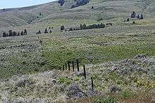

Umtanum Ridge is a long anticline mountain ridge in Yakima County and Kittitas County in the U.S. state of Washington. It runs for approximately 55 miles east-southeast from the Cascade Range, through the Yakima Training Center to the edge of the Columbia River at Priest Rapids Dam and Hanford Reach. The eastern end of Umtanum Ridge enters Hanford Reach National Monument and the Hanford Site. Umtanum Ridge is paralleled on the north by Manastash Ridge and on the south by Yakima Ridge. The Yakima River cuts through the ridge at the Umtanum Ridge Water Gap.
Umtanum Ridge is part of the Yakima Fold Belt of east-tending long ridges formed by the folding of Miocene Columbia River basalt flows.[1]
References
- ↑ Complete Report for Saddle Mountains structures, USGS Earthquake Hazards Program
External links
![]() Media related to Umtanum Ridge at Wikimedia Commons
Media related to Umtanum Ridge at Wikimedia Commons
- "Umtanum Ridge". Geographic Names Information System. United States Geological Survey.
- Umtanum Ridge, Bivouac.com
Coordinates: 46°41′7″N 120°10′50″W / 46.68528°N 120.18056°W