Umingan, Pangasinan
| Umingan | ||
|---|---|---|
| Municipality | ||
 | ||
| ||
 Map of Pangasinan showing the location of Umingan | ||
.svg.png) Umingan Location within the Philippines | ||
| Coordinates: 15°54′N 120°48′E / 15.900°N 120.800°ECoordinates: 15°54′N 120°48′E / 15.900°N 120.800°E | ||
| Country | Philippines | |
| Region | Ilocos (Region I) | |
| Province | Pangasinan | |
| District | 6th district of Pangasinan | |
| Founded | May 5, 1843 | |
| Barangays | 58 | |
| Government[1] | ||
| • Mayor | Eldred P. Tumbocon | |
| Area[2] | ||
| • Total | 258.43 km2 (99.78 sq mi) | |
| Population (2010)[3] | ||
| • Total | 67,534 | |
| • Density | 260/km2 (680/sq mi) | |
| Time zone | PST (UTC+8) | |
| ZIP code | 2443 | |
| Dialing code | 75 | |
| Income class | 1st class | |
| Website |
umingan | |

Umingan is a first-class municipality in the province of Pangasinan, Philippines. According to the 2010 census, it has a population of 67,534 people.[3]
Barangays
Umingan is politically subdivided into 58 barangays.[2]
- Abot Molina
- Alo-o
- Amaronan
- Annam (San Felipe)
- Bantug
- Baracbac
- Barat
- Buenavista
- Cabalitian
- Cabangaran
- Cabaruan
- Cabatuan
- Cadiz
- Calitlitan
- Capas
- Carayungan Sur
- Carosalesan
- Casilan
- Caurdanetaan
- Concepcion
- Decreto
- Diaz
- Del Rosario (Trienta y Siete)
- Diket
- Don Justo Abalos (Caroan)
- Don Montano (Cadamortisan)
- Esperanza
- Evangelista
- Flores
- Fulgosino
- Gonzales (Carayungan)
- La Paz
- Labuan
- Lauren
- Lubong
- Luna Weste
- Luna Este
- Mantacdang
- Maseil-seil
- Nampalcan
- Nancalabasaan
- Pangangaan
- Papallasen
- Pemienta
- Poblacion East
- Poblacion West
- Prado
- Resurreccion
- Ricos
- San Andres (Parang)
- San Juan
- San Leon
- San Pablo
- San Vicente
- Santa Maria
- Santa Rosa
- Sinabaan
- Tanggal Sawang
Demographics
| Population census of Umingan | ||
|---|---|---|
| Year | Pop. | ±% p.a. |
| 1990 | 48,003 | — |
| 1995 | 51,693 | +1.40% |
| 2000 | 58,603 | +2.73% |
| 2007 | 62,497 | +0.89% |
| 2010 | 67,534 | +2.86% |
| 2015 | 73,252 | +1.56% |
| Source: National Statistics Office[3][4] | ||
Climate
| Climate data for Umingan, Pangasinan | |||||||||||||
|---|---|---|---|---|---|---|---|---|---|---|---|---|---|
| Month | Jan | Feb | Mar | Apr | May | Jun | Jul | Aug | Sep | Oct | Nov | Dec | Year |
| Average high °C (°F) | 31 (88) |
31 (88) |
32 (90) |
34 (93) |
35 (95) |
34 (93) |
32 (90) |
32 (90) |
32 (90) |
32 (90) |
32 (90) |
31 (88) |
32.3 (90.4) |
| Average low °C (°F) | 22 (72) |
22 (72) |
22 (72) |
24 (75) |
24 (75) |
24 (75) |
24 (75) |
24 (75) |
24 (75) |
23 (73) |
23 (73) |
22 (72) |
23.2 (73.7) |
| Average precipitation mm (inches) | 13.6 (0.535) |
10.4 (0.409) |
18.2 (0.717) |
15.7 (0.618) |
178.4 (7.024) |
227.9 (8.972) |
368 (14.49) |
306.6 (12.071) |
310.6 (12.228) |
215.7 (8.492) |
70.3 (2.768) |
31.1 (1.224) |
1,766.5 (69.548) |
| Average rainy days | 3 | 2 | 2 | 4 | 14 | 16 | 23 | 21 | 24 | 15 | 10 | 6 | 140 |
| Source: World Weather Online[5] | |||||||||||||
Local government
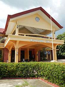
Umingan Town Hall
Elected officials June 30, 2013 - June 30, 2016:
- Mayor: Eldred P. Tumbocon, CE-GE
- Vice-Mayor: Alain P. Rabang
- Councilors:
- Emil Tristan T. Trinidad
- Michael Carleone M. Cruz
- Pillar O. Onia
- Troy P. Rabang
- Neil B. Andaya
- Welly B. Navalta
- Sian Liandro M. Fernandez
- Daneking A. Noble
- ABC President: Cesario B. Galleguez
- SK Federated President: Raisa M. Tumbocon
Education
Elementary schools
Government elementary schools:
|
Private:
|
Secondary schools
Government High Schools:
|
Private:
|
Tertiary schools
Private institutions:
- Hope of Melbourne School of Arts and Trade Foundation, Inc.
- Sta. Catalina College of Science and Technology
One Town, One Product
Kalabasa
References
- ↑ "Official City/Municipal 2013 Election Results". Intramuros, Manila, Philippines: Commission on Elections (COMELEC). 1 July 2013. Retrieved 9 September 2013.
- 1 2 "Province: PANGASINAN". PSGC Interactive. Makati City, Philippines: National Statistical Coordination Board. Retrieved 26 November 2012.
- 1 2 3 "Total Population by Province, City, Municipality and Barangay: as of May 1, 2010" (PDF). 2010 Census of Population and Housing. National Statistics Office. Retrieved 26 November 2012.
- ↑ "Province of Pangasinan". Municipality Population Data. LWUA Research Division. Retrieved 9 September 2013.
- ↑ "Umingan, Pangasinan: Average Temperatures and Rainfall". World Weather Online. Retrieved 31 October 2015.
External links
| Wikimedia Commons has media related to Umingan, Pangasinan. |
- Umingan Website
- Philippine Standard Geographic Code
- Philippine Census Information
- Local Governance Performance Management System
 |
San Quintin | Carranglan, Nueva Ecija | | |
| Balungao | |
Lupao, Nueva Ecija | ||
| ||||
| | ||||
| Cuyapo, Nueva Ecija | Talugtug, Nueva Ecija |
Lingayen (capital) | |
| Municipalities |
|
| Component cities | |
| Independent component city |
|
| Barangays | |
This article is issued from Wikipedia - version of the 9/13/2016. The text is available under the Creative Commons Attribution/Share Alike but additional terms may apply for the media files.