Ukhrul district
| Ukhrul | |
|---|---|
| district | |
|
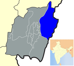
Location of Ukhrul district in Manipur | |
| Coordinates: 25°07′00″N 94°22′00″E / 25.11667°N 94.36667°ECoordinates: 25°07′00″N 94°22′00″E / 25.11667°N 94.36667°E | |
| Country |
|
| State | Manipur |
| Headquarters | Ukhrul |
| Area | |
| • Total | 4,544 km2 (1,754 sq mi) |
| Area rank | 2 |
| Population (2011)[1] | |
| • Total | 183,115 |
| • Rank | 7 |
| • Density | 40/km2 (100/sq mi) |
| Languages | |
| • Official | Tangkhul Naga (Naga) |
| Time zone | IST (UTC+5:30) |
| Vehicle registration | MN |
| Website |
manipur |
Ukhrul (Pron:/ˈuːkˌɹəl or ˈuːkˌɹʊl/) is a district in the north eastern state of Manipur in India. It lies about 84 kilometres (52 mi) north east of Imphal.
History
It was marked out first as a Sub-Division in 1919 during the British Raj. It was later upgraded to a full-fledged district, bearing the nomenclature of Manipur East District in November 1969 by the Government of India.
Linguistically, the Tangkhuls belong to a large language family called Sino-Tibetan, within that family to the sub-family Tibeto-Burman. In general this points towards an origin in the north, that is south-west China and Tibet. The earliest home of the Tangkhuls was the upper reaches of Huang heo and Yangtze Rivers which lies in the Zinjiang province of China. Like the other desert areas of the world, the people including the Tangkhuls, due to hardship of life, dispersed from this place to different directions. One group moved towards east and southeast to be become known as Chinese, another group moved southward to become the tribes of Tibeto-Burman which includes the Tangkhuls and other tribes. That was between c, 10,000 B.C. to 8000 B.C. This movement has continued into recent historic times. S.K. Chatterjee noted that from 2000 B.C. onwards, Sino-Tibetan speakers from China pushed south and west and entered India. According to W.I. Singh, in his “The History of Manipur”, the Tangkhuls settled in Samshok (Thuangdut) area in Myanmar. They belong to Yakkha tribe in China. The Tangkhuls were first noticed in Manipur by Poireiton, one of the earliest kings of a principality in Manipur valley.
The Tangkhuls as also other Naga tribes came to Manipur, Nagaland, Assam and Arunachal Pradesh through Myanmar . Some of them also settled down in Myanmar and did not venture further. However, their movement over Myanmar and into India was spread over a period of time. They entered the present habitat in waves following one another and in some cases in close succession. The Tangkhuls came together with the Maos, Poumeis, Marams and Thangals because all of them have references to their dispersal from Makhel a Mao village in Senapati district. They had also erected megaliths at Makhel in memory of their having dispersed from there to various directions.
The Tangkhuls point out to the association of their forefathers with the seashore. Most of the ornaments of the Tangkhuls such as kongsang, huishon, etc. were made of sea shells, cowrie and conch shells a prominent feature of the people who live on the shore.
By the 2nd century AD the Tangkhuls were living in Samshok (Thuangdut) in Myanmar. Ptolemy, a Greek astronomer and geographer of Alexandria in his Geography of Further India c. 140 AD, referred to the Tangkhul (Nangalogue) at Triglypton (Thuangdut). The Tangkhuls began disperse from Samshok after the invasion of Ko-lo-feng and his successor I-mau-shun the king of Nan-chao in the closing part of the 8th century AD and beginning of the 9th century AD. They were further driven towards the north-west of Myanmar by the Shan people.
Thus, the Tangkhuls as also other Naga tribes have travelled from China to Myanmar, and from there finally they came into their present land traversing through innumerable snow-covered landscapes, mountains and wild forests confronting wild beasts and wild tribes. The exodus of the Tangkhuls from China to Myanmar and finally to India is indeed a story of heroism of human migration, courage and endurance. In course of time every Tangkhul village became a small republic like the Greek city states. Every village had an unwritten constitution made up of age-old conventions and traditions. The Tangkhul villages were self-sufficient except for salt, and self-governing units ruled by hereditary or elected chief assisted by a Council of Elders. The chief was a judge, administrated and commander rolled into one. However, absence of a national government was disastrous for them in the mediaeval period as the small village states were unable to withstand the onslaught of the organised army invasion like Khagi ( Chinese ) , Awa ( Burmese ) etc. Kangleipak King or Meetei King always protects its people from foreign invasion. Some example of historic event like during the reign of King Telheiba 1335-1355 AD protected from Khagi Army (Chinese) and Awa Army (Burmese) invasion. During the reign of King Khagemba 1596-1651 AD of Kangleipak Kingdom, he just not only protected Chinese invasion but even defeated and conquer a Chinese Chieftain rule town somewhere in present Yunan provinces of China.
The ancient Tangkhul history is hitherto an unrecorded past. History however became more enlightened by the beginning of the 13th century owing to the cultural, trade and sometimes turbulent relations which had grown up with the people of the valley. We find a reference to the Tangkhuls as early as the 13th century during the reign of Thawanthaba (1195-1231 AD) of Kangleipak Kingdom. The chronicles refer to the punishment in some hill tribe villages for not giving their protection tax to their King. Most severe punishment for cutting down tree unnecessarily. The Kangleipak King had a strict rule against deforestation. For example a law say if u cut a tree u have to plant a tree somewhere around. The Meetei believed that cutting down excess tree cause flood in valley and landslide in hills area country road which make the army patrol team difficult to keep an eye of protection for their capital kingdom within the nine mountain ranges. The particular villages chief have to pay the price as a punishment for disturbing the mother nature if he was find guilty in trail. Even in many a case the hierarchy Chieftain Hood position was alter with their sibling if a particular Village Chief act against the King order. So there was a growth of anti Meetei sentiment since early days. A historical proof of separatist rebellion when King Tabungba 1359-1394 was assassinated by Chingdai village Chieftain while he was there for taking direct consent from the village chief for not showing up in religious ancestral festival of Mera Hou Chongba for Kangleicha (People of Kangleipak). It was well known that Chingdai village chief wife (Daughter of Chingsong Village chief) was a childhood lover of King Tabungba while they were young, before he take the throne in 1359.
There has always been some form of relationship between the Tangkhuls and the Meiteis in terms of political alliance and trade relation. Some items of Hao (Highlander of Kangleipak Kingdom) material - culture indicate a long history of contact between the plain and hills. The “Elephant Cloth” (Leirungphi), for instance, resplendent with complex animal designs, worn by the Hao of Manipur, has its origin in the wish of the ruler of Manipur in the mid-seventeenth to present his villages chief with a special cloth. The popular Tangkhul shawl “Changkhom” is also known as “Karaophi” in Manipur. The Tangkhul dance (pheichak) was known as “Chingkheirol” in Manipur, from the fact that it came from “Chingkhei” (North East of Imphal).
During the reign of the most powerful Meitei King Pamheiba a.k.a. Garib Nawaz (1709–1748) for the first time, the heartland rebellion area of the Tangkhul villages was brought under peace. In 1716, the king’s forces invaded the great Tangkhul village of Hundung and sixty eight prisoners were captured. In 1733, the king sent a military expedition to Ukhrul to destroy the rebellion force. The outcome of the expeditions incurred heavy casualty on the King’s forces; the royal chronicles record the death of seventy Meitei soldiers. The Ningek inscription of king Garib Nawaz refers to the Khullakpa of Okhrul (Ukhrul). Ukhrul was the headquarters of the Tangkhul Long (Tangkhul Assembly), as well as the Tangkhul annual fair locally known as “Leh Khangapha” used to be held at Somsai in Ukhrul. More significant relationship between the hills and the valley took place during the reign of Bhagyachandra (1759–1762 and 1763–1798). In 1779 king Bhagyachandra established a new capital at Langthabal about seven kilometers south east of Imphal. For the next¤ 17 years Langthabal remained as the capital. He employed many Tangkhul and Kabui Nagas in the digging of moats around the new capital of Langthabal. Of the Tangkhul chiefs, Khullakpa of Hundung and Ukhrul made friendship with the king.
The relationship between the Tangkhuls and the Meiteis during the mediaeval period was not only of wars and conquests. They also carried on trade and commerce. The Tangkhuls supplied cotton to the valley. They also came and did sale and purchased in the Sanakeithel which was the principal market in Imphal. The Tangkhuls ¤used Manipuri coin of bell-metal locally called ‘sel’ as a medium of exchange which was first introduced during the reign of Khagemba (1597–1652). The boundary of Manipur and Burma ( Myanmar ) was laid down by an agreement signed between the British authorities (East India Company) and Burma on 9 January 1834 on the river bank of Nighthee ( Chindwin). The Article No.4 (iii) of this agreement relates to the Tangkhul villages. In the period of 2nd world war, Ukhrul area also affected by war. gnanpeeth awardee recorded about this area that (in 1950 decade) highway between imphal and ukhrul partially demolished, hill areas in ukhrul are with signs of war attacks. people and their hearts also seem to be wounded out of war".[2] “Fourth (iii) - On the north, the line of boundary will begin at the foot of the same hills at the northern extremity of the Kabo Valley and pass due north up to the first range of hills, east of that upon which stand the villages of Chortor (Choithar), Noongbee (Nungbi), Nonghar (Nunghar), of the tribe called by the Munepooriis (Manipuris) Loohooppa (Tangkhul), and by the Burmahs Lagwensoung, now tributary of Manipoor.” As a result of this boundary demarcation without the knowledge let alone consent of the Tangkhuls, many Tangkhul village situated in Somrah hills are include under Burma . Later, when India and Burma attained national independence, the Tangkhuls found themselves totally dismembered belonging to two different countries.
Geography
Ukhrul as a town not only stands for administrative headquarters but it is also a place where all the traditional institutions of the Tangkhuls are located. The Town is home to about 75000 people from all works of life.
Sihai ¤Phangrei is another ideal spot for nature lovers.
Flora and fauna
Ukhrul District is best known for the Shirui Lily, (Lilium mackliniae Sealy), which is found in its natural habitat on the peak of Shirui Kashong, some 18 km east of the district headquarters, and khangkhui Mangsor cave which lies 16 kilometer away from the Town.
Divisions
The district now has five Sub-Divisions which are co-terminous with the five Development Blocks. In addition to these administrative units the district has four Sub-Deputy Collectors Offices.[3]
Transport
The district headquarters, Ukhrul, is linked with Imphal, the state capital by national highway 150. The national highway No. 150 also links Ukhrul with Kohima via Jessami. It has the distinction of being the highest hill station of Manipur. Besides the national highway 150 there are many district road and village road amongst them, Ukhrul-Kamjong, and Ukhrul-Phungyar Road are the main metalled Road of the district. The Tampak-Ngashan (Mahadev)- Pfutsero road connects the western part of the district with the district headquarters.
Demographics
According to the 2011 census Ukhrul district has a population of 183,115,[4] roughly equal to the nation of Sao Tome and Principe.[5] This gives it a ranking of 593rd in India (out of a total of 640).[4] The district has a population density of 40 inhabitants per square kilometre (100/sq mi) .[4] Its population growth rate over the decade 2001-2011 was 30.07%.[4] Ukhrul has a sex ratio of 948 females for every 1000 males,[4] and a literacy rate of 81.87%.[4]
The Tangkhul form the majority ethnic group in this district. According to oral tribal legend whenever a robust strong, fair child is born in a Meitei family the elders of the family praise god for sending a Tangkhul in the family. This legend is strongly supported by the cultural relation of the Meetei and the Tangkhul. Though the district has not seen much developmental works so far the place has produces many famous personalities of Manipur, the district is the home town to two Manipuri chief ministers, namely Yangmaso Shaiza and Rishang Keishing. It is also the home town of the first Indian ambassador from the north-east region, Mr. Bob Khathing. The district has also produced the first vice Chancellor from the North-East, Prof. Darlando Khathing, presently the VC of Central University of Jharkhand. The district has also produced the first IAS and IFS officers of the state – Christianson Chibber and PrimRose R Sharma. Besides Ameising Luikham, who is an IAS officer from the hill district of the state, Dr. Pam Shaiza, the first lady tribal doctor, and Mr. Siraphui Marinao, the first tribal engineer of the state, also hail from Ukhrul.
Ukhrul district is the home of the Tangkhuls. They are a highly cultured people. The name Tangkhul was given to them by their neighbours, the Meiteis. The northern Tangkhuls were also called the Luhupas.
Languages
Culture
Places of interest
Besides the Shirui Lily, the district is known for many natural wonders like the Khangkhui Mangsor, Mova (cave) which is one of the oldest archeological cave of India. Ukhrul town the headquarters of the district has also many scenic places like the Duncan park, the Japanese pond, Elshadai park, at the southern part of the town, about Twenty two (22) km lies the majestic Phangrei (bone of contention between two villages)which is an ideal picnic spot. The district is also home to many waterfalls, of which Khayang waterfall, which is about 20 km from Ukhrul, is very famous. There is also another famous picnic spot for youngsters called KNC river (Khangkhui, Nungshong Choithar); near the large river there was a different attractive spot for people coming for picnic. In past days this spot was called Saibai Kong; the title was given by Choithar Headman during kingship period.
Ukhrul is also a tourist hot spot of Manipur state. It is known for its hospitality and festivals. Almost every month one finds festival being celebrated by different villages and towns. The chief festivals of the Tangkhuls are, Luira (seed sowing festival) Mangkhap (resting feast) Thisham (feast for the departed) and thareo (harvest festival). Longpi village is known for its authentic Tangkhul cuisine during the Luira festival. While Ringui village is known for its celebration of Luira Festival, during the festival the village comes alive with the traditional dances (bridal dance, parade of the virgin dance, festive dance and war dance) and songs. The famous War dances is performed during this festival. Ringui village is also known for production of films, music and plays of the Tangkhuls.
Education
In the earlier days when education was sparse and primitive, Ukhrul was a well sought after place for the different tribe of the North East. The first school was set up by the then missionary Rev. William Pettigrew in 1896. Since then, not only has the place increase in the number of schools and colleges but it has produce many scholars and professionals in various fields. Mention may be made that the first tribal from the north east to teach in the prestigious Delhi University hails from the district (Prof. Horam). Today with more than 90% literate population. Ukhrul is considered as the most educated town of the state next to the capital city Imphal. Some of the well known schools of the town are: Sacred Heart Higher Secondary School, Alice Christian Higher Secondary School,Ktl Excel Higher Secondary School, Little Angels School, Savio School, Blesso Montessori School, Holy Spirit School, Patkai Academy, Juniors Academy, Sentinel College, Saint John School and Pettigrew college, Kendriya Vidyalaya and jawahar Lal Novadaya Vidyalaya
Though the Tangkhuls are highly educated community, hardly have they abandon the traditional way of life. In many village to the delights of the tourist one still sees the enchanting traditional lives of the past. The highest cultural and judicial institution of the tangkhuls is the Tangkhul Naga Long which was established in the year 1929 under the name all Tangkhul students conference. Realising the need of an organization that covers the whole community the organisation was changed to the Tangkhul Long in 1936. To this day all the disputes within the community is settled through the court of the LONG (organisation).
References
- ↑ "Ukhrul District". OurVillageIndia.com.
- ↑ Janavahini(preface):Birendra Kumar Bhattacharya:sahitya akademy press:1983
- ↑ "Administrative Setup". Ukhrul District of Manipur.
- 1 2 3 4 5 6 "District Census 2011". Census2011.co.in. 2011. Retrieved 2011-09-30.
- ↑ US Directorate of Intelligence. "Country Comparison:Population". Retrieved 2011-10-01.
Sao Tome and Principe 179,506 July 2011 est.
External links
- Ukhrul District of Manipur
- Ukhrul, India Page at Falling Rain Genomics
 |
Phek district, Nagaland | | ||
| Senapati district | |
Myanmar | ||
| ||||
| | ||||
| Thoubal district | Chandel district |