Uintah Basin
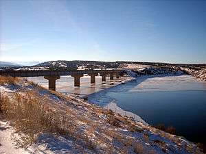
The Uinta Basin (sometimes misspelled Uintah Basin, is a physiographic section of the larger Colorado Plateaus province, which in turn is part of the larger Intermontane Plateaus physiographic division.[1] It is also a geologic structural basin in eastern Utah, east of the Wasatch Mountains and south of the Uinta Mountains. The Uinta Basin is fed by creeks and rivers flowing south from the Uinta Mountains. Many of the principal rivers (Strawberry River, Currant Creek, Rock Creek, Lake Fork River, and Uinta River) flow into the Duchesne River which feeds the Green River—a tributary of the Colorado River. The Uinta Mountains forms the northern border of the Uinta Basin. They contain the highest point in Utah, Kings Peak, with a summit 13,528 feet (4123 metres) above sea level. The climate of the Uinta Basin is semi-arid, with occasionally severe winter cold.
History
Father Escalante's expedition visited the Uinta Basin in September 1776. The Northern Ute Indian Reservation was established in 1861 by presidential decree. The United States opened the reservation for homesteading by non-Native Americans in 1905. During the early decades of the twentieth century, both Native and non-Native irrigation systems were constructed—the Uinta Indian Irrigation Project, the Moon Lake Project, and the Central Utah Project.
Communities
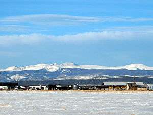
The largest community in the Utah part of the Uinta Basin is Vernal. According to the U.S. Census, the community's population in 2010 was 9,089. Other communities in the Utah part of the region include Duchesne, Roosevelt, Altamont, Tabiona, and a number of small unincorporated communities. The Uinta Basin is also the location of the Uintah and Ouray Indian Reservation, home to the Ute Tribe of the Uinta and Ouray Agency (also known as the Northern Ute Tribe). The Ute Tribe is the source of Utah's state name.
Local attractions include Dinosaur National Monument, Starvation Reservoir State Park, Flaming Gorge National Recreation Area, Raven Ridge and Fantasy Canyon.
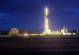
The local economy, once based on agriculture and mining, has diversified, and energy extraction and tourism are now major industries as well. In order to move oil out of the region, a new railroad is proposed to be constructed into the basin. In addition, Utah State University operates Branch campuses at Vernal and Roosevelt, expanding educational opportunities in a previously underserved region of Utah.
Physiography
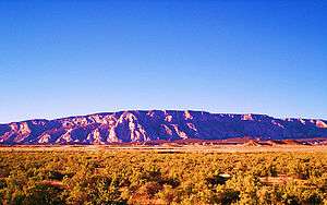
The Uintah Basin is the most northerly section of the Colorado Plateau sections. The basin is 5,000 to 10,000 ft (1500 to 3000 metres) above sea level and corresponding to this depression is a broad east-west strip of higher plateau that rises sharply above the denuded country to the south. On the south side of the plateau the descent of 3,000 ft (900 metres), to the general level of eastern Utah on the south, is made in two steps. The first is the Roan Cliffs and the second, the Book Cliffs. Eastward in Colorado the two lines of cliffs are poorly distinguished. The Green River flows southward out of the Uinta Mountains to the north, crossing the Uintah Basin, and flows in a 5,000 ft (1500 metre) deep gorge known as Desolation Canyon. The Colorado River crosses the eastern portion of this section, cutting off an area of some 40 miles (64 kilometres) in diameter in which are preserved fragments of a lofty lava cap forming Grand Mesa and Battlement Mesa.[2]
Geology
The Uintah Basin forms a geologic structural basin, and is the source of commercial oil and gas production.
See also
References
- ↑ "Physiographic divisions of the conterminous U. S.". U.S. Geological Survey. Retrieved 2007-12-06.
- ↑ Leighty, Dr. Robert D. (2001). "Colorado Plateau Physiographic Province". Contract Report. Defense Advanced Research Projects Agency (DOD) Information Sciences Office. Retrieved 2007-12-25.
Informational Links
- Utah -- Place. Population, Housing Units, Area, and Density: 2000. U.S. Census Bureau
- Utah History to Go
- The Uintah Basin Standard
- Utah State University, Uintah Basin Campus
- Uintah Basin Businesses
- "Uinta Basin". Geographic Names Information System. United States Geological Survey. Retrieved 2012-12-24.
Subfields of physical geography | ||
|---|---|---|
 | ||

Coordinates: 40°13′30″N 109°32′32″W / 40.22500°N 109.54222°W