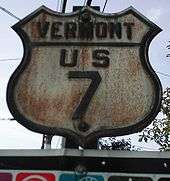
U.S. Route 7 in Vermont
| ||||
|---|---|---|---|---|
| Ethan Allen Highway[1] | ||||
|
Map of Vermont with US 7 highlighted in red | ||||
| Route information | ||||
| Maintained by VTrans | ||||
| Length: | 176.328 mi[2] (283.772 km) | |||
| Existed: | 1926[3] – present | |||
| Major junctions | ||||
| South end: |
| |||
| ||||
| North end: |
| |||
| Location | ||||
| Counties: | Bennington, Rutland, Addison, Chittenden, Franklin | |||
| Highway system | ||||
| ||||


U.S. Route 7 (US 7) is a north–south highway extending from southern Connecticut to the northernmost part of Vermont. In Vermont, the route extends for 176 miles (283 km) along the western side of the state as a mostly two-lane rural road with a few short expressway sections. US 7 is known as the Ethan Allen Highway for its entire length through the state.[1] US 7 ends at an interchange with Interstate 89 (I-89) in the town of Highgate, just south of the Canadian border. I-89 continues to the border crossing.
Route description
US 7 crosses the Massachusetts–Vermont state line at Pownal, from where the road heads north to Bennington as a rural two-lane highway. Just north of downtown Bennington, the highway transitions into a limited-access highway. For 3 miles (4.8 km), US 7 is a true expressway with divided carriageways and multiple lanes. The road subsequently narrows down to an undivided two-lane freeway; however, many stretches have passing lanes. This continues to a point just north of Manchester, where US 7 reverts to a surface road.
Most of US 7 between Manchester and the Canadian border is an undivided, uncontrolled road varying in width from two to four lanes. Two divided highway sections also exist: a 10-mile (16 km) section south of Rutland, and a 3-mile (4.8 km) stretch with numerous traffic signals between Shelburne and South Burlington known as Shelburne Road. There is overhead signage at the junction with I-189 in South Burlington that directs northbound trucks onto I-189. While US 7 heads directly into Burlington, I-189 bypasses the city to the south and east and leads directly to I-89, which runs close to US 7 north of Winooski.
Near downtown Burlington, US 7 intersects with US 2; the latter route joins US 7 for more than 9 miles (14 km) to Colchester. From here, US 7 and I-89 run through northern Vermont to Highgate, where US 7 ends at the northernmost exit on I-89.
History
US 7 was assigned in 1926.[3]
Future

A freeway is being built to the north and east of Bennington. Once complete, US 7 will utilize this new bypass.
Major intersections
| County | Location[2] | mi[2] | km | Exit | Destinations | Notes | |
|---|---|---|---|---|---|---|---|
| Bennington | Pownal | 0.000 | 0.000 | Massachusetts state line | |||
| 1.863 | 2.998 | Eastern terminus of VT 346 | |||||
| Bennington | 10.957 | 17.634 | |||||
| 12.140 | 19.537 | Southern terminus of VT 7A | |||||
| 12.236 | 19.692 | South end of freeway section | |||||
| 13.153 | 21.168 | 1 | Vermont Welcome Center in middle of interchange, brief overlap with VT 279 on outer ramps | ||||
| 14.393 | 23.163 | 2 | |||||
| Sunderland | 24.224 | 38.985 | 3 | Eastern terminus of VT 313 | |||
| Manchester | 34.501 | 55.524 | 4 | ||||
| North end of freeway section | |||||||
| Dorset | 38.897 | 62.599 | Northern terminus of VT 7A | ||||
| Rutland | Wallingford | 56.165 | 90.389 | ||||
| 57.054 | 91.820 | Southern terminus of VT 7B | |||||
| Clarendon | 58.581 | 94.277 | Southern terminus of US 7 / VT 7B overlap | ||||
| 59.297 | 95.429 | Northern terminus of US 7 / VT 7B overlap | |||||
| 61.169 | 98.442 | Northern terminus of VT 103 | |||||
| 62.591 | 100.730 | ||||||
| 63.393 | 102.021 | Northern terminus of VT 7B | |||||
| Town of Rutland | 63.844 | 102.747 | Southern terminus of US 4 / US 7 overlap | ||||
| City of Rutland | 65.944 | 106.127 | Eastern terminus of BR US 4 | ||||
| 66.081 | 106.347 | Northern terminus of US 4 / US 7 overlap | |||||
| Pittsford | 73.057 | 117.574 | Northern terminus of VT 3 | ||||
| Community of Brandon | 81.656 | 131.413 | Eastern terminus of US 7 / VT 73 overlap | ||||
| 82.072 | 132.082 | Western terminus of US 7 / VT 73 overlap | |||||
| Addison | Salisbury | 91.315 | 146.957 | Northern terminus of VT 53 | |||
| Middlebury | 94.157 | 151.531 | Southern terminus of VT 116 | ||||
| 94.431 | 151.972 | Southern terminus of US 7 / VT 125 overlap | |||||
| 98.285 | 158.174 | Northern terminus of VT 30; northern terminus of US 7 / VT 125 overlap | |||||
| New Haven | 106.034 | 170.645 | Western terminus of US 7 / VT 17 overlap | ||||
| 106.148 | 170.829 | Eastern terminus of US 7 / VT 17 overlap | |||||
| Ferrisburgh | 111.511 | 179.460 | Northern terminus of VT 22A | ||||
| Chittenden | Charlotte | 120.723 | 194.285 | Eastern terminus of VT F-5 | |||
| South Burlington–Burlington line | 130.350– 130.626 | 209.778– 210.222 | Current western terminus of I-189 | ||||
| Burlington | 131.627 | 211.833 | Southern terminus of ALT US 7 | ||||
| 132.550 | 213.319 | Southern terminus of US 2 / US 7 overlap | |||||
| 133.490 | 214.831 | Northern terminus of ALT US 7 | |||||
| Winooski | 134.793 | 216.928 | Western terminus of VT 15; Roundabout | ||||
| Colchester | 135.804– 135.876 | 218.555– 218.671 | Exit 16 on I-89 | ||||
| 137.620 | 221.478 | Northern terminus of VT 127 | |||||
| 139.067 | 223.807 | Unsigned VT 127 | |||||
| 139.261 | 224.119 | Northern terminus of VT 2A | |||||
| 142.151 | 228.770 | Northern terminus of US 2 / US 7 overlap | |||||
| Franklin | Georgia | 151.526 | 243.857 | Northern terminus of VT 104A | |||
| 151.689– 152.011 | 244.120– 244.638 | Exit 18 on I-89 | |||||
| City of St. Albans | 160.373 | 258.095 | Southern terminus of US 7 / VT 36 overlap | ||||
| 160.401 | 258.140 | Northern terminus of US 7 / VT 36 overlap | |||||
| 160.952 | 259.027 | Eastern terminus of VT 38 | |||||
| 161.363 | 259.689 | Western terminus of VT 105 | |||||
| Town of St. Albans | 162.514 | 261.541 | Southern terminus of VT 207 | ||||
| Village of Swanton | 168.951 | 271.900 | Southern terminus of US 7 / VT 78 overlap | ||||
| 169.033 | 272.032 | Northern terminus of US 7 / VT 78 overlap | |||||
| Highgate | 175.963– 176.328 | 283.185– 283.772 | Exit 22 on I-89 | ||||
1.000 mi = 1.609 km; 1.000 km = 0.621 mi
| |||||||
Suffixed routes
US 7 has two suffixed routes, both of which are old alignments of US 7.
- VT 7A (27.820 miles or 44.772 kilometres) is an alternate route of US 7 between Bennington and Dorset.[2] The route is signed as "Historic VT 7A" to distinguish it, the original routing of US 7, from the modern US 7 limited-access highway.
- VT 7B (6.786 miles or 10.921 kilometres) is an alternate route of US 7 through the towns of Wallingford and Clarendon.[2] VT 7B was the original alignment of US 7 prior to the construction of the current US 7 divided highway through the area. The route intersects US 7 five times (including the termini) and overlaps it for 0.716 miles (1.152 km) in Clarendon.[2]
US 7 Alternate
| |
|---|---|
| Location: | Burlington |
| Length: | 2.107 mi[2] (3.391 km) |
U.S. Route 7 Alternate (ALT US 7) is an alternate route of US 7 in Burlington. The southbound-only US 7 Alternate begins at the intersection of Hyde Street and Riverside Avenue (US 2 and US 7) and runs for a distance of 2.107 miles (3.391 km)[2] in the following manner: west on Riverside Avenue, south on North and South Winooski avenues, south on St. Paul Street, and south on Shelburne Street to its end at US 7 at the rotary-style intersection with South Willard Street (US 7), Locust Street and Ledge Road. Mainline US 7 travels over Hyde Street and North and South Willard streets until the aforementioned intersection.
As of July 2016, there are three "Alternate US 7" assemblies along the route. The original one is located on Saint Paul Street in Burlington, just south of the intersection with South Winooski Avenue and Howard Street, with the newer two on South Winooski Avenue, with one at the intersection with Pearl Street, and the other at Main Street.
References
- 1 2 State of Vermont Board of Libraries (April 28, 2008). "Vermont Named State Highways and Bridges" (PDF). Department of Libraries, State of Vermont. Retrieved March 27, 2015.
- 1 2 3 4 5 6 7 8 Traffic Research Unit (May 2013). "2012 (Route Log) AADTs for State Highways" (PDF). Policy, Planning and Intermodal Development Division, Vermont Agency of Transportation. Retrieved March 9, 2015.
- 1 2 Bureau of Public Roads & American Association of State Highway Officials (November 11, 1926). United States System of Highways Adopted for Uniform Marking by the American Association of State Highway Officials (Map). 1:7,000,000. Washington, DC: U.S. Geological Survey. OCLC 32889555. Retrieved November 7, 2013 – via University of North Texas Libraries.
External links
 Media related to U.S. Route 7 in Vermont at Wikimedia Commons
| Previous state: Massachusetts |
Vermont | Next state: Terminus |