U.S. Route 2 in Washington
| ||||
|---|---|---|---|---|
|
US 2 highlighted in red. | ||||
| Route information | ||||
| Defined by RCW 47.17.005 | ||||
| Maintained by WSDOT | ||||
| Length: | 326.34 mi[1] (525.19 km) | |||
| Existed: | December 20, 1946[2] – present | |||
| Tourist routes: |
| |||
| Major junctions | ||||
| West end: |
| |||
|
| ||||
| East end: |
| |||
| Location | ||||
| Counties: | Snohomish, King, Chelan, Douglas, Grant, Lincoln, Spokane, Pend Oreille | |||
| Highway system | ||||
| ||||


U.S. Route 2 (US 2) is a component of the United States Numbered Highway System that connects the city of Everett in the U.S. state of Washington to the Upper Peninsula of Michigan, with a separate segment that runs from Rouses Point, New York, to Houlton, Maine. Within Washington, the highway travels on a 326.36-mile-long (525.23 km) route that connects the western and eastern regions of the state as a part of the state highway system and the National Highway System. US 2 forms parts of two National Scenic Byways, the Stevens Pass Greenway from Monroe to Cashmere and the Coulee Corridor Scenic Byway near Coulee City, and an All-American Road named the International Selkirk Loop within Newport.
US 2 begins in Everett at an intersection with State Route 529 (SR 529) in Everett and travels east to an interchange with Interstate 5 (I-5). The highway travels over the Cascade Range through Stevens Pass, connecting the western and eastern parts of the state. US 2 becomes concurrent with US 97 from Peshastin to Orondo, crossing the Columbia River in Wenatchee on the Richard Odabashian Bridge. The highway continues east across the Columbia Plateau in Central Washington and crosses the Grand Coulee while concurrent with SR 17 west of Coulee City. The highway travels into Spokane concurrent with I-90 and US 395 and leaves both highways continuing northeast to Newport. US 2 leaves Washington at the Idaho state line, located along SR 41 in Newport and Idaho State Highway 41 (ID-41) in Oldtown, Idaho.
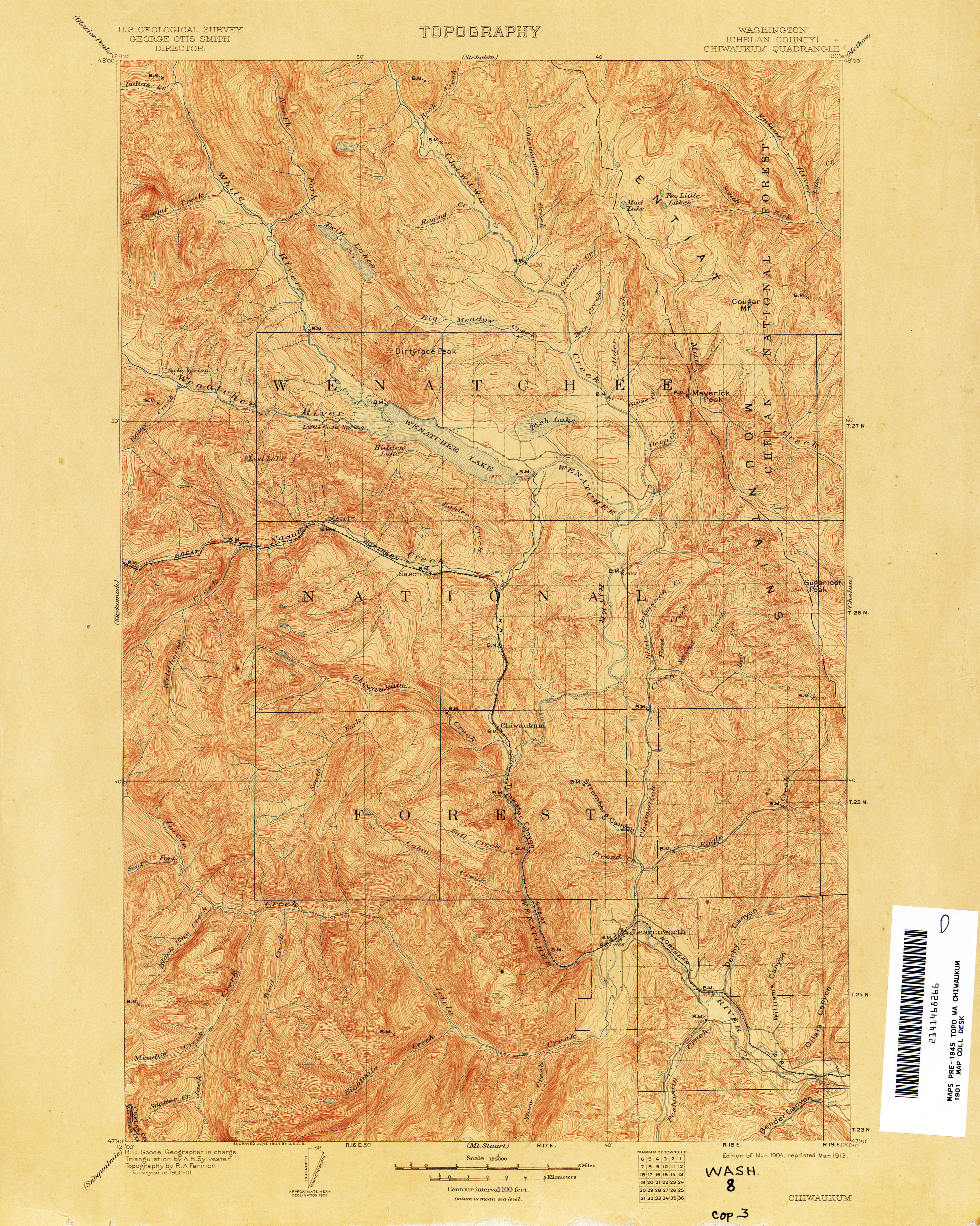
The present route of US 2 follows several wagon roads that were built in the late 19th century by local railroad companies, including the Stevens Pass Highway along the Skykomish River. The state of Washington began maintaining sections of what would become US 2 with the extension of State Road 7 in 1909, from Pashastin to Spokane on the Sunset Highway and later State Road 2. In addition to State Road 2, State Road 23 was created in 1915, traveling north from Spokane to Newport, and was renumbered to State Road 6 in 1923. The Stevens Pass Highway was transferred to state maintenance in 1931 with the establishment of State Road 15, traveling from Everett to Peshastin. The United States Highway System was adopted on November 11, 1926, and designated US 10 on the future route of US 2 from Peshastin to Spokane and US 195 from Spokane to Newport. US 10 was re-routed in 1939 and replaced by US 10 Alternate, which was routed across Stevens Pass in the 1940s and itself replaced by US 2 in 1946. The primary state highways were replaced by the current state route system during the 1964 state highway renumbering, and US 2 replaced its three concurrent routes. US 2 underwent conversions to limited-access highways during the next several decades, including the completion of the Hewitt Avenue Trestle and a bypass of Snohomish. A series of projects is planned to improve the US 2 corridor between Snohomish and Skykomish by expanding the highway near various cities and the completion of a bypass around Monroe in the near future.
Route description
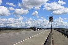
US 2 is defined by the Washington State Legislature as SR 2, part of the Revised Code of Washington as §47.17.005.[3] Every year, WSDOT conducts a series of surveys on its highways in the state to measure traffic volume. This is expressed in terms of annual average daily traffic (AADT), which is a measure of traffic volume for any average day of the year. In 2013, WSDOT calculated that the busiest section of US 2 within Washington was the Hewitt Avenue Trestle above the Snohomish River east of Everett, carrying over 76,000 vehicles, while the least busiest section of US 2 is in Moses Coulee, carrying 630 vehicles.[4] The entire route of US 2 within Washington is designated as part of the National Highway System,[5] classifying it as important to the national economy, defense, and mobility.[6] WSDOT designates US 2 as a Highway of Statewide Significance,[7] which includes highways that connect major communities in the state of Washington.[8]
US 2 begins in downtown Everett, with its eastbound lanes starting at the intersection of Hewitt Avenue and Maple Street, signed as SR 529, and its westbound lanes ending at the intersection of California Street and Maple Street (SR 529). The highway travels east onto the Hewitt Avenue Trestle,[9] crossing the Snohomish River after an interchange with I-5.[10][11] The four-lane trestle continues east across Ebey Island, intersecting Homeacres Road before crossing the Ebey Slough.[12] US 2 turns southeast at the east end of the trestle in Cavalero at an interchange with SR 204, which serves Lake Stevens.[13] The limited-access road travels around the city of Snohomish, intersecting Bickford Avenue in an at-grade intersection and SR 9 in a diamond interchange.[14][15] US 2 turns south and crosses over the Pilchuck River and the Centennial Trail before its limited-access road ends at a diamond interchange with 88th Street.[16][17] The two-lane road continues southeast along the Scenic Subdivision of the Northern Transcon, a BNSF rail line,[18][19] into Monroe. The highway travels past the Evergreen State Fairgrounds and intersects SR 522 before entering downtown Monroe.[20][21][22]
US 2, now part of a National Scenic Byway named the Stevens Pass Greenway,[23][24] continues through the city of Monroe and forms the northern terminus of SR 203. The highway leaves the city while parallel to the Skykomish River and travels through the cities of Sultan and Gold Bar. US 2 begins following the South Fork Skykomish River at Index into the Cascade Range, crossing into King County near the town of Baring. The highway enters Mount Baker-Snoqualmie National Forest and continues east along the Tye River past the town of Skykomish and the Cascade Tunnel towards Stevens Pass.[25] The pass, located 4,061 feet (1,238 m) above sea level,[26] is also home to the Stevens Pass Ski Area and a trailhead for the Pacific Crest Trail while serving as the point in which US 2 crosses into the Wenatchee National Forest in Chelan County.[27][28] The highway continues east down Nason Creek to Coles Corner, the southern terminus of SR 207, which serves Lake Wenatchee. US 2 travels due south along the Wenatchee River valley through Leavenworth before it begins a 27-mile-long (43 km) concurrency with US 97 at a diamond interchange east of Peshastin.[20][21][29]
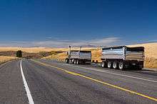
US 2 and US 97 travel together on a four-lane highway on the north side of the Wenatchee River heading southeast past Cashmere heading towards Wenatchee. The roadway intersects SR 285, a short connector to downtown Wenatchee,[30] and US 97 Alternate, an alternate route to Chelan,[31] in Sunnyslope before crossing the Richard Odabashian Bridge over the Columbia River and into Douglas County. The two highways continue east into East Wenatchee and turn north at the western terminus of SR 28. US 2 and US 97 continue north between the Columbia River to the west and Badger Mountain to the east, passing the Rocky Reach Dam and its reservoir, Lake Entiat before reaching Orondo. US 2 and US 97 split at Orondo, with US 97 continuing north along the Columbia River towards Chelan and US 2 traveling east up Pine Canyon onto the Waterville Plateau. The highway travels through the town of Waterville via several turns on city streets before heading due east across the Columbia Plateau, intersecting SR 172 at Farmer. US 2 becomes concurrent with SR 17 as it descends into the Grand Coulee south of Banks Lake, becoming part of the Coulee Corridor Scenic Byway.[20][21][32]
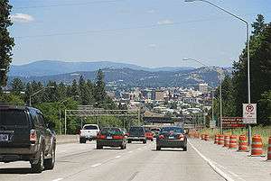
The byway travels off US 2 and onto SR 155 east of Coulee City at Fordair, continuing north through Grant County towards the Grand Coulee Dam.[33] US 2 travels east into Lincoln County between the towns of Hartline and Almira and becomes concurrent with SR 21 in Wilbur for several city blocks. The highway parallels the Columbia River Subdivision of the BNSF Northern Transcon through Bachelor Prairie towards Davenport,[18][19] where it intersects the termini of SR 28 and SR 25. US 2 travels into Reardan concurrent with SR 231 and enters Spokane County east of the town boundary. The highway passes Fairchild Air Force Base and becomes a four-lane arterial street through Airway Heights approaching Spokane. US 2 enters the city of Spokane as a four-lane freeway northeast of Spokane International Airport and intersects Airport Way before beginning its 3.82-mile-long (6.15 km) concurrency with I-90 and US 395 at a partial cloverleaf interchange.[20][21][34][35]
I-90, US 2 and US 395 travel east into Downtown Spokane and intersects the northern terminus of US 195, which travels south towards Pullman and Lewiston, Idaho.[36] US 2 and US 395 split from I-90 and travel into Downtown Spokane on the one-way pair of Browne and Division streets,[37][38] serving the Spokane Intermodal Center and Spokane Convention Center before reaching Riverfront Park. Division Street crosses the Spokane River and the Centennial Trail on the Senator Sam C. Guess Memorial Bridge before splitting into the one-way pairing of Division and Ruby streets.[39] Division Street continues north past the NorthTown Mall and the eastern terminus of SR 291 at Francis Street before US 2 and US 395 split.[20][21]
US 2 travels northeast through Country Homes on the Newport Highway to an interchange with the North Spokane Corridor,[40] an incomplete freeway bypass of Spokane that is signed as a spur route of US 395. The highway continues west of Mead and intersects SR 206, a road serving Mount Spokane State Park, before becoming a four-lane divided highway parallel the Kooteani River Subdivision of the BNSF Northern Transcon. US 2 travels north along the Little Spokane River through Colbert and Chattaroy before leaving Spokane County and entering Pend Oreille County. The divided highway ends at the southern terminus of SR 211, located west of Diamond Lake. US 2 continues northeast along the Little Spokane River and enters the city of Newport, splitting into a one-way pair on Washington and Union avenues. The two streets travel north through the city to the eastern terminus of SR 20 and turn east onto Walnut Street and the International Selkirk Loop,[41] where US 2 crosses the Idaho state line at the northern terminus of SR 41 in Newport and ID-41 in Oldtown, Idaho.[20][21][42]
History
US 2 follows the route of several wagon roads and early state highways that themselves followed the route of the Skykomish River and the Great Northern Railway, a transcontinental railroad that was completed in 1893.[43] A wagon road from Snohomish to Skykomish was completed in the late 1880s,[44][45] while another wagon road along the Wenatchee River from Leavenworth to Sunnyslope was completed by 1904.[46] The state of Washington began maintaining State Road 7 in 1909,[47][48] traveling from Peshastin to Spokane on what would become the Sunset Highway and US 2.[49] The easternmost segment of US 2 within Washington, from Spokane to Newport, was added to the state highway system in 1915 as State Road 23 and renamed to the Pend Oreille Highway two years later.[50][51][52] State Road 7 was renumbered to State Road 2, part of an east–west highway connecting Seattle to Spokane.[53] The Stevens Pass Highway was opened on July 11, 1925, and traveled from Everett along the Skykomish River and over Stevens Pass towards Leavenworth.[54] The highway was transferred to state maintenance from the Department of Highways in 1931 as State Road 15.[55][56]
The United States Highway System was adopted by the American Association of State Highway Officials (AASHO) on November 11, 1926, and included a shorter US 2, traveling from Bonners Ferry, Idaho to the Upper Peninsula of Michigan, and several routes along the modern route of US 2 in Washington.[2][57] The corridor of US 2 was signed as US 10 from Peshastin to Spokane and US 195 from Spokane to Newport, co-signed with State Road 2 and State Road 6, respectively.[58] The Washington primary and secondary state highway system was adopted by the Washington State Legislature on March 17, 1937, and the three highways that comprise the present route of US 2 were included in the system as Primary State Highway 15 (PSH 15) from Everett to Peshastin, PSH 2 from Peshastin to Spokane, and PSH 6 from Spokane to the Idaho state line in Newport via a short branch route.[59] US 10 was relocated to a southern route in 1939, crossing the Columbia River at Vantage,[60] and the former route was replaced by US 10 Alternate the following year.[61] A proposal from representatives of the highway departments of Idaho and Washington to extend US 2 to Everett was considered by the AASHO's U.S. Route Numbering Committee in January 1946, but was vetoed. The proposal resurfaced during the committee's meeting on December 20, 1946, and was approved as a replacement of US 10 Alternate from Everett to Bonners Ferry and US 195 from Spokane to Newport.[2]
The Washington state highway system was changed to its current "sign route system" beginning in January 1963 with a state highway renumbering.[62] Under the new system, Interstate highways, U.S. routes, and state routes replaced the primary and secondary highways and were codified under the Revised Code of Washington in 1970.[3] US 2 was re-routed around various cities over the next several decades onto limited-access highways to reduce congestion, beginning with the construction of the current westbound Hewitt Avenue Trestle east of Everett in the 1960s, moving traffic off an existing wooden trestle that would be replaced with a new eastbound trestle in 2002.[63][64][65] US 2 was routed north of Wenatchee onto the Olds Station Bridge, renamed in 1991 to honor Richard Odabashian, over the Columbia River in 1975,[66] while the former alignment was designated as SR 285 in 1977.[67] The present two-lane expressway north and east of Snohomish was completed in 1983 and was intended to also include an unfinished bypass of Monroe.[68] US 97 had its concurrency with US 2 extended from Sunnyslope to Orondo along the east side of the Columbia River in 1987 after US 97 was moved onto the former route of SR 151.[69] The Stevens Pass Greenway, which became a National Forest Scenic Byway on April 14, 1992, was re-designated as a National Scenic Byway on September 22, 2005.[70][71] Within Newport, US 2 had an unsigned spur route that traveled on the southbound lanes of ID-41 on the Idaho state line until 1997, when SR 41 was created to avoid confusion.[42][72] The intersection between US 2 and US 97 east of Peshastin was replaced by a new diamond interchange completed in October 2008 as part of general improvements to the two highways' concurrency from Peshastin to Sunnyslope.[29][73][74] The current interchange between US 2 and the North Spokane Corridor, a spur route of US 395, was opened in November 2011 to coincide with the opening of the northernmost 5.5 miles (8.85 km) of the future freeway.[75]
Recently, WSDOT began planning a series of 56 projects to improve the US 2 corridor between Snohomish and Skykomish, where the highway is two lanes wide and has been the site of over 2,600 collisions between 1999 and 2007 that caused 47 fatalities.[68] A study, conducted by WSDOT in 2007,[76] divided the corridor into four segments, each with a specialized development plan. The study suggested the expansion of the limited-access highway from Snohomish to the western city limits of Monroe to four lanes, including an interchange at Bickford Avenue that is expected to be completed in fall 2013.[77][78] WSDOT planned the re-routing of US 2 onto a northern bypass of Monroe with an extension of SR 522 to a roundabout with the bypass north of Monroe.[79] From Monroe to Gold Bar, US 2 would be expanded to a four-lane highway, with a roundabout connecting the highway to the city of Gold Bar,[80] and become a two-lane highway with wider shoulder lanes to Skykomish.[81]
Major intersections
| County | Location | mi[1] | km | Destinations | Notes | |||
|---|---|---|---|---|---|---|---|---|
| Snohomish | Everett | 0.00 | 0.00 | Western terminus, continues as Hewitt Avenue and California Street | ||||
| 0.14 | 0.23 | |||||||
| West end of limited-access | ||||||||
| | 0.87 | 1.40 | Homeacres Road – Ebey Island | |||||
| Cavalero | 2.54 | 4.09 | ||||||
| Fobes Hill | 4.02 | 6.47 | Bickford Avenue – Snohomish | No westbound exit | ||||
| | 5.17 | 8.32 | ||||||
| | 8.64 | 13.90 | 88th Street Southeast – Snohomish | |||||
| East end of limited-access | ||||||||
| Monroe | 14.35 | 23.09 | ||||||
| 15.00 | 24.14 | |||||||
| King |
No major junctions | |||||||
| King–Chelan county line | | 64.77 | 104.24 | Stevens Pass | ||||
| Chelan | Coles Corner | 84.83 | 136.52 | |||||
| Leavenworth | 100.35 | 161.50 | Chumstick Highway | Former SR 209 | ||||
| Peshastin | 104.58 | 168.31 | Interchange, west end of US 97 overlap | |||||
| Sunnyslope | 118.97 | 191.46 | Interchange | |||||
| 119.73 | 192.69 | Interchange | ||||||
| Columbia River | 119.97– 120.24 | 193.07– 193.51 | Richard Odabashian Bridge | |||||
| Douglas | East Wenatchee | 120.97 | 194.68 | |||||
| Orondo | 132.89 | 213.87 | East end of US 97 overlap | |||||
| 133.31 | 214.54 | |||||||
| Farmer | 156.27 | 251.49 | ||||||
| | 179.35 | 288.64 | West end of SR 17 overlap | |||||
| Grant | | 180.97 | 291.24 | East end of SR 17 overlap | ||||
| Fordair | 185.22 | 298.08 | ||||||
| Lincoln | | 212.81 | 342.48 | West end of SR 21 overlap | ||||
| Wilbur | 213.46 | 343.53 | East end of SR 21 overlap | |||||
| Davenport | 242.68 | 390.56 | ||||||
| 243.47 | 391.83 | |||||||
| | 253.01 | 407.18 | West end of SR 231 overlap | |||||
| Reardan | 255.89 | 411.82 | East end of SR 231 overlap | |||||
| Spokane | Spokane | 273.97 | 440.91 | West end of I-90 Bus. overlap | ||||
| West end of limited-access | ||||||||
| 275.14 | 442.79 | West end of I-90 / US 395 overlap, east end of I-90 Bus. overlap | ||||||
| 276.55 | 445.06 | |||||||
| 277.20 | 446.11 | Maple Street/Walnut Street | ||||||
| 278.73 | 448.57 | East end of I-90 overlap | ||||||
| East end of limited-access | ||||||||
| 283.08 | 455.57 | |||||||
| 284.76 | 458.28 | East end of US 395 overlap | ||||||
| Mead | 287.85 | 463.25 | North Spokane Corridor | Interchange, future US 395 | ||||
| | 289.15 | 465.34 | ||||||
| Pend Oreille | | 313.19 | 504.03 | |||||
| Newport | 325.79 | 524.31 | ||||||
| 326.34 | 525.19 | |||||||
| Idaho state line | ||||||||
1.000 mi = 1.609 km; 1.000 km = 0.621 mi
| ||||||||
References
- 1 2 Finch, Mark, ed. (March 4, 2014). State Highway Log: Planning Report 2013, SR 2 to SR 971 (PDF) (Report). Washington State Department of Transportation. pp. 112–187. Retrieved March 10, 2014.
- 1 2 3 Weingroff, Richard (January 30, 2008). "U.S. 2: Houlton, Maine, to Everett, Washington". Federal Highway Administration. Retrieved January 10, 2010.
- 1 2 "47.17.005: State route No. 2". Revised Code of Washington. Washington State Legislature. 1970; revised 1987, 1997. Retrieved April 3, 2013. Check date values in:
|date=(help) - ↑ 2013 Annual Traffic Report (PDF) (Report). Washington State Department of Transportation. 2013. pp. 60–66. Retrieved April 20, 2014.
- ↑ National Highway System: Washington (PDF) (Map). Federal Highway Administration. October 1, 2012. Retrieved April 3, 2013.
- ↑ "What is the National Highway System?". Federal Highway Administration. September 26, 2012. Retrieved April 3, 2013.
- ↑ "Transportation Commission List of Highways of Statewide Significance" (PDF). Washington State Transportation Commission. July 26, 2009. Retrieved April 3, 2013.
- ↑ Lorenzo, Judy. "Highways of Statewide Significance". Washington State Department of Transportation. Retrieved April 3, 2013.
- ↑ Gilmore, Susan (June 30, 2002). "Bumper to Bumper: Straight talk on S-curves, traffic lingo". The Seattle Times. Retrieved April 3, 2013.
- ↑ "SR 5 - Exit 193/194: Junction Pacific Avenue/SR 2/SR 529" (PDF). Washington State Department of Transportation. August 3, 2011. Retrieved January 10, 2010.
- ↑ "Feature Detail Report for: Hewitt Avenue Interchange". Geographic Names Information System. United States Geological Survey. May 1, 1992. Retrieved April 3, 2013.
- ↑ "SR 2: Junction Ebey Island" (PDF). Washington State Department of Transportation. January 6, 2009. Retrieved January 10, 2010.
- ↑ "SR 2: Junction SR 204/20th Street SE" (PDF). Washington State Department of Transportation. August 3, 2011. Retrieved January 10, 2010.
- ↑ "SR 2: Junction Bickford Avenue (Old SR 2)" (PDF). Washington State Department of Transportation. July 14, 2009. Retrieved January 10, 2010.
- ↑ "SR 2: Junction SR 9" (PDF). Washington State Department of Transportation. March 12, 2013. Retrieved January 10, 2010.
- ↑ Centennial Trail (PDF) (Map). Snohomish County Parks & Recreation. October 28, 2011. Retrieved April 3, 2013.
- ↑ "SR 2: Junction Campbell Road/88th Street SE/92nd Street SE" (PDF). Washington State Department of Transportation. October 27, 2003. Retrieved April 3, 2013.
- 1 2 2011 Washington State Rail System (PDF) (Map). Washington State Department of Transportation. January 2012. Retrieved April 3, 2013.
- 1 2 BNSF Subdivisions (PDF) (Map). BNSF Railway. September 1, 2011. Retrieved April 3, 2013.
- 1 2 3 4 5 6 Google (January 10, 2010). "U.S. Route 2 in Washington" (Map). Google Maps. Google. Retrieved January 10, 2010.
- 1 2 3 4 5 6 Washington State Highways, 2011–2012 (PDF) (Map). 1:842,000. Washington State Department of Transportation. 2011. Retrieved April 3, 2013.
- ↑ "SR 2: Junction SR 522" (PDF). Washington State Department of Transportation. March 1, 2012. Retrieved April 3, 2013.
- ↑ Washington State Highways, 2006–07: Scenic Byways (PDF) (Map). 1:842,000. Washington State Department of Transportation. 2006. Retrieved April 3, 2013.
- ↑ Stevens Pass Greenway: Map - Western Section (Map). United States Department of Transportation. Retrieved April 3, 2013.
- ↑ Vicinity Map: Mt. Baker-Snoqualmie National Forest (PDF) (Map). United States Forest Service. April 8, 2008. Retrieved April 3, 2013.
- ↑ "Feature Detail Report for: Stevens Pass". Geographic Names Information System. United States Geological Survey. September 10, 1979. Retrieved April 3, 2013.
- ↑ Okanogan-Wenatchee National Forest (PDF) (Map). United States Forest Service. Retrieved April 3, 2013.
- ↑ Stevens Pass Greenway: Map - Eastern Section (Map). United States Department of Transportation. Retrieved April 3, 2013.
- 1 2 "SR 2: Junction SR 97/Jeske Road" (PDF). Washington State Department of Transportation. June 1, 2010. Retrieved April 3, 2013.
- ↑ "SR 2/SR 97: Junction SR 285" (PDF). Washington State Department of Transportation. April 3, 2012. Retrieved April 3, 2013.
- ↑ "SR 2/SR 97: Junction SR 97 Alternate Route (AR)" (PDF). Washington State Department of Transportation. April 10, 2005. Retrieved April 3, 2013.
- ↑ Coulee Corridor Scenic Byway: Map - South Section (Map). United States Department of Transportation. Retrieved April 3, 2013.
- ↑ Coulee Corridor Scenic Byway: Map - South Section (Map). United States Department of Transportation. Retrieved April 3, 2013.
- ↑ "SR 2: Junction Sunset Highway" (PDF). Washington State Department of Transportation. December 24, 2001. Retrieved April 3, 2013.
- ↑ "SR 90 - Exit 277: Junction SR 2/Garden Springs Road" (PDF). Washington State Department of Transportation. March 14, 2011. Retrieved April 3, 2013.
- ↑ "SR 90 - Exit 279: Junction SR 195" (PDF). Washington State Department of Transportation. October 12, 2004. Retrieved April 3, 2013.
- ↑ "SR 90 - Exit 281: Junction SR 2/SR 2 Browne Street Couplet" (PDF). Washington State Department of Transportation. October 18, 2010. Retrieved April 3, 2013.
- ↑ "SR 2: Junction SR 2 Browne Street Couplet" (PDF). Washington State Department of Transportation. April 14, 2006. Retrieved April 3, 2013.
- ↑ "SR 2: Junction Division Couplet" (PDF). Washington State Department of Transportation. June 30, 2008. Retrieved April 3, 2013.
- ↑ "SR 395 Spur NSC: Junction SR 2/Farwell Road" (PDF). Washington State Department of Transportation. February 28, 2013. Retrieved April 3, 2013.
- ↑ International Selkirk Loop: Map - Washington Map (Map). United States Department of Transportation. Retrieved April 3, 2013.
- 1 2 "SR 2: Junction SR 2 Newport Couplet/SR 20/SR 41" (PDF). Washington State Department of Transportation. June 30, 2008. Retrieved April 3, 2013.
- ↑ MacIntosh, Heather M. (June 13, 1999). "Train arrives in Seattle over new transcontinental tracks on January 7, 1893.". HistoryLink. Retrieved April 3, 2013.
- ↑ "Chapter 1: Introduction" (PDF). US 2 Route Development Plan. Washington State Department of Transportation. November 2007. Retrieved April 3, 2013.
- ↑ "Old Cascade Scenic Highway Heritage Corridor" (PDF). King County Department of Transportation. December 2009. Retrieved April 3, 2013.
- ↑ Washington (Chelan County): Chiwaukum Quadrangle (JPG) (Map). 1:125,000. United States Geological Survey. March 1904. Retrieved April 3, 2013.
- ↑ Washington State Legislature (March 4, 1909). "Chapter 51: Providing for the Survey of Certain State Roads". Session Laws of the State of Washington. Session Laws of the State of Washington (1909 ed.). Olympia, Washington: Washington State Legislature. p. 95. Retrieved April 3, 2013.
Extension over the most feasible route of State Road No. 7 westerly through the town of Renton and along the shore of Lake Washington to the city of Seattle and easterly to the city of Spokane.
- ↑ Map of the State of Washington Showing State Roads - Located and Proposed (DJVU) (Map). Washington State Highway Commission. 1909. Retrieved April 3, 2013.
- ↑ Washington State Legislature (March 12, 1913). "Chapter 65: Classifying Public Highways". Session Laws of the State of Washington. Session Laws of the State of Washington (1913 ed.). Olympia, Washington: Washington State Legislature. p. 221. Retrieved April 3, 2013.
A highway starting from the Pacific Highway at Renton, Washington; thence over the most feasible route by the way of Snoqualmie Pass into the Yakima River Valley; thence by way of Wenatchee, over the most feasible route, through Waterville and Spokane, to the state boundary, which shall be known as the Sunset Highway.
- ↑ Washington State Legislature (March 19, 1915). "Chapter 164: Classification of Public Highways". Session Laws of the State of Washington. Session Laws of the State of Washington (1915 ed.). Olympia, Washington: Washington State Legislature. p. 486. Retrieved April 3, 2013.
A secondary state highway is established as follows: State road No. 23; this road shall begin at the city of Spokane in Spokane county, and run thence by way of Mead to the town of Newport.
- ↑ State of Washington Showing State Highways Authorized by Legislative Acts of 1915 (DJVU) (Map). Washington State Bureau of Statistics and Immigration. 1915. Retrieved April 3, 2013.
- ↑ Washington State Legislature (March 10, 1917). "Chapter 75: Appropriation for Primary and Secondary Highways". Session Laws of the State of Washington. Session Laws of the State of Washington (1917 ed.). Olympia, Washington: Washington State Legislature. p. 257. Retrieved April 3, 2013.
State Road No. 23, hereafter to be known as Pend Oreille Highway, between Newport and Mead
- ↑ Washington State Legislature (March 19, 1923). "Chapter 185: Primary and Secondary State Highways". Session Laws of the State of Washington. Session Laws of the State of Washington (1923 ed.). Olympia, Washington: Washington State Legislature. pp. 628–629. Retrieved April 3, 2013.
A primary state highway, to be known as State Road No. 2 or the Sunset Highway, is established as follows: Beginning at the City of Seattle; thence by the most feasible route in a easterly direction through the cities of Renton, North Bend, Cle Elum, Wenatchee, Waterville, Davenport and Spokane to the Washington-Idaho state line.
- ↑ Carlson, Warren (April 15, 2009). "Chapter Four: 1920–1930". Upper Skykomish Valley. Images of America. Skykomish, Washington: Arcadia Publishing. pp. 75–79. ISBN 0738558397.
- ↑ Washington State Legislature. "Chapter 35". Session Laws of the State of Washington. Session Laws of the State of Washington (1931 ed.). Olympia, Washington: Washington State Legislature.
- ↑ Highway Map: State of Washington (DJVU) (Map). Department of Highways. January 1931. Retrieved April 3, 2013.
- ↑ Weingroff, Richard F. (January 9, 2009). "From Names to Numbers: The Origins of the U.S. Numbered Highway System". Highway History. Federal Highway Administration. Retrieved April 3, 2013.
- ↑ Bureau of Public Roads & American Association of State Highway Officials (November 11, 1926). United States System of Highways Adopted for Uniform Marking by the American Association of State Highway Officials (Map). 1:7,000,000. Washington, DC: U.S. Geological Survey. OCLC 32889555. Retrieved November 7, 2013 – via University of North Texas Libraries.
- ↑ Washington State Legislature (March 17, 1937). "Chapter 190: Establishment of Primary State Highways". Session Laws of the State of Washington. Session Laws of the State of Washington (1937 ed.). Olympia, Washington: Washington State Legislature. pp. 934, 937, 940–941. Retrieved April 3, 2013.
A primary state highway to be known as Primary State Highway No. 2, or the Sunset Highway, is hereby established according to description as follows: Beginning at Seattle in King county, thence in an easterly direction by the most feasible route by way of Renton, Snoqualmie Pass, Cle Elum, Blewett Pass, Wenatchee, Waterville, Wilbur, Davenport and Spokane to the Washington-Idaho boundary line. A primary state highway to be known as Primary State Highway No. 6, or the Pend Oreille Highway, is hereby established according to description as follows: Beginning at a junction with Primary State Highway No. 3, in the vicinity north of Spokane, thence in a northerly direction by the most feasible route by way of Newport and Metaline Falls to the international boundary line; also beginning at Newport on Primary State Highway No. 6, as herein described, thence in an easterly direction to the Washington-Idaho boundary line. A primary state highway to be known as Primary State Highway No. 15, or the Stevens Highway, is hereby established according to description as follows: Beginning at a junction with Primary State Highway No. 2, in the vicinity of Peshastin, thence in a westerly direction by the most feasible route by way of Leavenworth, Stevens Pass and Monroe to Everett on Primary State Highway No. 1.
- ↑ Highways of the State of Washington (DJVU) (Map). Department of Highways. 1939. Retrieved April 3, 2013.
- ↑ "Alternative Route Given U.S. Okeh". Spokane Daily Chronicle. Spokane, WA. July 19, 1940. p. 5. Retrieved April 20, 2014.
- ↑ Prahl, C. G. (December 1, 1965). "Identification of State Highways" (PDF). Washington State Highway Commission, Department of Highways. Retrieved June 9, 2009.
- ↑ Lobos, Ignacio (June 17, 1993). "Twin Rivers Of Concrete -- New Hewitt Avenue Trestle Goes Up As 30, 000 Cars A Day Keep Flowing". The Seattle Times. Retrieved April 3, 2013.
- ↑ "U.S. 2/Hewitt Avenue trestle will be closed around the clock". Seattle Post-Intelligencer. July 28, 2002. Retrieved April 3, 2013.
- ↑ "Work On US 2 Hewitt Avenue Trestle Finished Early". KOMO-TV. August 19, 2002. Retrieved April 3, 2013.
- ↑ "Behind the name ... Richard Odabashian Bridge". The Wenatchee World. November 26, 2008. Retrieved April 3, 2013.
- ↑ "47.17.517: State route No. 285". Revised Code of Washington. Washington State Legislature. 1991 [1977]. Retrieved April 3, 2013.
- 1 2 Haynes, Brad (September 5, 2007). "Highway 2 safety, funds fail to intersect". The Seattle Times. Retrieved April 3, 2013.
- ↑ "47.17.290: State route No. 151". Revised Code of Washington. Washington State Legislature. 1970; repealed 1987. Retrieved April 3, 2013. Check date values in:
|date=(help) - ↑ "Stevens Pass Greenway: Official Designations". America's Byways. United States Department of Transportation. Retrieved April 3, 2013.
- ↑ "Three state byways get federal designation". The Daily Record. September 29, 2005. p. B12. Retrieved April 3, 2013.
- ↑ "47.17.133: State route No. 41". Revised Code of Washington. Washington State Legislature. 1997. Retrieved April 3, 2013.
- ↑ Pierson, Eric (November 2008). "US 2/97 - Peshastin East Interchange - Complete November 2008". Washington State Department of Transportation. Retrieved April 3, 2013.
- ↑ Steigmeyer, Rick (October 18, 2008). "Peshastin East Interchange opens". The Wenatchee World. Retrieved April 3, 2013.
- ↑ Prager, Mike (November 2, 2011). "U.S. 2, meet your newest neighbor". The Spokesman-Review. Retrieved April 3, 2013.
- ↑ Warren, Richard (November 2007). "US 2 - Route Development Plan - Snohomish to Skykomish - Complete November 2007". Washington State Department of Transportation. Retrieved April 3, 2013.
- ↑ Sawyer, Mark. "US 2 - Bickford Ave. Intersection Safety and Culvert Replacement". Washington State Department of Transportation. Retrieved April 3, 2013.
- ↑ "Segment 1: Snohomish to west Monroe" (PDF). US 2 Route Development Plan. Washington State Department of Transportation. November 2007. Retrieved April 3, 2013.
- ↑ "Segment 2: Monroe" (PDF). US 2 Route Development Plan. Washington State Department of Transportation. November 2007. Retrieved April 3, 2013.
- ↑ "Segment 3: east Monroe to east Gold Bar" (PDF). US 2 Route Development Plan. Washington State Department of Transportation. November 2007. Retrieved April 3, 2013.
- ↑ "Segment 4: east Gold Bar to east Skykomish" (PDF). US 2 Route Development Plan. Washington State Department of Transportation. November 2007. Retrieved April 3, 2013.
External links
 Media related to Category:U.S. Route 2 in Washington (state) at Wikimedia Commons
- US 2 at Highways of Washington State
- US 2 at US Highway Ends
| Previous state: Terminus |
Washington | Next state: Idaho |