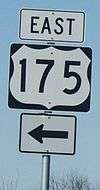
U.S. Route 175
| ||||
|---|---|---|---|---|
_map.svg.png) | ||||
| Route information | ||||
| Maintained by TxDOT | ||||
| Length: | 111.0 mi[1] (178.6 km) | |||
| Existed: | 1932 – present | |||
| Major junctions | ||||
| West end: |
| |||
| East end: |
| |||
| Highway system | ||||
| ||||

U.S. Route 175 (or, U.S. Highway 175) is an east-west United States highway, its span completely within the state of Texas. It comes very close to meeting its "parent", US 75, but decommissioning and rerouting in downtown Dallas, Texas brings it a couple of miles short. Before the decommissioning of US 75 south of downtown Dallas in favor of Interstate 45, US 175 met its "parent" US 75. US 175's western terminus is in Dallas, Texas at Interstate 45. The highway's eastern terminus is in Jacksonville, Texas at an intersection with US 69.
Route description
Dallas County
US 175 begins south of downtown Dallas at an interchange with Interstate 45 south of Interstate 30, Cesar Chavez Boulevard, and Good-Latimer Expressway. At this point, US 175 is six lanes in width (three westbound, three eastbound). The highway heads towards the southeast as a freeway carrying the moniker of S.M. Wright Freeway (named for a local minister and community leader in South Dallas); it was previously named South Central Expressway in this section.
At an interchange with State Highway 310 (known locally as Dead Man's Curve), US 175 begins to head to the east (taking the name C.F. Hawn Freeway, named after a Texas Highway commissioner who lived in Athens) while the S.M. Wright Freeway name follows SH 310. The freeway continues east along the north edge of Rochester Park, through lowlands that include a crossing of White Rock Creek, until it turns back to the southeast at an interchange at Second Avenue (a previous routing of US 175) and Bruton Road; from this point US 175 maintains a consistent southeasterly direction.
US 175 passes through the Pleasant Grove area of Dallas past an interchange with Loop 12 (Buckner Blvd.), then a few miles later, Interstate 20 just southwest of the I-20 and Interstate 635 interchange/split. The highway continues as a freeway past the I-20 interchange, where it briefly crosses into and out of Balch Springs. At this point, US 175 narrows from six lanes to four (two westbound, two eastbound). After a few miles, US 175 leaves Dallas just after the Woody Road exit then goes into the city of Seagoville. The portion of the route through Seagoville is its last urban portion before US 175's surroundings become more suburban and rural.
Kaufman County
On the far side of Seagoville, US 175 passes into Kaufman County and descends into a valley which includes land overseen by the John Bunker Sands Wetland Center and a crossing of the East Fork of the Trinity River. The river marks the city limit boundary between Seagoville and Crandall.
After rising out of the valley area, the highway goes through Crandall by intersecting Farm to Market Road 741 (which connects Crandall to Forney), then passing the center of town, and another exit, with Farm to Market Road 148 (connecting Crandall to Terrell). Then, US 175 goes into a more rural area, passing by rolling blackland prairies and farmland. A rural interchange for County Road 4104-Bud Stoy Road marks the city limit border of Crandall and Kaufman. The freeway continues into Kaufman past a wide right curve at the State Highway 243 interchange, then passes by a brief urban section at the State Highway 34 (Washington Street) exit.
After this part, US 175 loses its freeway characteristics but continues as a four-lane divided highway. The highway passes by more rolling prairie and farmland for several miles before approaching Kemp. Here a bypass takes US 175 around the north and east of town, while the first of three business routes of US 175 goes through Kemp along US 175's previous routing in the area. After the bypass makes its way past a freeway-style exit at State Highway 274 (which also forms the east end of Business US 175), US 175 leaves the main part of Kemp.
The highway continues as a divided four-lane road past two multi-bridge spans of Cedar Creek Reservoir. Between the two spans is the city limit border between Kemp and Mabank. After rising up from the area of the second span of the lake, US 175 begins bypassing the main part of Mabank while another US 175 business route serves a through-town portion along a previous routing of the highway. One part of US 175 along its bypass is freeway-style, at an interchange with State Highway 198. The highway leaves Kaufman County just before completing its bypass of Mabank.
Henderson County
US 175 enters the county as it approaches an at-grade intersection with the east end of Business US 175. The highway continues being divided with four lanes into an area that is more wooded, but still has rolling hills and some farmland. A rural at-grade intersection with a county road marks the city limit border between Mabank and Gun Barrel City, then US 175 approaches a freeway-style interchange with State Highway 334. This state highway connects to the main portion of Gun Barrel City to the west, and is the last major road connecting US 175 to Cedar Creek Reservoir.
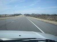
After the interchange, US 175 leaves the city limits of Gun Barrel City, and within a mile, it enters the city limits of Eustace. Soon afterward, the highway narrows to an undivided four-lane road with a left-turn lane. US 175 approaches its first signal light at the intersection of Farm to Market Road 316, which comes into Eustace from the south; the intersection is the beginning of a brief overlap of the two roads near the center of town. FM 316's overlap concludes after four short blocks by turning left at another signal-lighted intersection to go north out of Eustace. US 175 continues out of Eustace and goes on another mile or so before becoming divided once again with four lanes. Once out of Eustace, US 175's speed limit goes up to 75 mph (120 km/h), the highest maximum speed of any segment of the highway.
US 175 continues southeast for several more miles of rolling terrain of alternate areas of woods and farmland, then it passes one of two state-maintained roadside picnic areas. An intersection with Ranch to Market Road 2329 comes up right afterward, then within a mile, US 175 enters the city limits of Athens. A few more miles later, the divided roadway narrows again, to an undivided four-lane road with a left-turn lane. After another mile, US 175 intersects Loop 7; it begins bypassing Athens by turning left and overlapping the loop (as well as State Highway 31, which also bypasses Athens by way of the loop). At this same intersection, the last of US 175's three business routes goes into Athens, along a previous routing of US 175. The portion of the route carrying US 175, SH 31, and Loop 7 is a four-lane highway with a left turn lane. On the north side of Athens, the highway intersects State Highway 19 with a grade-separated exit; the south-bound SH 19 bypasses Athens by merging with US 175, SH 31, and Loop 7 here while north-bound SH 19 turns left to go away from Athens, and a business route of SH 19 begins here to go south into the main part of town.
The four routes continue around Athens eastward past an at-grade intersection with Farm to Market Road 1616. SH 31 turns away from the four-route overlap at the next exit; it leaves by turning left (northeast) toward Tyler, while a business route of SH 31 turns right at the exit to go into Athens. US 175, SH 19, and Loop 7 continue their overlap around to the east edge of Athens, past a grade-separated exit of Farm to Market Road 2495. This road connects to Lake Athens and the Texas Freshwater Fisheries Center. A short distance later, US 175 turns away from SH 19 and Loop 7 at the next exit; US 175 goes left to return to its southeastward path, and the east end of Business US 175 is also found at this exit by turning right from the exit intersection.
The roadway US 175 takes after leaving the Loop and the southeast side of Athens is once again a divided four-lane, with surroundings that are hillier, but still rural in nature with alternating wooded areas and farmland. After a few miles, US 175 intersects Farm to Market Road 804 in the community of Baxter. Less than a mile after FM 804, and after passing a county road intersection, US 175 goes from four lanes in width to a quite narrow two-lane road with more rolling hills and limited sight distances. At the top of one of the hills, the second and last roadside picnic area maintained by the state found alongside US 175 can be found. A couple more miles onward is an intersection with Loop 60 in the community of Larue. The signage at the at-grade turn to the left also points to an eventual intersection with Farm to Market Road 607. A short distance later is an intersection with Ranch to Market Road 2588, on the south side of Larue. Just after the intersection, an overpass bridge briefly takes US 175 up and over an abandoned railroad right-of-way. Another intersection with Loop 60 follows the overpass.
Leaving the vicinity of Larue, there are more hills and rural surroundings along US 175. After a few miles, the LaPoynor consolidated school campus can be found on the left side of the highway; it includes a school zone with a speed limit of 35 mph (55 km/h). About a mile past the school campus, at a county road crossing, is the city limits for the town of Poynor. Posted speeds slow to 45 mph (70 km/h) just before reaching the center of town, which includes a brief downtown-style area, and an intersection with Farm to Market Road 315. A signal with blinking yellow lights is posted at the intersection. At this point, US 175 becomes part of the Texas Forest Trail, one of several posted regional byways across the state. The Trail wanders around to several protected forest areas and scenic spots around eastern Texas. About a mile further, US 175 reaches the city limit border on the east side of Poynor, then it leaves Henderson County around a mile after that.
Anderson County
US 175 enters the county by going from the narrow two-lane condition to a much better two-lane width that includes shoulders on each side of the road. Most hills are more gradual here at first, but higher hills can be seen in the distance to the south, along with the alternate wooded areas and farm/ranch acreages that continue. After a few miles, US 175's first climbing lane is encountered in the westbound lane of the highway at the crest of a hill; it spans less than a half a mile.
Going down the same hill, US 175 crosses the city limit line of Frankston. After another half a mile, the roadway widens to four lanes at the beginning of the urban portion of town. US 175 also goes by the name of Pine Street in Frankston. Speed limits slow to 45 mph (70 km/h) here, then down to 35 mph (55 km/h) before the center of town. A few blocks later, the business district can be seen, with Frankston's downtown area just south of US 175. It is here where the highway intersects State Highway 155, the other major highway that serves the vicinity of Frankston. There is a full signal light at the intersection as well as a left-turn lane on each approach. This intersection marks the end of US 175's segment of the Texas Forest Trail; from here, it turns north to follow SH 155. After SH 155, and over a hill, US 175 leaves the urban portion of Frankston and the four-lane section narrows back to two lanes.
The east city limits of Frankston is crossed in less than two more miles. By this point, the speed limit is now up to 70 mph (115 km/h). An assortment of hills, climbing lanes, and gentle curves are encountered on US 175 along with the same geography of alternating woods and pastures. At the top of a hill east of Frankston is an intersection with Farm to Market Road 1892; this road connects to the south end of Lake Palestine near its dam. A gradual downward slope with a wide picturesque view can be seen on both sides of the highway immediately after passing FM 1892. At the bottom of the hill, a short, pine tree lined section with wider shoulders gives way to a short descent to the bridge crossing of the Neches River; this is the point where US 175 leaves Anderson County.
Cherokee County
After the bridge span over the Neches River, and a short distance later, US 175 reaches the west city limit border of Cuney. The speed limit is reduced here to 55 mph (90 km/h). There is not much of a town center besides a city hall and post office, mainly scattered stores, modest homes, and a church along the way. Just after crossing the east city limit border of Cuney, US 175 comes to an intersection with Farm to Market Road 855, as its speed limit goes back to 70 mph (115 km/h).
A left curve is ahead, then US 175 enters the community of Reese. There are two cemeteries, one on each side of the highway, then mostly homes and acreages in the community. Upon leaving Reese, there is a curve in the road to the right, then a slight ascent up a long hillside, with a climbing lane eastbound. At the top of the hill and around a wide right curve, US 175 approaches Cove Springs. The community is similar to Reese with mostly homes and acreages alongside the highway.
As US 175 departs Cove Springs, it descends a long hillside with a climbing lane on the westbound side. At the bottom of the hill, a curve to the left brings along a much shorter hill. A county road intersection at the top of that hill leads south into the community of Church Hill. Then US 175 descends down a slightly longer hill, and a slight right curve to an intersection with County Road 3405, which leads north. The site of the Killough Monument can be accessed by way of this same road. Across from this intersection is a Texas Historical Marker commemorating the past existence of the Neches Saline Road (a part of which is traversed by County Road 3405), a path used by Native Americans and early area settlers.
After another mile, a county road turns off to the right toward the community of Lakeview. A short hill ahead features climbing lanes in both directions. The far side of the hill is a gradual descent, followed by a short hill lined with tall trees on both sides, then a short rise leading to the city limit border on the northwest side of Jacksonville. Speed limits decrease gradually here, starting with a reduction to 55 mph (90 km/h). This part of US 175 in Jacksonville is also known as Frankston Street. Between the city limits and the next street intersection, Pineda Street, an elementary school is on the right, with a school zone speed of 35 mph (55 km/h).
After a short distance, commercial buildings and older homes begin lining both sides of US 175. By this point, the speed limit has lowered to 45 mph (70 km/h), then shortly to 35 mph (55 km/h). A signal light after three blocks marks an intersection with Farm to Market Road 347 (North Bolton Street). For its final three blocks, US 175 changes street names to Alexander Boulevard and widens to four lanes with a left turn lane, with wide berms beyond the sides of the street, separating it from neighborhoods to the north and south. Another signal light ahead marks an intersection with U.S. Highway 69 (North Jackson Street); this point marks US 175's eastern terminus.[2]
Business routes
There are currently three business routes of U.S. Highway 175.
Business U.S. Highway 175-D (formerly Loop 346) is a business loop that goes east into Kemp from its intersection of US 175 west. The route runs along Elm Street to an intersection with State Highway 274, then turns left to go north, overlapped with SH 274, until intersecting again with US 175. Most of the route is part of a previous route of US 175. The Business route was created in 1991 and is 2.432 miles (3.914 km) long.[3][4]
Business U.S. Highway 175-E is a business loop that runs through Mabank. This route runs on Mason Street, along a previous route of US 175, past an intersection with State Highway 198 until intersecting again with US 175. The business route was created in 1991 when US 175 was rerouted further north and east around town. The route is 2.935 miles (4.723 km) long.[5]
Business U.S. Highway 175-G is a business loop that runs through Athens. This route runs southeast on a previous routing of US 175 from an intersection of US 175 west / State Highway 31 / Loop 7, to an intersection with Business SH 31, then turns left where the two routes overlap on Corsicana Street. At the center of town by the courthouse square, Business SH 31 turns left away from Business US 175-G. The road passes an intersection with Business SH 19 on the east side of the square, then proceeds east, then later curves to the southeast, eventually intersecting again with US 175 / Loop 7 (as well as State Highway 19). The route was created in 2004 when US 175 was rerouted to go to the north and east of Athens on Loop 7. Business US 175-G is 4.871 miles (7.839 km) long.[6]
Former Business routes
There is one former Business Route along US 175. Business U.S. Highway 175-B was located in Crandall between 1992 and 2002 and was 0.6 miles (0.97 km) long. The route went southeast along Main Street from an intersection with the eastbound service road of US 175, to an intersection with Trunk Street, then turned left (northeast) until another intersection with the eastbound service road of US 175. This route had been previously designated Loop 219 before 1992; since 2002, though, the portions along Main and Trunk have been maintained by the city of Crandall.[7][8]
History
Future
Plans are underway to extend the C.F. Hawn Freeway to I-45 (Julius Schepps Freeway) and "deconstruct" the S.M. Wright Freeway into a six lane surface street.[9] This project will rid of the accident prone Dead Man's Curve and connect the neighborhoods that have been separated by the S.M. Wright Freeway for years. Environmental clearance was received September 13, 2013 and construction will begin once funds are available.
Major intersections
| County | Location | mi | km | Destinations | Notes |
|---|---|---|---|---|---|
| Dallas | Dallas | 0.0 | 0.0 | westbound exit and eastbound entrance; I-45 exit 283B; Western terminus | |
| 0.5 | 0.80 | Cesar Chavez Boulevard / Good-Latimer Expressway | Westbound exit and eastbound entrance | ||
| 0.3 | 0.48 | Martin Luther King, Jr. Boulevard – Fair Park | |||
| 0.8 | 1.3 | Pennsylvania Avenue | Westbound exit and eastbound entrance | ||
| 0.9 | 1.4 | Metropolitan Avenue | |||
| 1.3 | 2.1 | Pine Street | |||
| 1.6 | 2.6 | Elsie Faye Heggins Street | |||
| 1.9 | 3.1 | No direct westbound exit (signed at Elsie Faye Heggins Street) | |||
| 2.3 | 3.7 | Bexar Street | No eastbound entrance | ||
| 2.8 | 4.5 | Railroad Avenue | Westbound exit and eastbound entrance | ||
| 2.6 | 4.2 | Municipal Street | Eastbound access only | ||
| 4.0 | 6.4 | Second Avenue / Bruton Road | |||
| 4.8 | 7.7 | Lake June Road | |||
| Frontage Road | eastbound exit only | ||||
| Jim Miller Road | no direct westbound exit (signed at Elam Road) | ||||
| Elam Road | |||||
| Frontage Road | westbound exit only | ||||
| 5.3 | 8.5 | Prairie Creek Road | No direct westbound exit (signed at St. Augustine Road) | ||
| 5.8 | 9.3 | St. Augustine Road | |||
| 6.3 | 10.1 | Masters Drive | |||
| 7.1 | 11.4 | Haymarket Road / Kleberg Road | |||
| Balch Springs | 7.5 | 12.1 | I-20 exit 479 | ||
| Dallas | 8.3 | 13.4 | Silverado Drive | ||
| 9.1 | 14.6 | Edd Road | |||
| 9.5 | 15.3 | Belt Line Road | |||
| 10.0 | 16.1 | Woody Road | no direct westbound exit (signed at Stark Road) | ||
| Seagoville | 10.7 | 17.2 | Stark Road | ||
| 11.7 | 18.8 | Simonds Road / Kimberly Drive | |||
| 12.7 | 20.4 | Seagoville Road / Kaufman Street | |||
| 14.4 | 23.2 | Hall Street | |||
| 15.1 | 24.3 | Malloy Bridge Road | |||
| Kaufman | 16.7 | 26.9 | |||
| Crandall | 19.3 | 31.1 | |||
| 20.5 | 33.0 | ||||
| 23.8 | 38.3 | County Road 4106 / Bud Stoy Road | |||
| Kaufman | 25.8 | 41.5 | |||
| 27.0 | 43.5 | ||||
| 28.5 | 45.9 | Frontage Road | |||
| 29.3 | 47.2 | No eastbound entrance | |||
| 30.4 | 48.9 | ||||
| 30.8 | 49.6 | ||||
| 32.1 | 51.7 | Frontage Road | at-grade intersection; east end of freeway | ||
| | 37.3 | 60.0 | |||
| Kemp | 40.2 | 64.7 | |||
| 41.2 | 66.3 | ||||
| 42.0 | 67.6 | Interchange | |||
| Mabank | 48.9 | 78.7 | |||
| 50.5 | 81.3 | Interchange | |||
| Henderson | 52.1 | 83.8 | |||
| Gun Barrel City | 55.0 | 88.5 | Interchange | ||
| Eustace | 57.5 | 92.5 | West end of FM 316 overlap | ||
| 57.8 | 93.0 | East end of FM 316 overlap | |||
| Pickens | 63.8 | 102.7 | |||
| Athens | 67.9 | 109.3 | Interchange; west end of SH 31 / Loop 7 overlap | ||
| 69.6 | 112.0 | Interchange; west end of SH 19 overlap | |||
| 71.3 | 114.7 | ||||
| 72.0 | 115.9 | Interchange; east end of SH 31 overlap | |||
| 73.5 | 118.3 | Interchange | |||
| 75.1 | 120.9 | Interchange; east end of SH 19 / Loop 7 overlap | |||
| | 79.4 | 127.8 | |||
| | 84.3 | 135.7 | |||
| | 84.7 | 136.3 | |||
| | 85.1 | 137.0 | |||
| Poynor | 90.0 | 144.8 | |||
| Anderson | Frankston | 95.7 | 154.0 | ||
| | 99.3 | 159.8 | |||
| Cherokee | | 102.3 | 164.6 | ||
| Jacksonville | 110.8 | 178.3 | |||
| 111.0 | 178.6 | Eastern terminus | |||
1.000 mi = 1.609 km; 1.000 km = 0.621 mi
| |||||
Note: The community of Pickens is not signed along US 175.
See also
References
- ↑ Transportation Planning and Programming Division (n.d.). "U.S. Highway No. 175". Highway Designation Files. Texas Department of Transportation. Retrieved 2008-03-02.
- ↑ Google (2008-03-02). "overview map of US 175" (Map). Google Maps. Google. Retrieved 2008-03-02.
- ↑ Transportation Planning and Programming Division. "State Highway Loop No. 346". Highway Designation Files. Texas Department of Transportation. Retrieved 9-28-2015.
- ↑ Transportation Planning and Programming Division. "Business U. S. Highway No. 175-D". Highway Designation Files. Texas Department of Transportation. Retrieved 9-28-2015.
- ↑ Transportation Planning and Programming Division. "Business U. S. Highway No. 175-E". Highway Designation Files. Texas Department of Transportation. Retrieved 9-28-2015.
- ↑ Transportation Planning and Programming Division. "Business U. S. Highway No. 175-G". Highway Designation Files. Texas Department of Transportation. Retrieved 9-28-2015.
- ↑ Transportation Planning and Programming Division. "State Highway Loop No. 219". Highway Designation Files. Texas Department of Transportation. Retrieved 9-28-2015.
- ↑ Transportation Planning and Programming Division. "Business U. S. Highway No. 175-B". Highway Designation Files. Texas Department of Transportation. Retrieved 9-28-2015.
- ↑ "S.M. Wright Project - Home". S.M. Wright Project. Keep it Moving Dallas. Retrieved April 27, 2014.
External links
- US 175 page (old and new) at USEnds.com
- US 175 page at dfwfreeways.info
- US 175 video westbound between Silverado Drive exit and I-45 terminus