Twmbarlwm
| Twmbarlwm | |
|---|---|
 Twmbarlwm | |
| Highest point | |
| Elevation | 419 m (1,375 ft) |
| Prominence | 48 m (157 ft) |
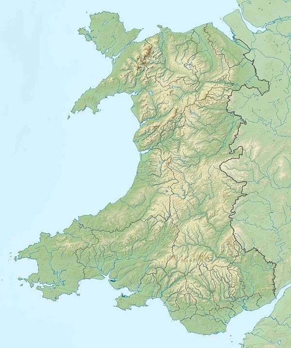
| Coordinates | 51°37′38″N 3°05′47″W / 51.62722°N 3.09639°WCoordinates: 51°37′38″N 3°05′47″W / 51.62722°N 3.09639°W |
| Geography | |
| OS grid | ST242926 |
| Topo map | OS Landranger 171 |
Twmbarlwm also known as Twm Barlwm, Twyn Barlwm, or locally known as "The twmp" (translation: hump) or the Pimple because of the mound that lies at its summit, is a hill situated 2 km (1.2 mi) to the northeast of Risca in South Wales. It is often mistakenly referred to as a mountain but is actually a hill due to being under 600m. It is 419 m (1,375 ft) high and is a well known landmark throughout the region. It commands extensive views across what is now the M4 corridor, over Newport and Cwmbran and out over the Bristol Channel.
History
At the top of the hill, near its summit, are the remains of what is presumed to be an Iron Age hillfort, believed to have been built by the Silures, the Celtic tribe that inhabited the area before and during Roman times. These remains have led the local people of Risca and Cwmcarn to call it "The tump". There was also thereafter possibly a Roman signal point and a substantial Norman motte-and-bailey castle which is incorporated into the eastern end of the fort, probably of early Norman construction. The area is a scheduled monument.[1][2]
In popular culture
The hill itself is a well known local landmark visible on the skyline for many miles and is indeed seen as a symbol of Monmouthshire/Gwent. It is very popular for hillwalking and mountain biking and with tourists who visit Cwmcarn Forest Drive or walk the Gwent Ridgeway. It features heavily in local folk legends with tales of a giant buried here, and treasure, supposedly guarded by swarms of bees.[3] Local legend says that the druids regarded it as a sacred site and a place of judgement.[4]
The hillfort is known to locals as 'the pimple' or 'the nipple'.[5][6] An example of the use of the term 'pimple' came during a boxing commentary on national radio by the BBC's Raymond Glendenning, who had grown up in Newport. As one of the boxers rose after being floored, Glendenning excitedly announced to the listeners that 'he has a lump on his head the size of the pimple on the top of Twm Barlwm!'
In years gone by people from Risca, Cwmbran and Newport enjoyed a day out "up the Tump" on Good Friday - Sunday schools, chapels, youth clubs, families and even whole streets would organise to walk to the top of the Tump - some church groups would carry a cross to the top and sing a few hymns. This tradition probably goes back to medieval times when Twmbarlwm was on the route of the Cistercian pilgrimage trail from Llantarnam to Penrhys. The march with church banners was certainly continued into the 1970s and attempts have been made to revive the tradition as recently as 2012. [7]
Youngsters from neighbouring areas and council estates such as that at Bettws often walk to the top of Twmbarlwm and back home on Good Friday, as a sort of tradition amongst friends and youngsters in the community.
The hill also is noted in the work of such local writers as W H Davies and Arthur Machen. Machen described it in his autobiography Far Off Things (1922): "As soon as I saw anything I saw Twym Barlwm, that mystic tumulus, the memorial of peoples that dwelt in that region before the Celts left the Land of Summer." This description was 'borrowed' by Dylan Thomas for Llareggub Hill in his Under Milk Wood.[8] Local historian and folklorist Fred Hando tells of the "Mountain Organ" produced by the wind on the southern slopes of the hill, and of the nearby "Pool of Avarice" the site of a great house which was swallowed wholesale by a landslip after the mistress of the house had turned away a hungy beggar.[9] The Cistercian Way (a waymarked, circular, long distance footpath developed in 1998)[10] passes through Llantarnam, Old Cwmbrân, Greenmeadow and Thornhill before reaching the ancient chapel of Llanderfel on Mynydd Maen, and then onwards to Twmbarlwm.[11]
In the past 20 years extensive damage has occurred to both the tump and surrounding areas, caused primarily by illegal off-road motorcycles. Several attempts have been made by the local councils to limit this damage by fencing off large areas, but so far all have failed with the fences being destroyed within weeks of erection.
Gallery
 Twmbarlwm seen from Llanfrechfa
 View from Twmbarlwm over Cwmbran
 View over the Bristol Channel with the Severn motorway bridges in the distance
 View from Twmbarlwm looking out over the Bristol Channel towards England
See also
References
- ↑ John Wiles (2008), Twmbarlwm, Castle Mound (ID NPRN268157). at the Royal Commission on the Ancient and Historical Monuments of Wales (RCAHMW)
- ↑ Twm Barlwm (ID PRN00115g) in the 'SMR' for Glamorgan-Gwent Archaeological Trust (GGAT)
- ↑ "Twmbarlwm and the Celts". Cwmcarn Forest. Caerphilly County Borough Council. The Curse of Bran. Retrieved 9 January 2016.
- ↑ "Twmbarlwm and the Celts". Cwmcarn Forest. Caerphilly County Borough Council. Courts of Justice. Retrieved 9 January 2016.
- ↑ Price, Katherine (9 May 2012). "Land of my fathers". The Boar. University of Warwick: The Boar (student newspaper). Retrieved 9 January 2016.
- ↑ Close, Carl (Summer 2012). "Memory Lane - A Vision of Home!" (PDF). Twmbarlwm News. Cymdeithas Twmbarlwm Society. p. 8. Retrieved 9 January 2016.
- ↑ http://www.campaignseries.co.uk/news/9623801.Walk_up_Twmbarlwm_this_Good_Friday/
- ↑ Dylan Thomas (1995), Under Milk Wood, The Definitive Edition, Dent, p 91.
- ↑ Hando, F.J., (1944) "The Pleasant Land of Gwent" - Chapter Two, Twyn Barllwm, R. H. Johns, Newport.
- ↑ "The Cistercian Way". The Cistercian Way. Newport, Wales: Alliance of Religions and Conservation. 5 September 2006. Archived from the original on 4 February 2015. Retrieved 9 January 2016.
- ↑ "Llantarnam to Risca". The Cistercian Way. Newport, Wales: Alliance of Religions and Conservation. 5 September 2006. Archived from the original on 4 February 2015. Retrieved 9 January 2016.
External links
- BBC - South East Wales Panoramics - Panoramics - see a 360 view from Twmbarlwm
- Twmbarlwm and the Celts at caerphilly.gov.uk