Twizel
| Twizel | |
|---|---|
 | |
 Twizel | |
| Coordinates: 44°15′S 170°06′E / 44.250°S 170.100°ECoordinates: 44°15′S 170°06′E / 44.250°S 170.100°E | |
| Country | New Zealand |
| Region | Canterbury |
| Territorial authority | Mackenzie District |
| Founded | 1968 |
| Area | |
| • Total | 12.23 km2 (4.72 sq mi) |
| Elevation | 470 m (1,540 ft) |
| Population (June 2016)[1] | |
| • Total | 1,230 |
| • Density | 100/km2 (260/sq mi) |
| Time zone | NZST (UTC+12) |
| • Summer (DST) | NZDT (UTC+13) |
| Postcode(s) | 7901 |
| Area code(s) | 03 |
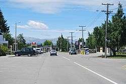
Twizel /ˈtwaɪzəl/ is the largest town in the Mackenzie District, in the Canterbury Region of New Zealand's South Island. The town was founded in 1968 to house construction workers on the Upper Waitaki Hydroelectric Scheme. Twizel has a resident population of 1,230 (June 2016);[1] during the summer, holidaymakers nearly triple the town's population.
History
The present town was built in 1968 as a greenfields project to service the Upper Waitaki Hydroelectricity Scheme. The scheme consisted of 50 km of canals, two dams, and four powerhouses (Tekapo B, Ohau A, B and C), and the formation of Lake Ruataniwha, producing 848 MW of electricity.[2][3] At the height of the project in the 1970s, population peaked of around 6,000.[4]
The town was laid out in a 'Scandinavian' fashion, featuring looping roads and pedestrian ways, making it usually far more direct to walk than use a car. Shops, school, and recreational parkland formed a hub in the centre of the town, around which the residential area were built. A previous version of this layout had been tried at Otematata. Accommodation was highly segregated: in addition to single men's quarters in the middle of town, there was a series of different houses available, with the smallest for workers, staff houses for teachers and professionals, and the largest for engineers and other high-status residents.[4]
As the intention was for the town to revert to farmland, there were many 'temporary' features. For example, instead of putting in kerbing, channels, and footpaths at the edge of the road, a single expanse of seal was contoured in a very flat 'W' shape: the seal was highest at the outer edge (footpath) and in the middle (centreline), with a lower area serving as a channel and delineation between the roadway and footpath. Likewise, most of the town's telephone local loop is strung above ground to save the task of burying and then removing the lines. Most houses were prefabricated, and intended to be portable. Some were brought from Otematata, and some were later moved to Clyde for the next hydroelectricity project. However, in 1983, as the hydroelectric project was winding up, residents successfully fought to save the town itself.[4]
Tourism and activities
Twizel is a now a service and tourist town for visitors. Nearby Lake Ruataniwha supports sailing, water skiing and prominent rowing events such as the Maadi Cup, while the Ohau Skifield and the Round Hill Ski Area attract winter tourists.
Twizel is also on the route of the Alps to Ocean Cycle Trail,[5]
The area boasts one of the world's cleanest, driest and darkest skies, and has long drawn astronomers to Twizel and the surrounding area, with several existing astro-tourism ventures, such as at Lake Tekapo and Omarama, catering to their needs during the development of two additional observatories in Twizel and at Mount Cook Village. Since 2012, Twizel has been a part of the Aoraki Mackenzie International Dark-Sky Reserve, one of only five such reserves in the world recognised by the International Dark-Sky Association.[6]
Education
Twizel Area School is the sole school in Twizel, catering for Year 1 to 13 students (ages 5 to 18). Established in 1986 following the merger of Twizel Primary School and Twizel High School, the school has a roll of 211 students as of July 2016.[7]
Transport
State Highway 8 is the main highway serving the town, which is also served by the nearby Pukaki Airport.
References
- 1 2 "Subnational Population Estimates: At 30 June 2016 (provisional)". Statistics New Zealand. 21 October 2016. Retrieved 21 October 2016. For urban areas, "Subnational population estimates (UA, AU), by age and sex, at 30 June 1996, 2001, 2006-16 (2017 boundary)". Statistics New Zealand. 21 October 2016. Retrieved 21 October 2016.
- ↑ "A HUGE SCHEME AND A LONG BUILD", JUNE 12TH, 2013, Vijay Naidu, EnergyNZ Magazine
- ↑ "Discover Waitaki", Meridian pamphlet
- 1 2 3 "Town saved from the bulldozers", 30 Nov 2013, David Bruce, ODT
- ↑ "Cycling from New Zealand's Alps to the ocean", Andrew Bain, Feb 26, 2015, "Australian Geographic"
- ↑ IDA - http://www.darksky.org/night-sky-conservation/87-international-dark-sky-reserves
- ↑ "Directory of Schools - as at 2 August 2016". New Zealand Ministry of Education. Retrieved 2016-08-16.
Further reading
- Sheridan, Marion (1995). Dam Dwellers – End of an Era. Twizel: Sheridan Press. pp. 392 pages. ISBN 0-473-03402-6.
External links
| Wikimedia Commons has media related to Twizel. |
- http://www.twizel.info OFFICIAL Twizel website.