Twenterand
| Twenterand | |||
|---|---|---|---|
| Municipality | |||
|
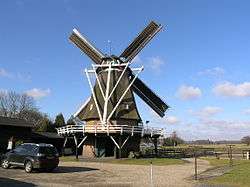
Windmill in Vriezenveen | |||
| |||
.svg.png) Location in Overijssel | |||
| Coordinates: 52°25′N 6°38′E / 52.417°N 6.633°ECoordinates: 52°25′N 6°38′E / 52.417°N 6.633°E | |||
| Country | Netherlands | ||
| Province | Overijssel | ||
| Established | 1 January 2001[1] | ||
| Renamed | 1 January 2003[2] | ||
| Government[3] | |||
| • Body | Municipal council | ||
| • Mayor | Cornelis Visser (CDA) | ||
| Area[4] | |||
| • Total | 108.14 km2 (41.75 sq mi) | ||
| • Land | 106.32 km2 (41.05 sq mi) | ||
| • Water | 1.82 km2 (0.70 sq mi) | ||
| Elevation[5] | 10 m (30 ft) | ||
| Population (May 2014)[6] | |||
| • Total | 33,921 | ||
| • Density | 319/km2 (830/sq mi) | ||
| Time zone | CET (UTC+1) | ||
| • Summer (DST) | CEST (UTC+2) | ||
| Postcode | 7670–7677, 7680–7683 | ||
| Area code | 0546 | ||
| Website |
www | ||

Twenterand [ˈtʋɛntərɑnt] (![]() pronunciation ) is a municipality in the province of Overijssel in the eastern Netherlands. The name means "edge of Twente" as it is situated on the northwestern fringe of the historical region of Twente.
pronunciation ) is a municipality in the province of Overijssel in the eastern Netherlands. The name means "edge of Twente" as it is situated on the northwestern fringe of the historical region of Twente.
The municipality of Twenterand also had two city halls, because of the merger between the former municipalities of Vriezenveen and Den Ham in 2001. The city hall in Vriezenveen remained. The extended municipality of Vriezenveen is called Twenterand since 2003. The former municipal area of Vriezenveen belongs to the region of Twente and the former municipal area of Den Ham partly to the region of Salland and partly to the region of Twente.
Population centres
- Bruinehaar
- De Pollen
- Den Ham
- Geerdijk
- Kloosterhaar
- Meer
- Vriezenveen
- Vroomshoop
- Weitemanslanden
- Westerhaar-Vriezenveensewijk
- Westerhoeven

Dutch topographic map of the municipality of Twenterand, June 2015
Transportation
References
- ↑ "Gemeentelijke indeling op 1 januari 2001" [Municipal divisions on 1 January 2001]. cbs.nl (in Dutch). CBS. Retrieved 2 April 2014.
- ↑ "Gemeentelijke indeling op 1 januari 2003" [Municipal divisions on 1 January 2003]. cbs.nl (in Dutch). CBS. Retrieved 2 April 2014.
- ↑ "Collegeleden" [Members of the board] (in Dutch). Gemeente Twenterand. Retrieved 2 April 2014.
- ↑ "Kerncijfers wijken en buurten" [Key figures for neighbourhoods]. CBS Statline (in Dutch). CBS. 2 July 2013. Retrieved 12 March 2014.
- ↑ "Postcodetool for 7671GS". Actueel Hoogtebestand Nederland (in Dutch). Het Waterschapshuis. Retrieved 2 April 2014.
- ↑ "Bevolkingsontwikkeling; regio per maand" [Population growth; regions per month]. CBS Statline (in Dutch). CBS. 26 June 2014. Retrieved 24 July 2014.
External links
 Media related to Twenterand at Wikimedia Commons
- Official website
 |
Ommen | Hardenberg | Uelsen (DE-NI) | |
| |
Tubbergen | |||
| ||||
| | ||||
| Hellendoorn | Wierden, Almelo |
Municipalities of Overijssel | ||
|---|---|---|
 | ||
| ||
This article is issued from Wikipedia - version of the 11/13/2016. The text is available under the Creative Commons Attribution/Share Alike but additional terms may apply for the media files.