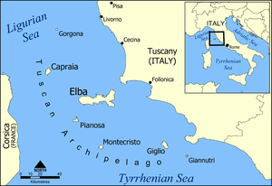
Tuscan Archipelago
| Native name: <span class="nickname" ">Arcipelago Toscano | |
|---|---|
 | |
 | |
| Geography | |
| Location | between Ligurian Sea and Tyrrhenian Sea |
| Archipelago | Tuscan Archipelago |
| Total islands | 7 |
| Major islands | Elba, Pianosa, Capraia, Montecristo, Giglio, Gorgona, Giannutri |
| Area | 295 km2 (114 sq mi) |
| Highest elevation | 1,018 m (3,340 ft) |
| Highest point | Monte Capanne |
| Administration | |
| Region | Tuscany |
| Province | Livorno, Grosseto |
| Largest settlement | Portoferraio (pop. 12,007) |
| Demographics | |
| Population | 34,250 |
| Pop. density | 108 /km2 (280 /sq mi) |
The Tuscan Archipelago is a chain of islands between the Ligurian Sea and Tyrrhenian Sea, west of Tuscany, Italy.
The islands' proximity to several major cities has made them a favourite tourist location. History and literature have ensured that most people are familiar with the islands of Elba and Montecristo.
| Island | Area in km² | Population 31 Dec 2011 |
|---|---|---|
| Elba | 223.5 | 32,160 |
| Giglio | 21.21 | 1,430 |
| Capraia | 19.30 | 420 |
| Montecristo | 10.39 | 2 |
| Pianosa | 10.25 | 10 |
| Gorgona | 2.23 | 220 |
| Giannutri | 2.60 | 10 |
| Other | 3.34 | 0 |
| Total: | 292.82 | 34,250 |
Geography
The Tuscan Archipelago is placed between the Corsica and the Tuscan coast and contains seven major islands as Capraia, Elba, Giannutri, Giglio, Gorgona, Montecristo and Pianosa; all of which are protected as part of the Arcipelago Toscano National Park. The Archipelago extends to 166 kilometres (103 mi) from the northernmost Island of Gorgona to the southernmost Giannutri and 56 kilometres (35 mi) from the western Island of Capraia to the Tuscan coast.
There are several islets in the archipelago including:
- Cerboli (Piombino Channel)
- Formiche di Grosseto (Grosseto)
- Isola della Cappa (Giglio)
- Isola Corbella (Elba)
- Isola di Ortano (Elba)
- Isola della Peraiola (Capraia)
- Isola dei Topi (Piombino Channel)
- Isole Gemini (Elba)
- Isolotto della Scarpa (Pianosa)
- Isolotto della Scola (Pianosa)
- Palmaiola (Piombino Channel)
- Scoglietto di Portoferraio (Elba)
and skerries as:
- Faraglione del Giglio
- Formiche di Capraia (Capraia)
- Formiche della Zanca (Elba)
- Isola dei Liscoli (Elba)
- Le Scole (Giglio)
- Meloria Shoal (Livorno)
- Scoglio d'Africa (Corsica Channel)
- Scoglio Forano (Pianosa)
- Scoglio del Gatto (Capraia)
- Scoglio della Manza (Capraia)
- Scoglio dell’Ogliera (Elba)
- Scoglio del Remaiolo (Elba)
- Scoglio della Triglia (Elba)
- Vada Shoal (Vada)
Others islets and skerries that are no part of the archipelago:
- Argentarola (Monte Argentario)
- Isolotto di Porto Ercole
- Isolotto dello Sparviero
- Scoglio della Focacciola
Geology
The Tuscan Archipelago represent a region of correlation between the Sardinian-Corsican system and the Italian Peninsula; it is formed by seven islands and several islets and skerries which have different geological provenance as magmatic, sedimentary and metamorphic rocks. The origin of the archipelago dates to the Triassic period according to the type of the rocks.
In the Quaternary the archipelago was related to the sea level fluctuations due to the glacial and interglacial periods; in the last glaciation the sea level fell 100 metres (330 feet), and Elba became a peninsula joined to the continent and to Pianosa. The Würm glaciation was followed by a warming phase, and the sea rose slowly to reach its current level.[1]
Fauna
The archipelago is distinguished by some endemism which are protected in order to avoid the loss of the biodiversity of fauna and flora. The most important are the Oxychilus pilula of Capraia and the Oxychilus gorgonianus of Gorgona; the Coenonympha elbana, the Podarcis muralis colosi, the Vipera aspis francisciredi at the Elba, the Vipera aspis montecristi at Montecristo. The mammals living on the archipelago are: the pine marten at Elba, the common rabbit at Capraia and Giglio while the introduction of the wild boar several years ago in the Elba has caused problems regarding the defence of some flora species.
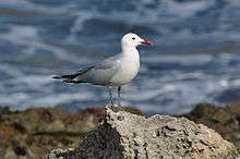
All the islands of the Tuscan Archipelago are a place where the bird migration take a stop along their seasonal movement from North to South and vice versa; the favourite places are Gorgona, Palmaiola, Cerboli and Montecristo. The Falco peregrinus brookei nests at Elba and Capraia, the shearwater and the rare Audouin's gull are common in all the islands.[2]
Flora

The archipelago is characterized by a Mediterranean climate with high insolation all year round. The archipelago’s flora change from island to island, the smaller have a vegetation similar each other as the macchia mediterranea and the garrigue formed by evergreen plants. The Elba have a complex orography and a relevant mountain as the Mount Capanne which favoured the preservation of the chestnut, the holm oak and the black alder mostly in the northern side.
The main widely plant formations are those of shrubs of erica, strawberry tree, genisteae, mastic, mediterranean buckthorn, myrtus and phoenician juniper; at Elba and Capraia is present the cork oak while at Elba and Gorgona are widely spread the Aleppo pine and the maritime pine. Separate chapter are the endemic plants which grow up in the archipelago as the pancratium illyricum, the borago pygmaea, the Corsican mint and the sea lavander that presents small differences depending on which island grows.[3]
Islands
Elba
Elba is a Mediterranean island in Tuscany, Italy, 10 kilometres (6.2 mi) from the coastal town of Piombino. The largest island of the Tuscan Archipelago, Elba is also part of the Arcipelago Toscano National Park and the third largest island in Italy, after Sicily and Sardinia. It is located in the Tyrrhenian Sea, about 50 kilometres (30 mi) east of the French island of Corsica.
Giglio
Isola del Giglio is an Italian island and comune situated in the Tyrrhenian Sea, off the coast of Tuscany, and is part of the Province of Grosseto. The island is one of seven that form the Tuscan Archipelago, lying within the Arcipelago Toscano National Park. Giglio means "lily" in Italian, and though the name would appear consistent with the insignia of Medici Florence, it derives from Aegilium, "Goat Island", a Latin transliteration of the Greek word for "little goat" (Ancient greek: Aigýllion, Αιγύλλιον).
Capraia
Capraia is an Italian island, is the north-westernmost of the seven islands of the Tuscan Archipelago, and the third largest after Elba and Giglio; it is also a comune (municipality) belonging to the Province of Livorno. The island has a population of about 400.
Montecristo
Montecristo is an island in the Tyrrhenian Sea and part of the Tuscan Archipelago. Administratively it belongs to the municipality of Portoferraio in the province of Livorno, Italy. The island has an area of 10.39 km2 (4.01 sq mi) and is approximately 4.3 km (2.7 mi) wide at its widest point; the coasts are steep, and extend for 16 km (9.9 mi). The island is a state nature reserve and forms part of the Tuscan Archipelago National Park.
Pianosa
The small island of Pianosa, about 10.25 km2 (3.96 sq mi) in area, has a coastal perimeter of 26 km (16 mi), forms part of Italy's Tuscan Archipelago in the Tyrrhenian Sea.
Gorgona
Gorgona is the northernmost island in the Tuscan Archipelago. Between Corsica and Livorno, this diminutive island has been valued most for its wildlife, especially marine birds, and its isolation. The latter quality resulted in the foundation of Gorgona Abbey in the Middle Ages. After its closure the monastery grounds and buildings were appropriated in 1869, at the foundation of an agricultural penal colony, which is currently in use.
Giannutri
Giannutri is a small island in the Tyrrhenian Sea off the coast of Tuscany, Italy ; it is the southernmost island of the Tuscan Archipelago and it is a frazione of the comune of Isola del Giglio in the Province of Grosseto.
Islets
Formiche di Grosseto
The Formiche di Grosseto ("Ants of Grosseto") is a group of islets which emerge sharply in the Tuscan Archipelago. They are located in open sea among the coast of the Natural Park of Maremma and Pianosa, approximately 13 nautical miles (24 km) from Porto Santo Stefano on Monte Argentario and 9.4 miles (15.1 km) from Marina di Grosseto; they are part of the comune of Grosseto and are placed in a nature reserve which makes part of a special protection area.
Palmaiola
Palmaiola is an islet placed in the middle of Piombino Channel, at 3 kilometres (1.9 mi) from Elba and 7 kilometres (4.3 mi) from Piombino; it is part of the comune of Rio Marina.
Skerries
Meloria
Meloria is a rocky skerry, surrounded by a shoal, off the Tuscan coast, in the Ligurian sea,[4] 3.5 miles (5.6 kilometres) north-west of Livorno.
Scoglietto di Portoferraio
 Scoglietto di Portoferraio Lighthouse | |
| Coordinates | 42°49′42.8″N 10°19′51.8″E / 42.828556°N 10.331056°E |
|---|---|
| Year first constructed | 1910 (first) |
| Year first lit | 1945 (current) |
| Construction | stone tower |
| Tower shape | two-stage cylindrical tower with balcony and lantern |
| Markings / pattern | unpainted tower, white lantern |
| Height | 8 metres (26 ft) |
| Focal height | 24 metres (79 ft) |
| Light source | solar power |
| Range | 5 nautical miles (9.3 km; 5.8 mi) |
| Characteristic | Fl (2) W 6s. |
| Admiralty number | E1410 |
| NGA number | 8892 |
| ARLHS number | ITA-257 |
| Italy number | 2068 E.F[5] |
Scoglietto di Portoferraio is a rocky skerry without vegetation placed in front of Portoferraio. It is a marine protected area since 1971, and from January 2014 it is a Site of Community Importance. The skerry is 150 metres (490 feet) long and 124 metres (407 feet) wide and it is placed at 1.36 kilometres (0.85 mi) from Punta Capo Bianco and 1.14 kilometres (0.71 miles) from Punta Falconaia.
Scoglietto di Portoferraio lighthouse
The first historic lighthouse was established in 1910, then it was reconstructed in 1945 because destroyed during World war II. The lighthouse is a small square stone keeper’s cottage with the cylindrical stone tower positioned at one corner; it has a balcony and the lantern is at 24 metres above sea level. It is fully automated and operated by Marina Militare identified by the code number 2068 E.F. The lighthouse is powered by a solar power unit and emits a group of two alternating white flash in a six seconds period visible up to five nautical miles (9.3 kilometres; 5.8 miles).[6]
Scoglio d'Africa
Scoglio d'Africa[7] (or Scoglio d'Affrica), also named Formica di Monte Cristo ("Monte Cristo's Ant"), is a solitary small skerry belonging to the Tuscan Archipelago located in open sea between Tyrrhenian Sea and Corsica Channel. It is located 18.5 kilometres (11.5 miles) west of the Island of Montecristo, 23.5 kilometres (14.6 miles) south of Pianosa Island and 43.1 kilometres (26.8 miles) east of Corsica. Administratively it belongs to the municipality of Campo nell'Elba. It is also part of the Tuscan Archipelago National Park.
Image gallery
 L'Enfola, Elba island
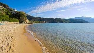 Scaglieri beach, Elba island
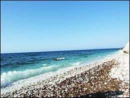
2.JPG) Cala Giovanna, Pianosa island
Cala Giovanna, Pianosa island Capraia main village, Capraia island
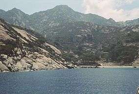 Montecristo Island
 Napoleon's house in Portoferraio.
 Cannelle beach, Giglio island
 Giannutri coast
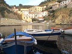 The village of Gorgona seen from the harbour
.jpg) Palazzo della Specola, Pianosa island
Palazzo della Specola, Pianosa island
See also
References
- ↑ Archipelago Toscano national Park
- ↑ Fauna Parco Nazionale Arcipelago Toscano
- ↑ Flora Parco Nazionale Arcipelago Toscano
- ↑ Mar Ligure Marina Militare
- ↑ Scoglietto di Portoferraio Lighthouse The Lighthouse Directory. University of North Carolina at Chapel Hill. Retrieved March 12, 2016
- ↑ Scoglietto di Portoferraio lighthouse Marina Militare
- ↑ Scoglio d'Africa Marina Militare
External links
| Wikimedia Commons has media related to Tuscan Archipelago. |
Coordinates: 42°45′N 10°18′E / 42.750°N 10.300°E