Tureng Tepe
Tureng Tepe (Persian: تورنگ تپه, "Hill of the Pheasants")[1] (alternatively spelled in English as Turang Tappe/Tape/Tappa/Tappeh) is an archaeological site in northeastern Iran, in the Gorgan plain,[2][3] approximately 17 km northeast of the town of Gorgan.[4]
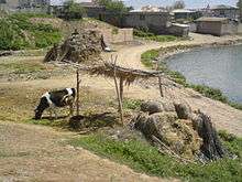
Tureng Tepe consists of a group of mounds interspersed with ponds and water courses. The whole archaeological pattern is about 800 – 900 m in diameter. Most of the mounds rise between 11 and 15 m above the level of the surrounding plan, but the steep central mound, marked A on the Wulsin's plan, is over 30 m high and dominated the entire site.
The oldest remains on the site date to the Neolithic and Chalcolithic periods. The Bronze Age settlement portion of the site dates from approximately 3100-2900 BC through 1900 BC.[5] In 1841, some material (including gold vessels) from the site was sent to the Shah (Mohammad Shah Qajar), and examined by Clement Augustus (C.A.) de Bode, piquing initial modern interest in the site.[1][6] The first modern excavations were done by Frederick Wulsin in 1931, sponsored by the Atkins Museum of Fine Arts.[5] Grey ware pottery from the site was found and studied.[7] In the mid-20th century, the site (a hill) had a height of approximately 30m. In 1959, Jean Deshayes (1924–1979)[8] rediscovered the site, and regular excavations began soon after until 1979.[9]
Chronology
Neolithic and Chalcolithic
- Tureng IA (Neolithic period - these layers are assumed to lie below the water table. From this horizon occur Djeitun-like sherds, incorporated in bricks made in later periods)
- Tureng IB (Late Neolithic period - again presumably below the water table)
- Tureng IIA (Early Chalcolithic period)
Bronze Age
- Tureng IIB (ca. 3100–2600 BCE)
- Tureng III A / B (ca. 2600–2100 BCE). To this period belongs an enormous, mud-bricks high terrace, constructed in the center of the settlement and representing perhaps the earliest example of monumental architecture in this region.[10]
- Tureng III C (about 2100 -? BCE)
Iron Age
- Tureng IV A (Iron Age, possibly 7th century BCE)
- Tureng IV B Iron Age, possibly 6th century BCE)
- Tureng VA (2nd century BCE)
Historical time
- Tureng VB (1st century BCE)
- Tureng VC / D (1st–2nd century AD)
- Tureng VI A Sasanian empire(3rd–5th century AD)
- Tureng VI B end of the Sasanian empire (possibly 6th - 7th centuries)
- Tureng VII A / B Islamic occupation at the top of Mound A(10th–11th century AD)
- Tureng VIII some Islamic remains located in the south-west part of the site (possibly 13th century AD)
During the Bronze Age, Tureng Tepe was likely a thriving settlement.
See also
References
- 1 2 Rostovtzeff, M. The Sumerian Treasure of Astrabad, in The Journal of Egyptian Archaeology, Vol. 6, No. 1 (Jan., 1920), pp. 4–27
- ↑ The pioneer of pre-history, The National (Abu Dhabi) (October 12, 2009)
- ↑ Potts, D.T. Mesopotamia: The Material Foundation (Athlone Press 1997) (ISBN 0-485-93001-3)
- ↑ Achaemenid history, p. 124–126 (1988)
- 1 2 Moreau, Kathy. Tureng Tepe, Iran expedition records (finding aid) (University of Pennsylvania, Penn Museum Archives, 2010), Retrieved July 19, 2010
- ↑ Coon, Carleton S. Caravan – The Story of Middle East, p. 221 (1958)
- ↑ Encyclopædia Iranica, CERAMICS ix. The Bronze Age in Northeastern Persia, Retrieved July 19, 2010
- ↑ NOTICES NECROLOGIQUES: Jean DESHAYES (1924–1979), Paleorient (1979), Vol. 5, Issue 5, p.7
- ↑ Leriche, Pierre. Fouilles de Tureng Tepe I (Review), Syria, 1994, vol. 71, n° 1, pp. 239–242.
- ↑ Deshayes, Jean (1977). "A propos des terrasses hautes de la fin du IIIe millénaire en Iran et en Asie centrale" IN Le Plateau iranien et l'Asie Centrale des origines à la Conquête islamique. Paris: Editions du CNRS. pp. 95–111.
Additional sources
- Deshayes, J., 1968 – Tureng Tepe and the Plain of Gorgan in the Bronze Age. Archaeologia, I(1), Paris.
- Fouilles de Tureng Tepe (1987) (ISBN 2-86538-182-X)
- Wulsin, F.R., 1932 – Excavation at Tureng Tepe, near Asterabad. Supplement to the Bull. American Inst. Persian Art and Archaeology, New York
External links
- Turang Tepe, View of the Mound, From an Altitude of 1,740 M on May 12, 1937 - Oriental Institute
- Report on similar finds at the nearby Bazgir Tepe - Tehran Times 2011
Coordinates: 36°55′53″N 54°34′59″E / 36.93139°N 54.58306°E