Tulsa County, Oklahoma
| Tulsa County, Oklahoma | |
|---|---|
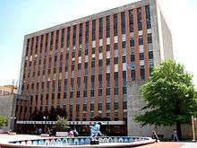 Tulsa County Courthouse | |
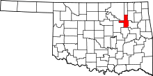 Location in the U.S. state of Oklahoma | |
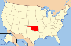 Oklahoma's location in the U.S. | |
| Founded | 1907 |
| Named for | city of Tulsa |
| Seat | Tulsa |
| Largest city | Tulsa |
| Area | |
| • Total | 587 sq mi (1,520 km2) |
| • Land | 570 sq mi (1,476 km2) |
| • Water | 17 sq mi (44 km2), 2.9% |
| Population (est.) | |
| • (2013) | 622,409 |
| • Density | 1,092/sq mi (422/km²) |
| Congressional district | 1st |
| Time zone | Central: UTC-6/-5 |
| Website |
www |
Tulsa County is a county located in the U.S. state of Oklahoma. As of the 2010 census, the population was 603,403,[1] making it the second-most populous county in Oklahoma, behind only Oklahoma County. Its county seat and largest city is Tulsa, the second-largest city in the state.[2] Founded at statehood, in 1907, it was named after the previously established city of Tulsa. Before statehood, the area was part of both the Creek Nation and the Cooweescoowee District of Cherokee Nation in Indian Territory.
Tulsa County is included in the Tulsa, OK Metropolitan Statistical Area.
Tulsa County is notable for being the most densely populated county in the state. Tulsa County also ranks as having the highest-income.[3]
History
The history of Tulsa County greatly overlaps the history of the city of Tulsa. This section addresses events that largely occurred outside the present city limits of Tulsa.
Old Fort Arbuckle
The U. S. Government's removal of Native American tribes from the southeastern United States to "Indian Territory" did not take into account how that would impact the lives and attitudes of the nomadic tribes that already used the same land as their hunting grounds. At first, Creek immigrants stayed close to Fort Gibson, near the confluence of the Arkansas and Verdigris rivers. However, the government encouraged newer immigrants to move farther up the Arkansas. The Osage tribe had agreed to leave the land near the Verdigris, but had not moved far and soon threatened the new Creek settlements.[4]
In 1831, a party led by Rev. Isaac McCoy and Lt. James L. Dawson blazed a trail up the north side of the Arkansas from Fort Gibson to its junction with the Cimarron River. In 1832, Dawson was sent again to select sites for military posts. One of his recommended sites was about two and a half miles downstream from the Cimarron River junction. The following year, Brevet Major George Birch and two companies of the 7th Infantry Regiment followed the "Dawson Road" to the aforementioned site. Flattering his former commanding officer, General Matthew Arbuckle, Birch named the site "Fort Arbuckle."[4][5]
According to Encyclopedia of Oklahoma History and Culture, the fort was about 8 miles (13 km) west of the present city of Sand Springs, Oklahoma.[6] Author James Gardner visited the site in the early 1930s. His article describing the visit includes an old map showing the fort located on the north bank of the Arkansas River near Sand Creek, just south of the line separating Tulsa County and Osage County. After ground was cleared and a blockhouse built, Fort Arbuckle was abandoned November 11, 1834. The remnants of stockade and some chimneys could still be seen nearly a hundred years later.[5] The site was submerged when Keystone Lake was built.
Battle of Chusto-Talasah
Main article Battle of Chusto-Talasah
At the outbreak of the Civil War in 1861, many Creeks and Seminoles in Indian Territory, led by Opothleyahola, retained their allegiance to the U. S. Government. In November, 1861, Confederate Col. Douglas H. Cooper led a Confederate force against the Union supporters with the purpose of either compelling their submission or driving them out of the country. The first clash, known as the Battle of Round Mountain, occurred November 19, 1861. Although the Unionists successfully withstood the attack and mounted a counterattack, the Confederates claimed a strategic victory because the Unionists were forced to withdraw.[7]
The next battle occurred December 9, 1861. Col. Cooper's force attacked the Unionists at Chusto-Talasah (Caving Banks) on the Horseshoe Bend of Bird Creek in what is now Tulsa County. The Confederates drove the Unionists across Bird Creek, but could not pursue, because they were short of ammunition. Still, the Confederates could claim victory.[7]
Coming of the railroads
The Atlantic and Pacific Railroad Company had extended its main line in Indian Territory from Vinita to Tulsa in 1883, where it stopped on the east side of the Arkansas River. The company, which later merged into the St. Louis and San Francisco Railway (familiarly known as the Frisco), then built a steel bridge across the river to extend the line to Red Fork. This bridge allowed cattlemen to load their animals onto the railroad west of the Arkansas instead of fording the river, as had been the practice previously. It also provided a safer and more convenient way to bring workers from Tulsa to the oil field after the 1901 discovery of oil in Red Fork.
Oil Boom
A wildcat well named Sue Bland No. 1 hit paydirt at 540 feet on June 25, 1901 as a gusher. The well was on the property of Sue A. Bland (née Davis), located near the community of Red Fork. Mrs. Bland was a Creek citizen and wife of Dr. John C. W. Bland, the first practicing physician in Tulsa. The property was Mrs. Bland's homestead allotment. Oil produced by the well was shipped in barrels to the nearest refinery in Kansas, where it was sold for $1.00 a barrel.[8]
Other producing wells followed soon after. The next big strike in Tulsa County was in the vicinity of Glenn Pool.
Ironically, while the city of Tulsa claimed to be "Oil Capital of the World" for much of the 20th Century, a city ordinance banned drilling for oil within the city limits.
Tulsa County Court House
In 1910, Tulsa County built a court house in Tulsa on the northeast corner of Sixth Street and South Boulder Avenue. Yule marble was used in its construction. The land had previously been the site of a mansion owned by George Perryman and his wife. This was the court house where a mob of white residents gathered on May 31, 1921, threatening to lynch a young black man held in the top-floor jail. It was the beginning of the Tulsa Race Riot. See Yule marble.
An advertisement for bids specified that the building should be fireproof, built of either reinforced concrete or steel and concrete. The size was to be 120 feet (37 m) by 120 feet (37 m) with three floors and a full basement. Cost of the building was not to exceed $200,000. The jail on the top floor was not to exceed $25,000.[9]
The building continued to serve until the present court house building (shown above) opened at 515 South Denver. The old building was then demolished and the land was then sold to private investors. The land is now the site of the Bank of America building, completed in 1967.
Geography and climate
According to the U.S. Census Bureau, the county has a total area of 587 square miles (1,520 km2), of which 570 square miles (1,500 km2) is land and 17 square miles (44 km2) (2.9%) is water.[10]
The Arkansas River drains most of the county. Keystone Lake, formed by a dam on the Arkansas River, lies partially in the county. Bird Creek and the Caney River, tributaries of the Verdigris River drain the northern part of the county.[6]
Adjacent counties
- Washington County (north)
- Rogers County (northeast)
- Wagoner County (southeast)
- Okmulgee County (south)
- Creek County (west)
- Pawnee County (northwest)
- Osage County (northwest)
Major highways
-
 Interstate 44
 -
 Interstate 244
 -
 Interstate 444
 -
 U.S. Route 64
 -
.svg.png) U.S. Historic Route 66
U.S. Historic Route 66 -
 U.S. Route 75
 -
 U.S. Route 169
 -
 U.S. Route 412
 -
 Creek Turnpike
 -
 Oklahoma State Highway 11
 -
 Future Oklahoma State Highway 12
 -
 Oklahoma State Highway 20
 -
 Oklahoma State Highway 51
 -
 Oklahoma State Highway 67
 -
 Oklahoma State Highway 97
 -
 Oklahoma State Highway 97T
 -
 Oklahoma State Highway 117
 -
 Oklahoma State Highway 151
 -
 Oklahoma State Highway 266
 -
 Future Oklahoma State Highway 364
 - Gilcrease Expressway
- L.L. Tisdale Parkway
Demographics
| Historical population | |||
|---|---|---|---|
| Census | Pop. | %± | |
| 1910 | 34,995 | — | |
| 1920 | 109,023 | 211.5% | |
| 1930 | 187,574 | 72.0% | |
| 1940 | 193,363 | 3.1% | |
| 1950 | 251,686 | 30.2% | |
| 1960 | 346,038 | 37.5% | |
| 1970 | 401,663 | 16.1% | |
| 1980 | 470,593 | 17.2% | |
| 1990 | 503,341 | 7.0% | |
| 2000 | 563,299 | 11.9% | |
| 2010 | 603,403 | 7.1% | |
| Est. 2015 | 639,242 | [11] | 5.9% |
| U.S. Decennial Census[12] 1790-1960[13] 1900-1990[14] 1990-2000[15] 2010-2013[1] | |||
As of the census[16] of 2010, there were 603,403 people, 241,737 households, and 154,084 families residing in the county. The population density was 1,059 people per square mile (409/km²). The racial makeup of the county was 69.2% White, 10.7% Black or African American, 6.0% Native American, 2.3% Asian, 0.1% Pacific Islander, 5.8% from other races, and 5.8% from two or more races. 11.0% of the population were Hispanic or Latino of any race (8.8% Mexican). 14.2% were of German, 12.3% Irish, 8.8% English, 8.5% American, 2.3% French, and 2.3% Scottish ancestries according to the Census 2010. 88.3% spoke English, 8.1% Spanish, and 0.4% Vietnamese as their first language.[17][18]
There were 241,737 households out of which 30.1% had children under the age of 18 living with them, 45.3% were married couples living together, 13.3% had a female householder with no husband present, and 36.3% were non-families. 29.60% of all households were made up of individuals and 22% had someone living alone who was 65 years of age or older. The average household size was 2.46 and the average family size was 3.07.
In the county, the population was spread out with 26.30% under the age of 18, 10.00% from 18 to 24, 30.40% from 25 to 44, 21.60% from 45 to 64, and 11.80% who were 65 years of age or older. The median age was 34 years. For every 100 females there were 94.20 males. For every 100 females age 18 and over, there were 90.90 males.
The median income for a household in the county was $47,005, and the median income for a family was $60,093. The per capita income for the county was $27,425. About 11.0% of families and 15.1% of the population were below the poverty line, including 22.6% of those under age 18 and 8.2% of those age 65 or over.[19][20] Of the county's population over the age of 25, 29.2% held a bachelor's degree or higher, and 88.2% have a high school diploma or equivalent.
Politics
| Voter Registration and Party Enrollment as of January 15, 2016[21] | |||||
|---|---|---|---|---|---|
| Party | Number of Voters | Percentage | |||
| Democratic | 114,826 | 35.40% | |||
| Republican | 164,910 | 50.84% | |||
| Unaffiliated | 44,661 | 13.77% | |||
| Total | 324,397 | 100% | |||
| Year | Republican | Democratic |
|---|---|---|
| 2016 | 58.39% 144,258 | 35.56% 87,847 |
| 2012 | 63.68% 145,062 | 36.32% 82,744 |
| 2008 | 62.23% 158,363 | 37.77% 96,133 |
| 2004 | 64.43% 163,452 | 35.57% 90,220 |
| 2000 | 61.34% 134,152 | 37.34% 81,656 |
Parks and recreation
River Parks was established in 1974 as a joint operation of the City of Tulsa and Tulsa County, with funding from both governments as well as private entities. It is not a part of the Tulsa Parks and Recreation Department, but is managed by the River Parks Authority. It is a series of linear parks that run adjacent to the Arkansas River for about 10 miles (16 km) from downtown to the Jenks bridge. Since 2007 a significant portion of the River Parks area has been renovated with new trails, landscaping and playground equipment. The River Parks Turkey Mountain Urban Wilderness Area on the west side of the Arkansas River in south Tulsa is a 300 acres (120 ha) area that contains over 45 miles (72 km) of dirt trails available for hiking, trail running, mountain biking and horseback riding.[23] The "Tulsa Townies" organization provide bicycles that may be checked out for use. There are three kiosks in the parks where bicycles may be obtained or returned.[24]
Communities
Cities
- Bixby (part)
- Broken Arrow (part)
- Collinsville
- Glenpool
- Jenks
- Owasso (part)
- Sand Springs (part)
- Sapulpa (part)
- Tulsa (county seat) (part)
Towns
Census-designated places
Unincorporated communities
Former communities
- Alsuma - Annexed by Tulsa in 1968.[25][26]
- Carbondale - Annexed by Tulsa in 1928.[27]
- Dawson - Annexed by Tulsa in 1949.[28]
- Keystone, Oklahoma - Submerged by Keystone Lake, whose construction began in 1958.
- North Tulsa - Annexed by Tulsa in 1904.[29]
- Prattville - Annexed by Sand Springs in 1965.[30]
- Red Fork - Annexed by Tulsa in 1927.[28]
- South Haven - Annexed by Tulsa in 1966.[27]
NRHP sites
The following sites in Tulsa County are listed on the National Register of Historic Places:
- 66 Motel, Tulsa
- Ambassador Hotel, Tulsa
- Bishop Kelley High School
- Boston Avenue United Methodist Church, Tulsa
- Boulder-on-the-Park, Tulsa
- Brady Heights Historic District, Tulsa
- Broken Arrow Elementary--Junior High School, Broken Arrow
- Cain's Dancing Academy, Tulsa
- Circle Theater, Tulsa
- Clinton-Hardy House, Tulsa
- Tulsa Convention Hall, Tulsa
- Cosden Building, Tulsa
- Creek Council Oak Tree, Tulsa
- Dawson School, Tulsa
- Carl K. Dresser House, Tulsa
- Eleventh Street Arkansas River Bridge, Tulsa
- Fort Arbuckle Site, Sand Springs
- Gillette Historic District, Tulsa
- Gillette-Tyrell Building, Tulsa
- Haskell State School of Agriculture, Broken Arrow
- Holy Family Cathedral, Rectory, and School, Tulsa
- Hooper Brothers Coffee Company Building, Tulsa
- Robert Lawton Jones House, Tulsa
- Maple Ridge Historic Residential District, Tulsa
- Mayo Building, Tulsa
- Mayo Hotel, Tulsa
- Mayo Motor Inn
- James H. McBirney House, Tulsa
- McFarlin Building, Tulsa
- Robert M. McFarlin House, Tulsa
- B. W. McLean House and Office, Jenks
- Mincks-Adams Hotel, Tulsa
- Moore Manor, Tulsa
- Mount Zion Baptist Church, Tulsa
- North Cheyenne Historic District, Tulsa
- Oil Capital of the World Historic District
- Oklahoma Natural Gas Company Building, Tulsa
- Owen Park Historic District, Tulsa
- Page Memorial Library, Sand Springs
- Foster B. Parriott House, Tulsa
- Petroleum Building, Tulsa
- Philcade Building, Tulsa
- Phillips 66 Station 473, Tulsa
- Waite Phillips Mansion (now Philbrook Museum), Tulsa
- Philtower, Tulsa
- Pierce Block, Tulsa
- Public Service of Oklahoma Building, Tulsa
- Ranch Acres Historic Residential District, Tulsa
- Riverside Historic Residential District, Tulsa
- Riverside Studio, Tulsa
- Sand Springs Power Plant, Sand Springs
- Sinclair Service Station, Tulsa
- William G. Skelly House, Tulsa
- Southwestern Bell Main Dial Building, Tulsa
- St. John Vianney Training School for Girls, Tulsa
- Swan Lake Historic District, Tulsa
- Tracy Park Historic District
- Tribune Building, Tulsa
- Tulsa Fire Alarm Building, Tulsa
- Tulsa Municipal Building, Tulsa
- United States Post Office and Courthouse, Tulsa
- James Alexander Veasey House, Tulsa
- Vickery Phillips 66 Station, Tulsa
- Westhope, Tulsa
- White City Historic District, Tulsa
- Woodward Park and Gardens Historic District
- Yorktown Historic District, Tulsa
See also
References
- 1 2 "State & County QuickFacts". United States Census Bureau. Retrieved November 13, 2013.
- ↑ "Find a County". National Association of Counties. Retrieved 2011-06-07.
- ↑ Per capita income in Tulsa County highest in state | Tulsa World
- 1 2 Carter, Sandi and Marlene Clark. "Old Fort Arbuckle." Accessed April 10, 2011.
- 1 2 Gardner, James E. Chronicles of Oklahoma, Volume 11, No. 2. June, 1933. "One Hundred Years Ago in the Region of Tulsa."
- 1 2 O"Dell, Larry. "Tulsa County," Encyclopedia of Oklahoma History and Culture, Oklahoma Historical Society, 2009. Accessed April 5, 2015.
- 1 2 Civil War Academy.com Website. Retrieved April 11, 2011.
- ↑ Clinton, Fred S. "First Oil and Gas Well in Tulsa County," Chronicles of Oklahoma, p. 312-332. Accessed April 5, 2015.
- ↑ "Sketches for Court House and County Jail." The American Contractor. Accessed July 15, 2015.
- ↑ "2010 Census Gazetteer Files". United States Census Bureau. August 22, 2012. Retrieved February 22, 2015.
- ↑ "County Totals Dataset: Population, Population Change and Estimated Components of Population Change: April 1, 2010 to July 1, 2015". Retrieved July 2, 2016.
- ↑ "U.S. Decennial Census". United States Census Bureau. Retrieved February 22, 2015.
- ↑ "Historical Census Browser". University of Virginia Library. Retrieved February 22, 2015.
- ↑ Forstall, Richard L., ed. (March 27, 1995). "Population of Counties by Decennial Census: 1900 to 1990". United States Census Bureau. Retrieved February 22, 2015.
- ↑ "Census 2000 PHC-T-4. Ranking Tables for Counties: 1990 and 2000" (PDF). United States Census Bureau. April 2, 2001. Retrieved February 22, 2015.
- ↑ "American FactFinder". United States Census Bureau. Retrieved 2008-01-31.
- ↑ American FactFinder - Results
- ↑ American FactFinder - Results
- ↑ American FactFinder - Results
- ↑ Tulsa County QuickFacts from the US Census Bureau
- ↑ https://www.ok.gov/elections/documents/20160115%20-%20Registration%20By%20County%20%28vr2420%29.pdf
- ↑ "Dave Leip's Atlas of U.S. Presidential Elections". Retrieved 2016-11-19.
- ↑ "About the Park." River Parks Authority. Retrieved November 30, 2014.
- ↑ Tulsa Townies. "How it works." Retrieved November 30, 2014.
- ↑ Alsuma website. Retrieved September 30, 2011
- ↑ "Alsuma: The Town That Disappeared From Southeast Tulsa." Arnett, David. GTR Newspapers. March 30, 2007. Retrieved August 2, 2014.
- 1 2 Breed, David M., with early drafting and initial research by Kent Schell. "Appendix D: Early History of Southwest Tulsa" Southwest Tulsa Planning Team, Southwest Tulsa Historical Society and Tulsa Planning Department. p. 111. Accessed April 5, 2015.
- 1 2 Tulsa City Council. A History of Tulsa Annexation. 2004. Accessed April 5, 2015.
- ↑ Tulsa Preservation Commission. "Urban Development {1901–1945) Accessed May 5, 2011.>
- ↑ Gregory, Carl N. "Sand Springs," Encyclopedia of Oklahoma History and Culture, Oklahoma Historical Society, 2009. Accessed April 5, 2015.
External links
- Tulsa County Government's website
- Oklahoma Digital Maps: Digital Collections of Oklahoma and Indian Territory
 |
Osage County Pawnee County |
Washington County | Rogers County | |
| Creek County | |
|||
| ||||
| | ||||
| Okmulgee County | Wagoner County |
Municipalities and communities of Tulsa County, Oklahoma, United States | ||
|---|---|---|
| Cities | | |
| Towns | ||
| CDPs | ||
| Unincorporated community | ||
| Footnotes | ‡This populated place also has portions in an adjacent county or counties | |
| Counties | 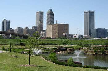 | |
|---|---|---|
| Principal city | ||
| Cities over 20k | ||
| Cities 10k-20k | ||
| Cities 5k-10k | ||
| Cities and towns 1k-5k | ||
Coordinates: 36°07′N 95°56′W / 36.12°N 95.94°W