Tully, Queensland
| Tully Queensland | |||||||||||||
|---|---|---|---|---|---|---|---|---|---|---|---|---|---|
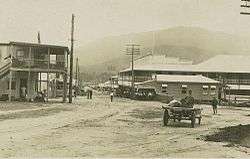
 Tully's main street | |||||||||||||
 Tully | |||||||||||||
| Coordinates | 17°56′0″S 145°56′0″E / 17.93333°S 145.93333°ECoordinates: 17°56′0″S 145°56′0″E / 17.93333°S 145.93333°E | ||||||||||||
| Population | 2,436 (2011 census)[1] | ||||||||||||
| Postcode(s) | 4854 | ||||||||||||
| Elevation | 24 m (79 ft) | ||||||||||||
| Location |
| ||||||||||||
| LGA(s) | Cassowary Coast Region | ||||||||||||
| State electorate(s) | Hinchinbrook | ||||||||||||
| Federal Division(s) | Kennedy | ||||||||||||
| |||||||||||||
| |||||||||||||
Tully is a town and locality in the Cassowary Coast Region, Queensland, Australia.[2][3] It is adjacent to the Bruce Highway approximately 140 kilometres (87 mi) south of Cairns by road and 210 kilometres (130 mi) north of Townsville. In the 2011 census, Tully had a population of 2,436 people.[1]
The Tully River (previously known as the Mackay River) was named after Surveyor-General William Alcock Tully in the 1870s. The town of Tully was named after the river when it was surveyed off when the sugar mill was erected in 1924. Previously a settlement known as Banyan had grown up on the other side of Banyan Creek during the previous decade.
Tully is one of the larger towns of the Cassowary Coast Region. The economic base of the region is agriculture; sugar cane and banana being the dominant crops grown. The sugar cane grown at the many farms in the district is processed locally at the Tully Sugar Mill to give raw sugar which is shipped elsewhere for refinement.
History

The Tully River area was slowly settled once Cardwell, to the south, was established. The river was renamed in 1872 in honour of William Alcock Tully, then under-secretary for public lands and chief commissioner of crown lands in Queensland. The first settlers were the nephews of James Tyson who raised beef cattle. It was not until the government constructed a sugar mill in 1925 that the town began to develop.[4]
Tully was originally within the Cardwell Division, which became the Shire of Cardwell in 1903. The original headquarters for the division/shire were in older town of Cardwell. In 1929, the decision was taken to relocate the shire council's headquarters to the newer but more populous town of Tully. The first council meeting held in Tully was on 27 June 1929. A new shire chambers was built in 1930 on the south-east corner of Bryant and Morris Streets.
At the 2011 census, Tully had a population of 2,436.[1]
Tully remained the administrative centre for the Shire of Cardwell, until the shire was amalgamated into the Cassowary Coast Region in 2008. The regional council has its headquarters in Innisfail.
In March 2015, a farm at Tully tested positive for the soil-borne Panama disease.[5] Follow-up testing confirmed the results. One of the strains of the disease affects all types of bananas and has previously only been detected in the Northern Territory. Harvesting continued on the property with strict protocols allowing the farm to continue to operate and distribute product without posing a threat.[6]
Climate
Tully has a tropical rainforest climate. With an average annual rainfall exceeding 4,000 millimetres (160 in), and the highest ever annual rainfall in a populated area of Australia (7,900 millimetres (310 in) in 1950), Tully is arguably the wettest town in Australia – a rivalry exists between Tully and the nearby town of Babinda for said title in which most years Babinda wins. Although Tully's average rainfall is less than Babinda, in 2003 a giant gumboot (the "Golden Gumboot") was erected as a monument to the town's climate; it also serves as a museum documenting past floods, as well as displaying the current rainfall for the year.
| Climate data for Tully, Queensland | |||||||||||||
|---|---|---|---|---|---|---|---|---|---|---|---|---|---|
| Month | Jan | Feb | Mar | Apr | May | Jun | Jul | Aug | Sep | Oct | Nov | Dec | Year |
| Average high °C (°F) | 31.3 (88.3) |
30.8 (87.4) |
29.9 (85.8) |
28.3 (82.9) |
26.3 (79.3) |
24.5 (76.1) |
24.0 (75.2) |
25.3 (77.5) |
27.3 (81.1) |
29.1 (84.4) |
30.5 (86.9) |
31.3 (88.3) |
28.22 (82.77) |
| Average low °C (°F) | 22.7 (72.9) |
22.8 (73) |
22.1 (71.8) |
20.7 (69.3) |
18.6 (65.5) |
16.1 (61) |
15.1 (59.2) |
15.6 (60.1) |
16.9 (62.4) |
19.0 (66.2) |
20.8 (69.4) |
22.1 (71.8) |
19.38 (66.88) |
| Average precipitation mm (inches) | 605.7 (23.846) |
738.0 (29.055) |
752.6 (29.63) |
533.7 (21.012) |
329.9 (12.988) |
195.6 (7.701) |
152.0 (5.984) |
125.6 (4.945) |
114.2 (4.496) |
109.7 (4.319) |
176.8 (6.961) |
270.1 (10.634) |
4,103.9 (161.571) |
| Source: BOM (Bureau of Meteorology)[7] | |||||||||||||
Cyclone Yasi
Buildings in Tully were badly damaged by Cyclone Yasi on 3 February 2011.[8][9] According to residents, Tully was "...a scene of mass devastation". An unknown number of homes were completely destroyed as intense winds, estimated at 300 km/h (190 mph), battered the area. Many other homes not destroyed sustained severe façade and or roof damage.[10] As daybreak came, reports from the town stated that about 90 per cent of the structures along the main avenue sustained extensive damage.[11]
Transport
Tully railway station is a prominent station on the main North Coast Railway Line, situated just over halfway between Townsville and Cairns. By 10 December 1924, Tully was connected with both Townsville and Innisfail.[12]
Schools
Tully State High School
Tully State High School has serviced students in the Tully district (comprising Cardwell, Kennedy, Mission Beach, Wongaling Beach, Tully, Feluga, El Arish and various other small centres) since its establishment in 1964. Tully State High School has an enrolment of approximately 630 students. As of 2016, Richard Graham is the principal of the school.
Tully State High School has been accredited as a Centre of Excellence in Mathematics, Science and Technology and is also one of only a few Reef Guardian schools. The campus is situated on extensive grounds, 38 hectares, and includes an aquaculture centre, a worm farm, an arboretum, a herd of cattle and several sports fields.
The high school was destroyed by Cyclone Yasi in 2011 and will need to be rebuilt.[13]
Tully State School
Tully State School caters to the educational needs of the town's primary school children. When erected in 1924, it was known as Banyan Provisional and has since gone through a number of name changes: Tully Provisional (1925); Tully State School (1926); Tully State Rural School (1934); Tully State Rural and High School (1951); and reverted to Tully State School in 1964. The school's current motto is "Work well and succeed".
St. Clare's Parish School
St. Clare's Parish School is a Catholic primary school which was erected in 1928.
Sport
Tully Tigers, is the local Rugby League club. One of their most famous juniors is former Cowboys forward Peter Jones. Tully was once one of the biggest sporting hubs in Far North Queensland, but since the economic crisis has hit, they are looking for more and more ways to support their clubs.
Tully is the last place reclusive All Black rugby player Keith Murdoch has been sighted.[14]
Heritage listings
Tully has a number of heritage-listed sites, including:
- 17 Mars Street: Tully State School[15]
- 69 Bryant Street: Tully Court House[16]
See also
References
- 1 2 3 Australian Bureau of Statistics (31 October 2012). "Tully". 2011 Census QuickStats. Retrieved 27 March 2016.
- ↑ "Tully - town (entry 35296)". Queensland Place Names. Queensland Government. Retrieved 27 March 2016.
- ↑ "Tully - locality (entry 45760)". Queensland Place Names. Queensland Government. Retrieved 27 March 2016.
- ↑ "Guide to Tully in Queensland". Sydney Morning Herald. 25 Nov 2008. Retrieved 6 July 2013.
- ↑ Carmen Brown, Marty McCarthy and Charlie McKillop (10 April 2015). "Queensland banana farm quarantined as suspected Panama disease outbreak investigated". ABC Rural. Australian Broadcasting Corporation. Retrieved 11 May 2015.
- ↑ "Quarantined farms send out first shipments of bananas". Media Statement. Department of the Premier and Cabinet. 30 April 2015. Retrieved 11 May 2015.
- ↑ "Climate Statistics for Tully, Queensland". Retrieved 9 October 2013.
- ↑ AAP (3 February 2011). "Cyclone Yasi wreaks havoc in Mission Beach, Tully and Innisfail". The Australian. Retrieved 3 February 2011.
- ↑ Greg Stolz and AAP (3 February 2011). "Time to clean-up: Tully's call to arms". The Courier-Mail. Retrieved 3 February 2011.
- ↑ Schwarten, Evan (2 February 2011). "Tully a scene of mass devastation". The Sydney Morning Herald. Australian Associated Press. Archived from the original on 2 February 2011. Retrieved 2 February 2011.
- ↑ ONE News (3 February 2011). "Yasi wreaks havoc but no fatalities". TVNZ. Archived from the original on 3 February 2011. Retrieved 3 February 2011.
- ↑ Milne, Road (May 1989). "Tully as a Railhead: Timber, Cattle and Cane". Australian Railway Historical Society Bulletin: 99–106.
- ↑ Packham, Laura (7 February 2011). "Cyclone Yasi destroys Tully High School". The Cairns Post. Archived from the original on 7 February 2011. Retrieved 7 February 2011.
- ↑ Lowe, Robert (7 October 2005). "Disgraced All Black 'heroic' in dignified silence". The New Zealand Herald. Retrieved 25 November 2011.
- ↑ "Tully State School (entry 601577)". Queensland Heritage Register. Queensland Heritage Council. Retrieved 7 July 2013.
- ↑ "Tully Court House (entry 601703)". Queensland Heritage Register. Queensland Heritage Council. Retrieved 7 July 2013.
External links
| Wikimedia Commons has media related to Tully, Queensland. |