Tuktut Nogait National Park
| Tuktut Nogait National Park | |
|---|---|
|
IUCN category II (national park) | |
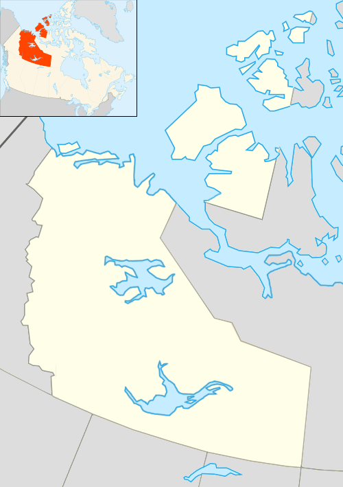 Location of Tuktut Nogait National Park in Canada | |
| Location | Northwest Territories, Canada |
| Nearest city | Paulatuk |
| Coordinates | 68°49′07″N 121°44′57″W / 68.81869°N 121.74925°WCoordinates: 68°49′07″N 121°44′57″W / 68.81869°N 121.74925°W |
| Area | 18,000 km2 (6,900 sq mi) |
| Established | 1996 |
| Governing body | Parks Canada |
Tuktut Nogait National Park is a national park located in the Northwest Territories of Canada. Meaning "young caribou" in Inuvialuktun, the park is home to the calving grounds of the Bluenose-West caribou herd.
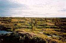
It is also the home to other wildlife species which are muskoxen, grizzly bears, Arctic chars, red foxes, wolverines, Arctic ground squirrels, collared lemmings, and wolves. Tuktut Nogait is a major breeding and nesting ground for a wide variety of migratory birds. Raptors such as peregrine falcons, rough-legged hawks, gyr falcons and golden eagles nest along the steep walls of river canyons.
The Dolphin-Union Caribou herd which normally occupies Victoria Island and winters in the Bathurst area of Nunavut, sometimes migrates as far as Tuktut Nogait National Park following the shoreline in search of windswept areas where the snow cover is cleared making it easier for them to graze.[1]
The park encompasses over 18,000 square kilometres (6,900 sq mi) and is located 170 kilometres (110 mi) north of the Arctic Circle in the northeast corner of mainland Northwest Territories.
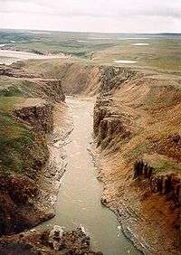
The main rivers that run through the park are the Hornaday River, Brock River and Roscoe River.[2]
Humans have occupied Tuktut Nogait since AD 1000 and recent surveys have identified over 360 archaeological sites in the park. The oldest known archaeological sites are most likely Thule or Copper Inuit ranging from AD 1200 to 1500.
Father Émile Petitot was the first European to reach the area in 1867-68. In 1930, the Hudson's Bay Company established an outpost at Letty Harbour but the post was closed in 1937 due to insufficient trade. In 1935, a Roman Catholic Mission was located at Paulatuk and operated a small trading post there until 1954. The Inuit who came to Paulatuk and the Darnley Bay area were primarily Mackenzie and Alaskan Inuit from the west. In 1955, most people abandoned the Paulatuk mission and moved to Cape Parry where a Distant Early Warning (DEW) line site was being built, which meant seasonal construction and permanent wage labour work.
As is outlined in the Inuvialuit Final Agreement and the Tuktut Nogait Agreement, Inuvialuit beneficiaries have the right to pursue subsistence harvesting within the park. Currently, this takes place in the north-western part of the park and mostly entails fishing Arctic char, hunting caribou, and some trapping. By federal national parks legislation, commercial or sport hunting is not permitted.
Current park initiatives include establishing a base camp facility at Uyarsivik Lake to support ecological integrity and cultural resource monitoring, visitor opportunities, management meetings and youth outreach; developing a cultural resource strategy; and updating interpretive materials such as the Hornaday River guide.
There are four barren-ground caribou herds in the Northwest Territories—Cape Bathurst, Bluenose West, Bluenose East and Bathurst caribou herd.[3] The Bluenose East caribou herd began a recovery with a population of approximately 122,000 in 2010,[4] which is being credited to the establishment of Tuktut Nogait National Park.[5] According to T. Davison 2010, CARMA 2011, the three other herds "declined 84-93% from peak sizes in the mid-1980s and 1990s.[3]
See also
References
- ↑ Species at Risk in the Northwest Territories 2012 (PDF). Government of Northwest Territories, Department of Environment and Natural Resources. 2012. p. 19. ISBN 978-0-7708-0196-0. Retrieved 31 October 2014.
- ↑ "Natural Environment - Geography and Geology". Tuktut Nogait National Park of Canada. Parks Canada. 2013-11-14. Retrieved 2009-03-05.
- 1 2 Kolpashikov, L.; Makhailov, V.; Russell, D. (2015). "The role of harvest, predators and socio-political environment in the dynamics of the Taimyr wild reindeer herd with some lessons for North America". Ecology and Society. 20 (1): 9. doi:10.5751/ES-07129-200109.
- ↑ Adamczewski, J.; Boulanger, J.; Croft, B.; Davison, T.; Sayine-Crawford, H.; Tracz, B. A Comparison of Calving and Post-calving Photo Surveys for the Bluenose-East Herd of Barren-ground Caribou in the Northwest Territories, Canada in 2010 (PDF) (Report). Manuscript Report No. 244. Environment and Natural Resources, Government of the Northwest Territories. p. 35-40.
- ↑ "N.W.T. park may be contributing to caribou herd recovery: Bluenose West herd has seen first increase in size in 20 years". CBC News. 19 December 2012. Retrieved 29 May 2015.
External links
| National Parks |
|
|---|---|
| National Park Reserves | |
| Marine Conservation Areas | |
| National Marine Conservation Area Reserves | |
| National Landmarks | |
| National Urban Parks |
|
| |