Tuckahoe Creek
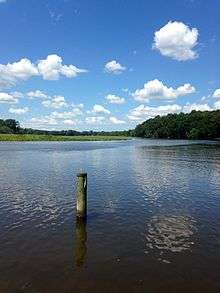
Tuckahoe Creek[1] is a 21.5-mile-long (34.6 km)[2] tributary of the Choptank River on Maryland's Eastern Shore. It is sometimes (erroneously) referred to as the Tuckahoe River.[3] Upstream of Hillsboro, it forms the boundary between Caroline County and Queen Anne's County, passing through Tuckahoe State Park[4] and dividing the small towns of Queen Anne and Hillsboro. Downstream of Hillsboro, it forms the boundary between Caroline County and Talbot County, before flowing into the Choptank.
Two miles south of Queen Anne, east of where Tapper's Corner Road ends at Lewistown Road, a creek flows (38°53′04″N 75°57′29″W / 38.8845°N 75.958°W) into the Tuckahoe at the birthplace[5] of Frederick Douglass.
Details on navigating the creek, sights to be seen, etc. may be found in the Choptank & Tuckahoe RiverGuide.[6]
See also
Notes and references
- ↑ U.S. Geological Survey Geographic Names Information System: Tuckahoe Creek
- ↑ U.S. Geological Survey. National Hydrography Dataset high-resolution flowline data. The National Map, accessed April 1, 2011
- ↑ Where State Route 404 crosses the Tuckahoe, the state road sign says "Tuckahoe River".
- ↑ "Tuckahoe State Park Trail Guide". Maryland Department of Natural Resources. Retrieved 2008-10-16.
- ↑ Amanda Barker (1996). "The Search for Frederick Douglass' Birthplace". Retrieved January 8, 2012.
- ↑ Choptank River Heritage "Choptank & Tuckahoe RiverGuide".
Coordinates: 38°48′53″N 75°53′50″W / 38.814836°N 75.897158°W