Tsurumi-ku, Yokohama
| Tsurumi 鶴見区 | ||
|---|---|---|
| Ward | ||
| Tsurumi Ward | ||
| ||
 Location of Tsurumi in Kanagawa | ||
 Tsurumi
| ||
| Coordinates: 35°30′30″N 139°40′57″E / 35.50833°N 139.68250°ECoordinates: 35°30′30″N 139°40′57″E / 35.50833°N 139.68250°E | ||
| Country | Japan | |
| Region | Kantō | |
| Prefecture | Kanagawa | |
| City | Yokohama | |
| Area | ||
| • Total | 33.23 km2 (12.83 sq mi) | |
| Population (February 2010) | ||
| • Total | 270,433 | |
| • Density | 8,140/km2 (21,100/sq mi) | |
| Time zone | Japan Standard Time (UTC+9) | |
| - Tree | Lagerstroemia indica | |
| - Flower | Scarlet sage | |
| Address |
3-20-1 Tsurumi-chuō, Tsurumi-ku Yokohama-shi, Kanagawa-ken 230-0051 | |
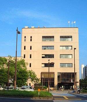
| Website | Tsurumi Ward Office | |
Tsurumi (鶴見区) (literal translation "place to see crane-district"),is one of the 18 ku (wards) of the city of Yokohama in Kanagawa Prefecture, Japan. As of 2010, the ward had an estimated population of 270,433 and a density of 8,140 persons per km². The total area was 33.23 km².
Geography
Tsurumi-ku is located in eastern Kanagawa Prefecture, in the northeast corner of the city of Yokohama.
Surrounding municipalities
History
The area around present-day Tsurumi Ward has been inhabited continuously for thousands of years. Archaeologists have found stone tools from the Japanese Paleolithic period and ceramic shards from the Jomon period, and tombs from the Kofun period at numerous locations in the area. Under the Nara period Ritsuryō system, it became part of Musashi Province. During the Edo period, the territory came under the control of Tokugawa Ieyasu. It was administered as tenryō territory controlled directly by the Tokugawa shogunate, but administered through various hatamoto. During the Bakumatsu period, nearby Kanagawa-juku was the location of the signing of the Convention of Kanagawa, which ended Japan’s national isolation policy and led to the normalization of diplomatic relations between the United States and Japan. The subsequent Treaty of Amity and Commerce led to the establishment of a treaty port for foreign commerce and settlement, which was initially stipulated to be Kanagawa. However, for security reasons, the actual settlement was established at neighboring Yokohama (present day Naka-ku). The Namamugi Incident, which led to the 1863 Anglo-Satsuma War, occurred in what is now part of Tsurumi Ward.
After the Meiji Restoration, the area was transferred to the new Tachibana District of Kanagawa Prefecture in 1868. Tsurumi was connected to Yokohama and Tokyo by train in 1872, and the area rapidly urbanized. Sōji-ji, the head temple of the Sōtō sect of Zen Buddhism relocated to Tsurumi from Ishikawa Prefecture in 1911. Tsurumi suffered severe damage from the 1923 Great Kantō earthquake. In April 1924, Tsurumi became a town within Tachibana District. On October 1, 1927 Tsurumi became a ward within the city of Yokohama. The area suffered greatly again during World War II, and was completely devastated during the massive Yokohama air raid of May 29, 1945. The area soon rebuilt after the end of the war, assisted by an influx of educational facilities in the 1950s and rapid re-industrialization of the area in the 1950s and 1960s. The Tsurumi railway accident occurred near Tsurumi Station on November 9, 1963, killing 161 people. The population of Tsurumi Ward surpassed 260,000 people in 2007, and celebrated the 80th anniversary of its foundation in 2009.
Economy
Tsurumi Ward is a regional commercial center and bedroom community for central Yokohama and Tokyo. The coastal area is part of the Keihin Industrial Zone, and is the most industrialized region within Yokohama. Major factories are operated by:
- ExxonMobil (Anzencho 2-chome)
- JFE Steel (Oogijima) - JFE's main plant for eastern Japan is on the border of Tsurumi-ku and Kawasaki-ku, Kawasaki.
- Kirin Brewery (Namamugi 1-chome)
- Nissan Motors (Daikokucho)
- Toshiba (Suehirocho 2-chome) - Toshiba's largest factory is located on Tokyo Bay and has its own JR train station, Umi-Shibaura Station.
- Morinaga & Company
- Asahi Glass Co.
- J-OIL MILLS, Inc
- Tokyo Electric Power Company
Daikokufuto, an artificial island in Tokyo Bay, is a major warehousing center.
Transportation
Railroads
- East Japan Railway Company –Keihin-Tohoku Line
- East Japan Railway Company - Nambu Line
- Keihin Electric Express Railway - Keikyū Main Line
- East Japan Railway Company - Tsurumi Line
Highways
- Shuto Expressway B, K1 and K5 Routes
- National Route 1 (No. 2 Keihin Route)
- Japan National Route 15 (No. 1 Keihin Route)
Prefecture roads
- Kanagawa Prefecture Road 6
- Kanagawa Prefecture Road 14
- Kanagawa Prefecture Road 101
- Kanagawa Prefecture Road 111
- Kanagawa Prefecture Road 140
Education
Colleges and universities
International schools:
- Tsurumi Korean Primary School (鶴見朝鮮初級学校) - North Korean international school[1][2] - Kindergarten and primary school[3]
Noted people from Tsurumi Ward
- Kanna Arihara, singer
- Antonio Inoki, professional wrestler, politician
- Shingo Katori, singer, actor
- Yakkun Sakurazuka, comedian, voice actor
- Junpei Shinoda, professional baseball player
- Fumie Suguri, professional figure skater
- Yutaka Niida, professional boxer
- Yasuhiro Kojima, professional wrestler
- Akina Minami, gravure idol and actress
- Miri Yu, author
References
- Kato, Yuzo. Yokohama Past and Present. Yokohama City University (1990).
- ↑ "アクセスのご案内" (Archive). Tsurumi Korean Primary School. Retrieved on October 13, 2015.
- ↑ "The Education System and Schools" (Archive). Government of Kanagawa Prefecture. Retrieved on October 13, 2015. "Tsurumi Korean Primary School10 Ono-cho, Tsurumi-ku, Yokohama 230-0046"
- ↑ "International schools." City of Yokohama. Retrieved on October 13, 2015.
| Wikimedia Commons has media related to Tsurumi-ku, Yokohama. |
External links
- Tsurumi Ward Office (Japanese)
- City of Yokohama statistics
| Wards of Yokohama | ||
|---|---|---|
| Wards of Kawasaki | ||
| Wards of Sagamihara | ||
| Core city | ||
| Special cities | ||
| Cities | ||
| Aikō District | ||
| Ashigarakami District | ||
| Ashigarashimo District | ||
| Kōza District | ||
| Miura District | ||
| Naka District | ||