Tsuen Wan Line
Tsuen Wan Line 荃灣綫 | ||||||||||||||||||||||||||||||||||||||||||||||||||||||||||||||||||||||||||||||||||||||||||||||||||||||||||||||||||||||||||||||||||||||||||||||||||||||||||||||||||||||||||||||||||||||||||||||||||||||||||||||||||||||||||||||||||||||||||||||||||||||||||||||||||||||||||||||||||||||||||||||||||||||||||||||||||||||||||||||||||||||||||||||||||||||||||||||||||||||||||||||||||||||||||
|---|---|---|---|---|---|---|---|---|---|---|---|---|---|---|---|---|---|---|---|---|---|---|---|---|---|---|---|---|---|---|---|---|---|---|---|---|---|---|---|---|---|---|---|---|---|---|---|---|---|---|---|---|---|---|---|---|---|---|---|---|---|---|---|---|---|---|---|---|---|---|---|---|---|---|---|---|---|---|---|---|---|---|---|---|---|---|---|---|---|---|---|---|---|---|---|---|---|---|---|---|---|---|---|---|---|---|---|---|---|---|---|---|---|---|---|---|---|---|---|---|---|---|---|---|---|---|---|---|---|---|---|---|---|---|---|---|---|---|---|---|---|---|---|---|---|---|---|---|---|---|---|---|---|---|---|---|---|---|---|---|---|---|---|---|---|---|---|---|---|---|---|---|---|---|---|---|---|---|---|---|---|---|---|---|---|---|---|---|---|---|---|---|---|---|---|---|---|---|---|---|---|---|---|---|---|---|---|---|---|---|---|---|---|---|---|---|---|---|---|---|---|---|---|---|---|---|---|---|---|---|---|---|---|---|---|---|---|---|---|---|---|---|---|---|---|---|---|---|---|---|---|---|---|---|---|---|---|---|---|---|---|---|---|---|---|---|---|---|---|---|---|---|---|---|---|---|---|---|---|---|---|---|---|---|---|---|---|---|---|---|---|---|---|---|---|---|---|---|---|---|---|---|---|---|---|---|---|---|---|---|---|---|---|---|---|---|---|---|---|---|---|---|---|---|---|---|---|---|---|---|---|---|---|---|---|---|---|---|---|---|---|---|---|---|---|---|---|---|---|---|---|---|---|---|---|---|---|---|---|---|---|---|---|---|---|---|---|---|---|---|---|---|---|---|---|---|---|---|
|
| ||||||||||||||||||||||||||||||||||||||||||||||||||||||||||||||||||||||||||||||||||||||||||||||||||||||||||||||||||||||||||||||||||||||||||||||||||||||||||||||||||||||||||||||||||||||||||||||||||||||||||||||||||||||||||||||||||||||||||||||||||||||||||||||||||||||||||||||||||||||||||||||||||||||||||||||||||||||||||||||||||||||||||||||||||||||||||||||||||||||||||||||||||||||||||
| Overview | ||||||||||||||||||||||||||||||||||||||||||||||||||||||||||||||||||||||||||||||||||||||||||||||||||||||||||||||||||||||||||||||||||||||||||||||||||||||||||||||||||||||||||||||||||||||||||||||||||||||||||||||||||||||||||||||||||||||||||||||||||||||||||||||||||||||||||||||||||||||||||||||||||||||||||||||||||||||||||||||||||||||||||||||||||||||||||||||||||||||||||||||||||||||||||
| Type | Rapid transit | |||||||||||||||||||||||||||||||||||||||||||||||||||||||||||||||||||||||||||||||||||||||||||||||||||||||||||||||||||||||||||||||||||||||||||||||||||||||||||||||||||||||||||||||||||||||||||||||||||||||||||||||||||||||||||||||||||||||||||||||||||||||||||||||||||||||||||||||||||||||||||||||||||||||||||||||||||||||||||||||||||||||||||||||||||||||||||||||||||||||||||||||||||||||||
| System | MTR | |||||||||||||||||||||||||||||||||||||||||||||||||||||||||||||||||||||||||||||||||||||||||||||||||||||||||||||||||||||||||||||||||||||||||||||||||||||||||||||||||||||||||||||||||||||||||||||||||||||||||||||||||||||||||||||||||||||||||||||||||||||||||||||||||||||||||||||||||||||||||||||||||||||||||||||||||||||||||||||||||||||||||||||||||||||||||||||||||||||||||||||||||||||||||
| Locale | Districts: Central and Western, Yau Tsim Mong, Sham Shui Po, Kwai Tsing, Tsuen Wan | |||||||||||||||||||||||||||||||||||||||||||||||||||||||||||||||||||||||||||||||||||||||||||||||||||||||||||||||||||||||||||||||||||||||||||||||||||||||||||||||||||||||||||||||||||||||||||||||||||||||||||||||||||||||||||||||||||||||||||||||||||||||||||||||||||||||||||||||||||||||||||||||||||||||||||||||||||||||||||||||||||||||||||||||||||||||||||||||||||||||||||||||||||||||||
| Termini |
Central Tsuen Wan | |||||||||||||||||||||||||||||||||||||||||||||||||||||||||||||||||||||||||||||||||||||||||||||||||||||||||||||||||||||||||||||||||||||||||||||||||||||||||||||||||||||||||||||||||||||||||||||||||||||||||||||||||||||||||||||||||||||||||||||||||||||||||||||||||||||||||||||||||||||||||||||||||||||||||||||||||||||||||||||||||||||||||||||||||||||||||||||||||||||||||||||||||||||||||
| Stations | 16 | |||||||||||||||||||||||||||||||||||||||||||||||||||||||||||||||||||||||||||||||||||||||||||||||||||||||||||||||||||||||||||||||||||||||||||||||||||||||||||||||||||||||||||||||||||||||||||||||||||||||||||||||||||||||||||||||||||||||||||||||||||||||||||||||||||||||||||||||||||||||||||||||||||||||||||||||||||||||||||||||||||||||||||||||||||||||||||||||||||||||||||||||||||||||||
| Ridership |
1,058,300 daily average (weekdays, September 2014)[1] | |||||||||||||||||||||||||||||||||||||||||||||||||||||||||||||||||||||||||||||||||||||||||||||||||||||||||||||||||||||||||||||||||||||||||||||||||||||||||||||||||||||||||||||||||||||||||||||||||||||||||||||||||||||||||||||||||||||||||||||||||||||||||||||||||||||||||||||||||||||||||||||||||||||||||||||||||||||||||||||||||||||||||||||||||||||||||||||||||||||||||||||||||||||||||
| Operation | ||||||||||||||||||||||||||||||||||||||||||||||||||||||||||||||||||||||||||||||||||||||||||||||||||||||||||||||||||||||||||||||||||||||||||||||||||||||||||||||||||||||||||||||||||||||||||||||||||||||||||||||||||||||||||||||||||||||||||||||||||||||||||||||||||||||||||||||||||||||||||||||||||||||||||||||||||||||||||||||||||||||||||||||||||||||||||||||||||||||||||||||||||||||||||
| Opened |
10 May 1982 (Tsuen Wan to Lai King section) 17 May 1982 (Rest of the line) | |||||||||||||||||||||||||||||||||||||||||||||||||||||||||||||||||||||||||||||||||||||||||||||||||||||||||||||||||||||||||||||||||||||||||||||||||||||||||||||||||||||||||||||||||||||||||||||||||||||||||||||||||||||||||||||||||||||||||||||||||||||||||||||||||||||||||||||||||||||||||||||||||||||||||||||||||||||||||||||||||||||||||||||||||||||||||||||||||||||||||||||||||||||||||
| Technical | ||||||||||||||||||||||||||||||||||||||||||||||||||||||||||||||||||||||||||||||||||||||||||||||||||||||||||||||||||||||||||||||||||||||||||||||||||||||||||||||||||||||||||||||||||||||||||||||||||||||||||||||||||||||||||||||||||||||||||||||||||||||||||||||||||||||||||||||||||||||||||||||||||||||||||||||||||||||||||||||||||||||||||||||||||||||||||||||||||||||||||||||||||||||||||
| Line length | 16 km (9.9 mi) | |||||||||||||||||||||||||||||||||||||||||||||||||||||||||||||||||||||||||||||||||||||||||||||||||||||||||||||||||||||||||||||||||||||||||||||||||||||||||||||||||||||||||||||||||||||||||||||||||||||||||||||||||||||||||||||||||||||||||||||||||||||||||||||||||||||||||||||||||||||||||||||||||||||||||||||||||||||||||||||||||||||||||||||||||||||||||||||||||||||||||||||||||||||||||
| Track gauge | 1,432 mm (4 ft 8 3⁄8 in) | |||||||||||||||||||||||||||||||||||||||||||||||||||||||||||||||||||||||||||||||||||||||||||||||||||||||||||||||||||||||||||||||||||||||||||||||||||||||||||||||||||||||||||||||||||||||||||||||||||||||||||||||||||||||||||||||||||||||||||||||||||||||||||||||||||||||||||||||||||||||||||||||||||||||||||||||||||||||||||||||||||||||||||||||||||||||||||||||||||||||||||||||||||||||||
| Electrification | 1.5 kV DC | |||||||||||||||||||||||||||||||||||||||||||||||||||||||||||||||||||||||||||||||||||||||||||||||||||||||||||||||||||||||||||||||||||||||||||||||||||||||||||||||||||||||||||||||||||||||||||||||||||||||||||||||||||||||||||||||||||||||||||||||||||||||||||||||||||||||||||||||||||||||||||||||||||||||||||||||||||||||||||||||||||||||||||||||||||||||||||||||||||||||||||||||||||||||||
| ||||||||||||||||||||||||||||||||||||||||||||||||||||||||||||||||||||||||||||||||||||||||||||||||||||||||||||||||||||||||||||||||||||||||||||||||||||||||||||||||||||||||||||||||||||||||||||||||||||||||||||||||||||||||||||||||||||||||||||||||||||||||||||||||||||||||||||||||||||||||||||||||||||||||||||||||||||||||||||||||||||||||||||||||||||||||||||||||||||||||||||||||||||||||||
| Tsuen Wan Line | |||||||||||||||
| Traditional Chinese | 荃灣綫 | ||||||||||||||
|---|---|---|---|---|---|---|---|---|---|---|---|---|---|---|---|
| Simplified Chinese | 荃湾线 | ||||||||||||||
| |||||||||||||||
The Tsuen Wan Line is one of the ten lines of the metro network in Hong Kong's MTR. It is indicated in red on the MTR map.
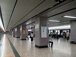
There are 16 stations on the line. The southern terminus is Central station on Hong Kong Island and the northwestern terminus is Tsuen Wan station in the New Territories. A journey on the entire line takes 30 minutes.
As a cross-harbour route that goes through the heart of Kowloon and densely populated Sham Shui Po and Kwai Chung, the line is very heavily travelled.
History
Early construction
The Tsuen Wan Line was the second of the three original lines of the MTR network. The initial plan for this line is somewhat different from the current line, especially in the names and the construction characteristics of the New Territories section.
The original plan envisioned a terminus in a valley further west of the present Tsuen Wan station. That Tsuen Wan West station is different from the current Tsuen Wan West station on the West Rail Line, which is located under land reclaimed at a much later time. The line was supposed to run underground in Tsuen Wan rather than as currently on the ground level.
The final route design allowed for a truncated line. The construction of the branch line to Tsuen Wan was approved in 1975 and commenced soon afterwards. The new section from Tsuen Wan to Lai King and skipping all intermediary stations to Prince Edward opened on 10 May 1982 and joined the section under Nathan Road in Kowloon that had been in service since 1979 as part of the Kwun Tong Line. At opening, Prince Edward was an interchange-only station with no option to enter or exit. It did not become a standard station until the remaining stations on the line in Sham Shui Po District, i.e. Sham Shui Po, Cheung Sha Wan, Lai Chi Kok and Mei Foo, opened a week later.
Several stations differ in names or location from the initial plan. During planning, Kwai Hing was named Kwai Chung, Kwai Fong was Lap Sap Wan (literally "rubbish bay, as the location was close to a now-disused landfill in Gin Drinker's Bay), Lai Wan (currently Mei Foo) was Lai Chi Kok, Lai Chi Kok was Cheung Sha Wan, Cheung Sha Wan was So Uk. These stations were all renamed in English and Chinese before service began.
Upon the opening of the Island Line, Chater, Waterloo, and Argyle, originally named based on the streets crossing or above the stations, Chater Road, Argyle Street, and Waterloo Road respectively, were renamed to Central, Yau Ma Tei, and Mong Kok, resembling the names of the station in Chinese. Lai Wan was renamed to Mei Foo in both English and Chinese.
Mong Kok station was planned to be built a bit further north of its present location and Sham Shui Po a bit further south of its present location before the need to accommodate an intermediary station, Prince Edward.
Transfer with Tung Chung Line
When the Tung Chung Line was constructed, Lai King was selected as an interchange so that passengers did not have to go all the way to Hong Kong Island to change trains. The northbound tracks on the Tsuen Wan Line were moved to run above the southbound tracks at Lai King to support cross-platform interchange with the Tung Chung Line.
The original platform 1 for Tsuen Wan-bound trains was removed and filled, becoming part of the current, wider low-level island platform. This allowed interchange with platform 4 for Hong Kong-bound Tung Chung Line trains, which run on tracks further away from the original platform.
The new platform was opened in 1997, nearly a year before the Tung Chung Line began service. Tracks were also built to the south of Lai King station linking the Tsuen Wan Line and Tung Chung Line; this is the only point where the Tung Chung Line connects with the other urban lines.
Transfer with former KCR systems
To cope with extensions and new lines, Mei Foo and Tsim Sha Tsui stations had new subsurface walkways added to connect to West Rail Line's Mei Foo and East Tsim Sha Tsui Stations. The interchange facilities at Mei Foo opened in 2003 when the West Rail was opened. The interchange located at Tsim Sha Tsui entered service in 2004, along with the completion of the East Rail Line's (formerly KCR East Rail) extension to East Tsim Sha Tsui.
Chronology
- 1967: Tsuen Wan Line was included in Hong Kong Mass Transport Study
- 1970: Tsuen Wan Line was included in Hong Kong Mass Transit Further Studies, as Kong Kow Line and Tsuen Wan Branch
- 1977: Construction was approved and, not long after, started on 1 March 1979
- 16 Dec 1979: Jordan and Tsim Sha Tsui opened as part of Kwun Tong Line
- 16 Dec 1979: Waterloo and Argyle opened as part of Kwun Tong Line
- 12 Feb 1980: Admiralty and Chater opened as part of Kwun Tong Line
- 26 Apr 1982: The original Kwun Tong Line was split into two sections: the new Kwun Tong Line ran as far as Waterloo, while Tsuen Wan Line ran from Chater to Argyle; there were non-passenger Tsuen Wan Line trains that continued to Tsuen Wan
- 10 May 1982: The line opened with service from Tsuen Wan to Lai King and then direct to Prince Edward Station, which was opened as an interchange with Kwun Tong Line
- 17 May 1982: The remaining stations, Lai Wan to Sham Shui Po, opened; Prince Edward became a standard station
- 31 May 1985: On the opening of the Island Line, 8 stations of the line were renamed. (See station list below for details)
- 23 May 1986: Central became an interchange station upon the extension of the Island Line to Sheung Wan
- 11 Mar 1991: The line broke down and public transport was adversely affected
- 23 Apr 1993: Two interlinking carriages disconnected during operation within the section between Tsuen Wan and Tai Wo Hau. Nobody was hurt, and MTRC reported that a hook between the two concerned carriages was not fastened, leading to the incident
- 2 Jul 1997: The new platform 1 situated on the new high-level platform at Lai King opened
- 20 Mar 2003: To connect with the new KCR West Rail Mei Foo Station, a passageway was built between the two stations, with a new exit D on about midway of the passageway
- 5 Jan 2004: A fire started in a train on its way to Admiralty Station with 14 people injured. A 65-year-old male arsonist was responsible for the fire and was arrested the following day
- 24 Oct 2004: A new exit G at Tsim Sha Tsui was constructed for a passageway under Mody Road to connect the station with new KCR East Rail
- 30 Mar 2005: A new exit F at Tsim Sha Tsui was constructed for a passageway under Middle Road to connect to East Tsim Sha Tsui Station
- 21 Oct 2010: An overhead electric cable in Yau Ma Tei Station broke during service hours; at least 280,000 passengers were affected.
Route description
The Tsuen Wan Line runs north-south. It is mostly underground, beginning at Central and crosses Victoria Harbour after Admiralty to Tsim Sha Tsui. Then, the line first runs underneath Nathan Road (Tsim Sha Tsui to Prince Edward), then Cheung Sha Wan Road (Sham Shui Po to Mei Foo), before emerging from the hills at Lai King.
The line is elevated between Lai King and Kwai Hing. Between Kwai Fong and Kwai Hing, the tracks are covered to minimise disturbance to residents nearby. After Kwai Hing, the line re-enters the tunnel to Tai Wo Hau before finally re-emerging at ground level at Tsuen Wan.
Some of the underground stations on the line are significantly deeper than the others. Tsim Sha Tsui and Admiralty stations are deeper because they precede harbour crossings. Admiralty and Central are deeper they provide cross-platform interchange with the deep-level Island Line.
 Tsuen Wan Line route map (with detailed interchanges) |
Stations
The following is a list of the stations on the Tsuen Wan Line.
| Livery and name | District | Connections | Opening date | |
|---|---|---|---|---|
| Tsuen Wan Line | ||||
| Central formerly Chater |
Central and Western | Island Line Hong Kong Station for Tung Chung Line and Airport Express |
12 February 1980[lower-alpha 1] | |
| Admiralty | Island Line, South Island Line (2016/2017) and North South Corridor (2021) | |||
| Tsim Sha Tsui | Yau Tsim Mong | East Tsim Sha Tsui Station for West Rail Line | 31 December 1979[lower-alpha 1] | |
| Jordan | ||||
| Yau Ma Tei formerly Waterloo |
Kwun Tong Line | |||
| Mong Kok formerly Argyle |
Kwun Tong Line[lower-alpha 2] | |||
| Prince Edward | Kwun Tong Line | 10 May 1982 | ||
| Sham Shui Po | Sham Shui Po | 17 May 1982 | ||
| Cheung Sha Wan | ||||
| Lai Chi Kok | ||||
| Mei Foo formerly Lai Wan |
West Rail Line | |||
| Lai King | Kwai Tsing | Tung Chung Line | 10 May 1982 | |
| Kwai Fong | ||||
| Kwai Hing | ||||
| Tai Wo Hau | ||||
| Tsuen Wan | ||||
| Tsuen Wan | [lower-alpha 3] | |||
Notes
- 1 2 Originally opened as part of the Kwun Tong Line.
- ↑ Mong Kok Station is not an interchange station to Mong Kok East Station on the East Rail Line in the MTR fare system. The two stations are not physically connected. There is pedestrian transfer via a footbridge; the journey time is approximately 10–15 minutes on foot.
- ↑ Tsuen Wan Station is not an interchange station to Tsuen Wan West Station on the West Rail Line, but green public light bus route 95K (free transfer with an immediate West Rail Line journey record on the Octopus card) connects the two stations. It normally takes 15–20 minutes to walk to Tsuen Wan West Station.
See also
| Wikimedia Commons has media related to Tsuen Wan Line. |
References
- ↑ "Weekday patronage of MTR heavy rail network from September 1 to 27 and September 28 to October 25, 2014" (PDF). Legislative Council. 29 October 2014. Retrieved 15 April 2015.
| Rail service |
| ||||||||||||||||||||||||||||
|---|---|---|---|---|---|---|---|---|---|---|---|---|---|---|---|---|---|---|---|---|---|---|---|---|---|---|---|---|---|
| Non-rail service |
| ||||||||||||||||||||||||||||
| |||||||||||||||||||||||||||||
Public transportation in Eastern Pearl River Delta | |||||||||||
|---|---|---|---|---|---|---|---|---|---|---|---|
| Shenzhen Metro |
| ||||||||||
| Dongguan Rail Transit |
| ||||||||||
| Hong Kong MTR |
| ||||||||||
| Other Urban Rails/Cableways |
| ||||||||||
| Intercity Rails (PRD-RT) |
| ||||||||||
| Transportation Hubs |
| ||||||||||
| |||||||||||