Tsaratanana
| Tsaratanana | |
|---|---|
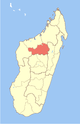
 Tsaratanana Location in Madagascar | |
| Coordinates: 16°47′50″S 47°39′10″E / 16.79722°S 47.65278°E | |
| Country |
|
| Region | Betsiboka |
| District | Tsaratanana |
| Elevation[1] | 350 m (1,150 ft) |
| Population (2001)[2] | |
| • Total | 18,000 |
| Time zone | EAT (UTC3) |
Tsaratanana is a town and commune (Malagasy: kaominina) in Madagascar. It belongs to the district of Tsaratanana, which is a part of Betsiboka Region. The population of the commune was estimated to be approximately 18,000 in 2001 commune census.[2]
Tsaratanana is served by a local airport. In addition to primary schooling the town offers secondary education at both junior and senior levels. The town provides access to hospital services to its citizens.[2]
The majority 65% of the population of the commune are farmers, while an additional 33% receives their livelihood from raising livestock. The most important crop is rice, while other important products are bananas and cassava. Services provide employment for 2% of the population.[2]
References and notes
- ↑ Estimated based on DEM data from Shuttle Radar Topography Mission
- 1 2 3 4 "ILO census data". Cornell University. 2002. Retrieved 2008-03-05.
| Kandreho |
|  |
|---|---|---|
| Maevatanana | ||
| Tsaratanana | ||
Coordinates: 16°47′50″S 47°39′10″E / 16.79722°S 47.65278°E