Trujillo (state)
| Trujillo | ||
|---|---|---|
| State of Venezuela | ||
| ||
| Anthem: Himno del Estado Trujillo | ||
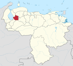 Location within Venezuela | ||
| Country | Venezuela | |
| Created | 1899 | |
| Capital | Trujillo | |
| Government | ||
| • Governor | Henry Rangel Silva (2012–present) | |
| Area | ||
| • Total | 7,198 km2 (2,779 sq mi) | |
| Area rank | 18th | |
| 0.81% of Venezuela | ||
| Population (2011 census est.) | ||
| • Total | 686,367 | |
| • Rank | 17th | |
| 2.58% of Venezuela | ||
| Time zone | UTC-04:30 | |
| ISO 3166 code | VE-T | |
| Emblematic tree | Bucare anauco (Erythrina fusca) | |
| Website |
www | |


Bocono, Trujillo

"La Lagunita", located in La Puerta, Trujillo state, Venezuela.
Trujillo State (Spanish: Estado Trujillo, IPA: [esˈtaðo tɾuˈxiʎo]) is one of the 23 states of Venezuela. Its capital is Trujillo but the largest city is Valera. The state is divided into 20 municipalities and 93 parishes. Trujillo State covers a total surface area of 7,198 km² [1] and, has a 2011 census population of 686,367.
History
Trujillo state was founded from the former Trujillo Province following the creation of the States of Venezuela in 1864 after the Federal War.
Municipalities and municipal seats
- Andrés Bello (Santa Isabel)
- Boconó (Boconó)
- Bolívar (Sabana Grande)
- Candelaria (Chejendé)
- Carache (Carache)
- Escuque (Escuque)
- José Felipe Márquez Cañizales (El Paradero)
- José Vicente Campo Elías (Campo Elías)
- La Ceiba (Santa Apolonia)
- Miranda (El Dividive)
- Monte Carmelo (Monte Carmelo)
- Motatán (Motatán)
- Pampán (Pampán)
- Pampanito (Pampanito)
- Rafael Rangel (Betijoque)
- San Rafael de Carvajal (Carvajal)
- Sucre (Sabana de Mendoza)
- Trujillo (Trujillo)
- Urdaneta (La Quebrada)
- Valera (Valera)
Population
Race and ethnicity
According to the 2011 Census, the racial composition of the population was:[2]
| Racial composition | Population | % |
|---|---|---|
| Mestizo | N/A | 49.6 |
| White | 369,961 | 48.3 |
| Black | 9,958 | 1.3 |
| Other race | N/A | 0.8 |
Education
See also
References
- ↑ "GeoHive - Venezuela population statistics". Retrieved July 4, 2012.
- ↑ "Resultado Básico del XIV Censo Nacional de Población y Vivienda 2011 (Mayo 2014)" (PDF). Ine.gov.ve. p. 29. Retrieved 8 September 2015.
External links
- Trujillo - Venezuela Tuya (in English)
- Trujillo - Venezuela Tuya (in Spanish)
| Wikimedia Commons has media related to Trujillo. |
Coordinates: 9°25′01″N 70°30′00″W / 9.417°N 70.500°W
This article is issued from Wikipedia - version of the 11/23/2016. The text is available under the Creative Commons Attribution/Share Alike but additional terms may apply for the media files.