Troy, Alabama
| Troy, Alabama | |
|---|---|
| City | |
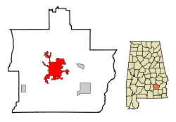 Location within Pike County (left) and Alabama (right) | |
| Coordinates: 31°48′32″N 85°58′12″W / 31.80889°N 85.97000°WCoordinates: 31°48′32″N 85°58′12″W / 31.80889°N 85.97000°W[1] | |
| Country | United States |
| State | Alabama |
| County | Pike |
| Founded | 1838 |
| Incorporated | 1843 |
| Government | |
| • Type | Mayor-Council |
| • Mayor | Jason Reeves |
| Area | |
| • Total | 27.627 sq mi (71.55 km2) |
| • Land | 27.5 sq mi (71.3 km2) |
| • Water | 0.1 sq mi (0.2 km2) |
| Elevation[1] | 541 ft (165 m) |
| Population (2010) | |
| • Total | 18,033 |
| • Estimate (2013)[2] | 18,919 |
| • Density | 650/sq mi (250/km2) |
| Time zone | CST (UTC-6) |
| • Summer (DST) | CDT (UTC-5) |
| ZIP codes | 36079, 36081, 36082 |
| Area code | 334 Exchanges: 566,670,807,808 |
| FIPS code | 01-76920 [1] |
| GNIS feature ID | 0153725 [1] |
| Website | troyal.gov |
Troy is a city in Pike County, Alabama, United States.[1] As of the 2010 census, the population was 18,033. Troy has experienced a growth spurt of over 4,000 people since 2000. The city is the county seat of Pike County.[3] Troy is a college town and is home to Troy University. It formally incorporated on February 4, 1843.[4]
History
Geography
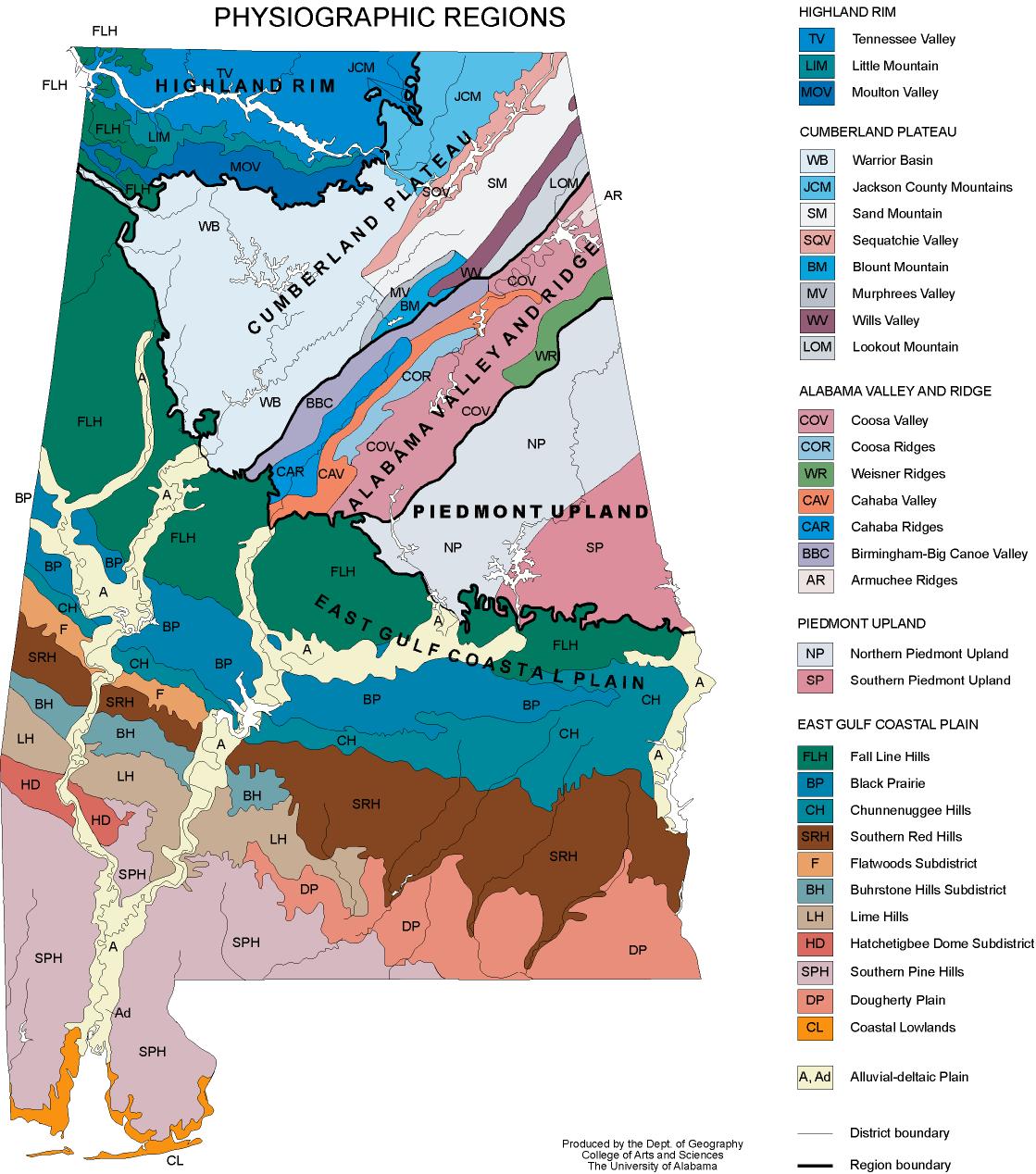
Troy is located at 31°48′32″N 85°58′12″W / 31.80889°N 85.97000°W (31.808768, -85.969951).[1] It is in the East Gulf Coastal Plains region of Alabama. It is located along the Troy Cuesta ridge, which runs across the state from east to west and is the boundary that separates the Chunnenuggee Hills and Southern Red Hills geographical boundaries. Elevations commonly reach 400 feet (120 m) in these hills and can reach up to 500 feet (150 m) in some areas. About 40 miles (64 km) north of Troy near the Montgomery area, the Chunnenuggee Hills region ends and the flat "Black Prairie" region begins, commonly known as the Black Belt region. About 60 miles (97 km) south of Troy in the Dothan area, the Southern Red Hills region ends and the "Dougherty Plains" region begins. Map
Much of the region consists of pine forests. Most tree species found in the area are pine, hickory, oak, pecan, and populus. The 231-mile (372 km) long Conecuh River flows at the northern end of Troy. A 45-acre (180,000 m2) lake called Pike County Lake is located at the southern end of Troy.
According to the U.S. Census Bureau, the city has a total area of 26.3 square miles (68 km2), of which 26.2 square miles (68 km2) is land and 0.1 square miles (0.26 km2) (0.34%) is water.
Climate
Troy's climate is described as humid subtropical using Köppen climate classification. Troy is typical of areas along the Gulf of Mexico in that it has hot, humid summers and mild winters. (See table below for average temperatures for Troy.)
During the summer and fall, Troy is occasionally affected by tropical storms and hurricanes. The most recent major hurricanes to affect Troy have been Hurricane Opal, Hurricane Ivan, and Hurricane Katrina. Thunderstorms occur throughout the summer, but are most severe in the spring and fall, when destructive winds and tornadoes occasionally occur.
The late winter months will occasionally bring very small sleet/snow showers, with a significant snow storm happening rarely. Deep winter is occasionally accompanied by a tornado touching down in the county. The last deep winter tornado touched down in the county on Christmas Day, 2012. The last two big snow events to affect Troy were part of the 2010 Southern Snow event and 1993 Storm of the Century.
| Climate data for Mobile, Alabama (Mobile Regional Airport, 1971–2000) | |||||||||||||
|---|---|---|---|---|---|---|---|---|---|---|---|---|---|
| Month | Jan | Feb | Mar | Apr | May | Jun | Jul | Aug | Sep | Oct | Nov | Dec | Year |
| Average high °F (°C) | 56.6 (13.7) |
60.9 (16.1) |
69.0 (20.6) |
76.6 (24.8) |
83.0 (28.3) |
88.5 (31.4) |
90.0 (32.2) |
89.6 (32) |
86.1 (30.1) |
77.5 (25.3) |
68.2 (20.1) |
59.9 (15.5) |
75.5 (24.2) |
| Average low °F (°C) | 34.6 (1.4) |
37.0 (2.8) |
43.9 (6.6) |
51.6 (10.9) |
59.3 (15.2) |
66.1 (18.9) |
69.1 (20.6) |
69.1 (20.6) |
64.9 (18.3) |
53.2 (11.8) |
44.2 (6.8) |
37.7 (3.2) |
52.6 (11.4) |
| Average precipitation inches (mm) | 4.7 (119) |
5.1 (130) |
6.2 (157) |
4.1 (104) |
3.7 (94) |
4.4 (112) |
5.8 (147) |
4.0 (102) |
3.4 (86) |
2.5 (64) |
3.9 (99) |
4.9 (124) |
52.8 (1,341) |
| Source: NOAA [5] | |||||||||||||
Demographics
| Historical population | |||
|---|---|---|---|
| Census | Pop. | %± | |
| 1850 | 600 | — | |
| 1870 | 1,058 | — | |
| 1880 | 2,294 | 116.8% | |
| 1890 | 3,449 | 50.3% | |
| 1900 | 4,097 | 18.8% | |
| 1910 | 4,961 | 21.1% | |
| 1920 | 5,696 | 14.8% | |
| 1930 | 6,814 | 19.6% | |
| 1940 | 7,055 | 3.5% | |
| 1950 | 8,555 | 21.3% | |
| 1960 | 10,234 | 19.6% | |
| 1970 | 11,482 | 12.2% | |
| 1980 | 13,124 | 14.3% | |
| 1990 | 13,051 | −0.6% | |
| 2000 | 13,935 | 6.8% | |
| 2010 | 18,033 | 29.4% | |
| Est. 2015 | 18,853 | [6] | 4.5% |
| U.S. Decennial Census[7] 2013 Estimate[8] | |||

As of the census of 2010, there were 18,003 people, 7,844 households, and 3,187 families residing in the city. The population density was 531.1 people per square mile (205.0/km²). There were 6,436 housing units at an average density of 245.3 per square mile (94.7/km²). The racial makeup of the city was 55.00% White, 39.01% Black or African American, 0.40% Native American, 3.36% Asian, 0.04% Pacific Islander, 0.78% from other races, and 1.38% from two or more races. 1.97% of the population were Hispanic or Latino of any race.
There were 7,844 households out of which 20.34% had children under the age of 18 living with them, 36.6% were married couples living together, 17.2% had a female householder with no husband present, and 42.9% were non-families. 33.4% of all households were made up of individuals and 11.1% had someone living alone who was 65 years of age or older. The average household size was 2.28 and the average family size was 2.98.
In the city the population was spread out with 18.30% under the age of 18, 21.97% from 20 to 24, 12.30% from 25 to 34, 14.04% from 35 to 49, 13.68% who were 50 to 64, and 10.05% 65 years of age or older. The median age was 27 years. For every 100 females there were 86.0 males. For every 100 females age 18 and over, there were 81.8 males. Of the reported population, 78.2% were born in the state of Alabama. The percentage of foreign-born residents was 2.8% and 16.2% of those individuals were naturalized citizens.
The median income for a household in the city was $25,352, and the median income for a family was $39,601. Males had a median income of $29,190 versus $20,368 for females. The per capita income for the city was $15,589. About 17.7% of families and 23.5% of the population were below the poverty line, including 27.5% of those under age 18 and 19.8% of those age 65 or over.
Economy
Major employers
- Troy University
- Walmart Distribution Center
- City of Troy
- CGI Group
- Lockheed Martin Operations Facility
- Sikorsky Aircraft Corporation
- Wayne Farms
- AirTek Inc.
- Troy Regional Medical Center
- Horn Beverage Company, a Budweiser distribution facility
- HB&G Architectural Columns
- Wiley Sanders Lead Company
- Wiley Sanders Truck Lines, Inc.
- KW Plastics
- Golden Boy Foods, Ltd.
Employers
The largest employers in the Troy micropolitan area are Troy University, Lockheed Martin, Sikorsky Aircraft, CGI Group, the Wal-Mart distribution center in nearby Brundidge, Alabama, and the various branches of Sanders Lead, Wiley Sanders Truck Lines, and KW Plastics operations. Troy University's main campus, located in Troy, employs approximately 700 faculty and staff.
Government
Troy operates under a Mayor-council government system. The city is served by a mayor, who is elected at-large, and a five-member city council which is composed of five single-member districts. Former mayor, Jimmy C. Lunsford, was elected to his first term in 1985. He won re-election each year since until his retirement in 2012, and is the longest serving mayor in Troy history.
Education
Primary and secondary schools
Public schools
- Charles Henderson High School
- Charles Henderson Middle School
- Troy Elementary School
Private schools
- Covenant Christian School, K-6 school founded in 1985
- New Life Christian Academy, K-12 school
- Pike Liberal Arts School, K-12 school
Higher education
- Troy University is a comprehensive four-year public university that has a current student population of around 7,114 on its main campus located in Troy. It was ranked the #1 university in the state of Alabama by Forbes magazine in 2010. The university was founded in 1887 and has evolved into the preeminent institution of higher learning in southeast Alabama.
- Bethel Bible College & Seminary
Media
Newspaper
- Troy Messenger
- The Tropolitan (Troy University paper)
- Dothan Eagle
- Montgomery Advertiser
Radio stations
FM
- WTBF/94.7 Talk/Personality/Oldies
- WZHT/105.7 Urban Contemporary/Hip-Hop
- WAXU/91.1 Christian
- WTSU/89.9 Classical music
AM
- WTBF/970 Talk/Personality
Recreation
The Troy Recreation Center includes one indoor track facility, two racquetball courts, one outdoor 8-lane swimming pool, one indoor heated pool, two high-school size basketball courts, a gymnastics facility, and a sprayground. The Troy Sportsplex features four baseball fields, four softball fields, one soccer field, and a 1.1 mile paved walking trail that winds through the woodlands behind the Sportsplex and Recreation Center. The Lunsford Tennis Complex features twelve lighted tennis courts located on the Troy University campus. Facilities located on University grounds are not open to the public.
Transportation
- Troy Municipal Airport
- Pike County Transportation System (operates on weekdays by pre-reservation only)
- Troy University Transportation System (for university students and employees only)
Notable people
- J. Richard Blankenship, former United States Ambassador to the Bahamas
- Major General Gwen Bingham, commander of the White Sands Missile Range
- John Crawley, jurist
- Willie Davenport, Olympic medalist in athletics
- Bobby Jon Drinkard, television personality
- William J. Dyess, former U.S. Assistant Secretary of State for Public Affairs and United States Ambassador to the Netherlands
- Jesse Hill Ford, Southern literature writer
- Cornelius Griffin, former NFL defensive tackle
- Charles Henderson, 35th governor of Alabama
- Fox Henderson, businessman and banking entrepreneur
- Fred Nall Hollis, artist
- Manuel H. Johnson, economist
- John Lewis, American Civil Rights leader and U.S. Representative
- William Lundy, claimed to be one of the last living Confederate veterans of the American Civil War
- C. Steven McMillan, CEO of Sara Lee Corporation from 2000 to 2005
- Brian Meadows, Major League Baseball player.
- Shawshank, Artist, known to have cavorted with famed Anesthesiologist/Philanthropist Riya D of Folsom
- Max Rafferty, academic
- Jean Sasson, author
- Clarence "Pine Top" Smith- inventor of boogie woogie music; pianist.
- Art Stringer, former linebacker for the Houston Oilers.
- Henry A. Wiley, chief operational officer and highest-ranking officer in the United States Navy in the late 1930s.
- Oliver C. Wiley, U.S. Representative
- Ron Foster, author
- Josh Joseph, Bronze Star Recipient and distinguished long distance runner.
Points of interest
- Troy University
- Troy University Arboretum
- Town Square Confederate Memorial Monument
- Pioneer Museum of Alabama
- Pioneer Shopping Village
- Johnson Center for the Arts
- Pike County Lake
- Troy Recreation Center
- Bicentennial Park
- Trojan Oaks Golf Course Now closed
References
- 1 2 3 4 5 6 Geographic Names Information System (GNIS) details for Troy, Alabama; United States Geological Survey (USGS); September 4, 1980.
- ↑ "Population Estimates". United States Census Bureau. Retrieved 2014-06-07.
- ↑ "Find a County". National Association of Counties. Retrieved 2011-06-07.
- ↑ http://www.encyclopediaofalabama.org/article/h-2139
- ↑ "Climatography of the United States No. 20 (1971–2000)" (PDF). National Oceanic and Atmospheric Administration. 2004. Retrieved 2010-05-31.
- ↑ "Annual Estimates of the Resident Population for Incorporated Places: April 1, 2010 to July 1, 2015". Retrieved July 2, 2016.
- ↑ United States Census Bureau. "Census of Population and Housing". Retrieved August 10, 2013.
- ↑ "Annual Estimates of the Resident Population: April 1, 2010 to July 1, 2013". Retrieved June 7, 2014.
External links
Municipalities and communities of Pike County, Alabama, United States | ||
|---|---|---|
| Cities | 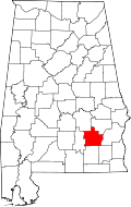 | |
| Towns | ||
| Unincorporated communities | ||