Trevinca
| Peña Trevinca | |
|---|---|
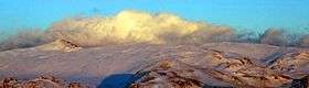 A view of Peña Trevinca | |
| Highest point | |
| Elevation | 2,127 m (6,978 ft) |
| Coordinates | 42°14′33.6″N 6°47′45.6″W / 42.242667°N 6.796000°WCoordinates: 42°14′33.6″N 6°47′45.6″W / 42.242667°N 6.796000°W |
| Geography | |
 Peña Trevinca Spain | |
| Location | Galicia & Castile and León |
| Parent range | Galician Massif |
| Climbing | |
| First ascent | Unknown |
| Easiest route | From Sobradelo or A Veiga on the Galician side, or from Puebla de Sanabria[1] on the Leonese side |
Peña Trevinca (Galician: Pena Trevinca), also known as Trevinca, is a mountain in northern Spain. It is located at the confluence of the Montes de León and the Macizo Galaico on the boundary between the autonomous communities of Galicia and Castile and León. It is the highest mountain in Galicia and in the province of Zamora.
The mountain has a 22,510 ha bird-life Special Protection Area.
See also
- Serra do Eixe, also known as Sierra Segundera
- Scrambling
References
External links
_01.JPG)
_02.JPG)
_03.JPG)
This article is issued from Wikipedia - version of the 11/19/2015. The text is available under the Creative Commons Attribution/Share Alike but additional terms may apply for the media files.