Trautenstein
| Trautenstein | ||
|---|---|---|
| Ortsteil of Oberharz am Brocken | ||
|
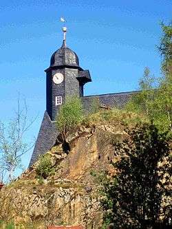
View of Trautenstein church | ||
| ||
 Trautenstein | ||
| Coordinates: 51°40′00″N 10°53′02″E / 51.66667°N 10.88389°ECoordinates: 51°40′00″N 10°53′02″E / 51.66667°N 10.88389°E | ||
| Country | Germany | |
| State | Saxony-Anhalt | |
| District | Harz | |
| Town | Oberharz am Brocken | |
| Area | ||
| • Total | 1.928 km2 (0.744 sq mi) | |
| Population (01-01-2010) | ||
| • Total | 493 | |
| • Density | 260/km2 (660/sq mi) | |
| Time zone | CET/CEST (UTC+1/+2) | |
| Postal codes | 38899 | |
| Dialling codes | 039459 | |

Trautenstein is a village in the borough of Oberharz am Brocken in the district of Harz in the German state of Saxony-Anhalt. Trautenstein has 493 inhabitants (1-1-2010).
Geography
The small climatic health resort lies in the valley of the Rappbode and at the southwestern end of the Rappbode Reservoir. South of the village is the Bärenhöhe ("Bear Heights"), also known as the Carlshaushöhe, which is 626 metres high. On the summit is the popular Carlshaus Tower, a telecommunication and observation tower of the Harz Narrow Gauge Railway.
Larger towns and villages in the vicinity include Braunlage, Bad Lauterberg, Bad Harzburg (in Lower Saxony) as well as Blankenburg, Wernigerode and Hasselfelde (in Saxony-Anhalt). The most important link road is the B 242 from Hasselfelde to Braunlage which passes through Trautenstein.
Personalities
- Albert Schneider (1838–1910), surveyor and railway director
- Karl Gronau (1889-1950), high school teacher
External links
Subdivisions of Oberharz am Brocken | ||
|---|---|---|