Transport in El Salvador

El Salvador has transport links by road, rail, sea and air.
El Salvador has over 10,000 km of roads, and one passenger rail service. There are several seaports on the Pacific Ocean, and two international airports.
Railways
A weekday passenger service links San Salvador and Apopa, a journey of 40 minutes.[1] Of a total of 602 km narrow gauge (3 ft (914 mm)) rail, much is abandoned. In November 2013 the government rail agency FENADESAL announced plans for development of four electrified railways serving San Salvador, Sitio del Niño (La Libertad), El Salvador International Airport, La Unión, and the Honduran frontier.[2]
Railway links with adjacent countries
-
 Guatemala - 3 ft (914 mm) gauge both countries, currently closed.[3]
 -
 Honduras - none
 - A new railway to be known as FERISTSA was proposed in 2005 to connect Mexico with Panama, passing through El Salvador.[4]
Highways
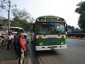
- total: 10,029 km
- paved: 1,986 km (including 327 km of Highways)
- unpaved: 8,043 km (1999 est.)
The RN-21 (Bulevar Monseñor Romero) (East–West) is the very first freeway to be built in El Salvador and in Central America. The freeway passes the northern area of the city of Santa Tecla, La Libertad. It has a small portion serving Antiguo Cuscatlan, La Libertad, and merges with the RN-5 (Autopista Comalapa) (East–West, Boulevard de Los Proceres/Autopista del Aeropuerto) in San Salvador.
The total length of the RN-21 is 9.95 kilometres (6.18 mi) and is currently working as a traffic reliever in the metropolitan area. The RN-21 was named in honor of Monseñor Romero. The first phase of the highway was completed in 2009, and the second phase in November 2012.
Ports and harbors
Pacific Ocean
- Acajutla
- Puerto Cutuco
- La Libertad
- La Unión
- Puerto El Triunfo
Merchant marine
none (1999 est.)
Airports

75 (2006 est.)
Airports - with paved runways
- total: 4
- over 3,047 m: 1
- 1,524 to 2,437 m: 1
- 914 to 1,523 m: 2 (2006 est.)
Airports - with unpaved runways
- total: 71
- 1,524 to 2,437 m: 1
- 914 to 1,523 m: 14
- under 914 m: 56 (2006 est.)
Heliports
1 (2006 est.)
Airports by name
References
- ↑ Servicio de Tren de Pasajeros, FENADESAL, 2009
- ↑ Jaime García, La CEPA construirá nuevo sistema de ferrocarril en el país (CEPA will build a new rail system in the country"), elsalvador.com, 25 November 2013
- ↑ El Salvador Travel Tips | iExplore
- ↑ "Shaw Group in talks with US railroad cos for Feristsa project, Central America, Infrastructure, news". Retrieved 2010-10-16.
El Salvador articles | |||||||
|---|---|---|---|---|---|---|---|
| History |  | ||||||
| Geography | |||||||
| Politics | |||||||
| Economy | |||||||
| Society |
| ||||||
| |||||||
Transport in the Americas | ||
|---|---|---|
| ||
| Sovereign states |
| .svg.png) |
| ||