Transdanubian Mountains
| Transdanubian Mountains | |
 | |
| Badacsony, an isolated mountain in the range. In ancient times, it was an active volcano | |
| Location | Komárom-Esztergom, Fejér, Veszprém, Zala, Pest counties, Hungary |
| Territory | 7,000 km² |
| Highest point | Pilis, 757 m |
| Lowest point | Danube river |
| Terrain | Lower mountains and hills |

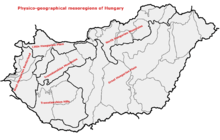
Transdanubian Mountains within physical subdivisions of Hungary
The Transdanubian Mountains (sometimes also referred to as Bakony Forest, Dunántúl Highlands, Highlands of Dunántúl, Highlands of Transdanubia, Mountains of Dunántúl, Mountains of Transdanubia, Transdanubian Central Range, Transdanubian Hills, Transdanubian Midmountains or Transdanubian Mid-Mountains, Hungarian: Dunántúli-középhegység)[1][2] are a mountain range in Hungary covering about 7000 km². Its highest peak is the Pilis, with a height of 757 metres.
Subdivisions
- Bakony
- Keszthely Mountains
- Tapolca Basin
- Balaton Uplands
- Southern Bakony
- Northern Bakony
- Bakonyalja, Sokoró, Vértesalja (Bársonyos)
- Vértes Mountains
- Velence Mountains
- Dunazug Mountains
- Gerecse Mountains
- Buda Mountains
- Pilis Mountains
Visegrád Mountains are often considered a part of it for geopolitical reasons, but geographically they are part of the North Hungarian Mountains.
Map of the Transdanubian Mountains
References
- ↑ Gábor Gercsák (2002). "Hungarian geographical names in English language publications" (PDF). Studia Cartologica. Eötvös Loránd University. Retrieved 30 April 2011.
- ↑ Gábor Gercsák (2005). "Magyar tájnevek angol fordítása" (PDF). Fasciculi Linguistici / Series Lexicographica (in Hungarian). Eötvös Loránd University. Retrieved 30 April 2011.
See also
| Wikimedia Commons has media related to Transdanubian Mountains. |
| ||||||||||||
| Transdanubian Mountains |
| |||||||||||
| Transdanubian Hills |
| |||||||||||
| North Hungarian Mountains | ||||||||||||
| Great Hungarian Plain | ||||||||||||
Coordinates: 47°15′00″N 17°50′00″E / 47.25°N 17.8333°E
This article is issued from Wikipedia - version of the 9/23/2015. The text is available under the Creative Commons Attribution/Share Alike but additional terms may apply for the media files.