Træna Lighthouse
 Nordland | |
| Location |
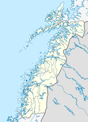
Træna Nordland Norway |
|---|---|
| Coordinates | 66°25′50.4″N 11°58′07.7″E / 66.430667°N 11.968806°ECoordinates: 66°25′50.4″N 11°58′07.7″E / 66.430667°N 11.968806°E |
| Year first constructed | 1877 |
| Automated | 1974 |
| Foundation | granite basement |
| Construction | cast iron tower |
| Tower shape | cylindrical tower with double balcony |
| Markings / pattern | red tower |
| Height | 18 metres (59 ft) |
| Focal height | 36.7 metres (120 ft) |
| Intensity | 88,000 cd |
| Range | 17 nmi (31 km; 20 mi) |
| Characteristic | Fl W 15s. |
| Admiralty number | L2348 |
| NGA number | 10196 |
| ARLHS number | NOR-255 |
| Norway number | NF-6600[1] |
Træna Lighthouse (Norwegian: Træna fyr) is a coastal lighthouse in the municipality of Træna in Nordland county, Norway. It is located on the island of Sørholmen in the Trænfjorden, about 10 kilometres (6.2 mi) southwest of the main island of Husøya and about 17 kilometres (11 mi) west of Lovund in Lurøy. The lighthouse was built in 1877 and automated in 1974. It has a granite foundation with an 18-metre (59 ft) tall red iron tower. The light can be seen for about 17 nmi (31 km; 20 mi).[2][3][4]
See also
References
- ↑ Træna Lighthouse The Lighthouse Directory. University of North Carolina at Chapel Hill. Retrieved March 2, 2016.
- ↑ Godal, Anne Marit (ed.). "Træna fyr". Store norske leksikon (in Norwegian). Norsk nettleksikon. Retrieved 7 January 2012.
- ↑ "Træna fyrstasjon" (in Norwegian). Norsk Fyrhistorisk Forening. Retrieved 7 January 2012.
- ↑ Kystverket (2011). Norske Fyrliste 2010 (PDF) (in Norwegian). ISBN 978-82-450-1039-8.
External links
This article is issued from Wikipedia - version of the 8/5/2016. The text is available under the Creative Commons Attribution/Share Alike but additional terms may apply for the media files.