Touws River (town)
| Touws River Touwsrivier | |
|---|---|
|
Street in Touws River | |
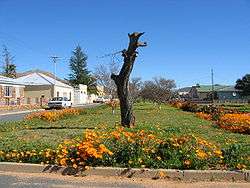
 Touws River  Touws River  Touws River
| |
| Coordinates: 33°20′16″S 20°02′01″E / 33.33778°S 20.03361°ECoordinates: 33°20′16″S 20°02′01″E / 33.33778°S 20.03361°E | |
| Country | South Africa |
| Province | Western Cape |
| District | Cape Winelands |
| Municipality | Breede Valley |
| Established | 1877 |
| Area[1] | |
| • Total | 21.62 km2 (8.35 sq mi) |
| Elevation | 770 m (2,530 ft) |
| Population (2011)[1] | |
| • Total | 8,126 |
| • Density | 380/km2 (970/sq mi) |
| Racial makeup (2011)[1] | |
| • Black African | 7.5% |
| • Coloured | 84.9% |
| • Indian/Asian | 0.3% |
| • White | 6.6% |
| • Other | 0.7% |
| First languages (2011)[1] | |
| • Afrikaans | 93.1% |
| • English | 2.6% |
| • Xhosa | 1.0% |
| • Other | 3.3% |
| Postal code (street) | 6880 |
| PO box | 6880 |
| Area code | 023 |
Touws River (Afrikaans: Touwsrivier) is a small railway town of 6,800 people in the Western Cape province of South Africa. It is located on the river of the same name, about 160 kilometres (100 mi) north-east of Cape Town.
History
_1.JPG)
The town of Touws River owes its existence to the Cape Government Railways, and to the route that their founder, Cape Prime Minister John Molteno, chose for a railway line over the Hex River Mountains.[2]
A railway was needed from the port at Cape Town, to service the newly discovered diamond fields in Kimberley. However, several seemingly impregnable ranges of mountains separated Cape Town from the hinterland of the Cape. The Royal Commonwealth Society (1898) records how the route was chosen:
When Mr. Molteno formulated his railway scheme he sent for his consulting engineer, who asked him what was the route he desired. Mr. Molteno asked for a map of South Africa, which was brought to him. Taking a ruler he drew his pen along it, in a direct line from Cape Town to Beaufort West. "But," said the engineer, "that means you go slap bang through the Hex River Mountains." "Never mind," said Mr. Molteno, "that is the way I want it to go." And that is the way it did go.[3]
In 1875 the engineers of the Cape Government Railways arrived to survey the region and found that, at the exact spot indicated, there was indeed a viable route through the formidable Hex River Mountains, starting from Worcester and descending on the other side, to a spot where the town of Touws River now stands.[4] On 7 November 1877, the Worcester–Matjiesfontein section of the Cape Government Railways' Cape Town–Kimberley main line was opened to traffic. The line included a station, originally named "Montagu Road", where the line bridged the Touws River.[5] The name was given in reference to the town of Montagu, which lies about 90 kilometres (56 mi) to the south by road. In 1883 the station was renamed "Touwsrivier".[5]
The town of Touws River developed around this railway depot, at which locomotives were changed after the climb over the Hex River Pass. It was particularly busy because of the need to bank trains over the pass; banking locomotives were turned at Touws River to return to De Doorns. From 1924 it also served as the junction for the branch line to Ladismith. The closing of the Ladismith branch in 1981 and the opening of the Hex River Tunnel in 1989 reduced the importance of Touws River as a depot.
Now a sleepy town, surrounded by farms, mountains and game reserves, it preserves open-air displays of steam engines in memory of its history as a railway centre.
Governance
Touws River received municipal government in 1962; with the transformation of local government in South Africa it has been incorporated into the Breede Valley Local Municipality. It is located in ward 1 of the local municipality, which in turn falls within the Cape Winelands District Municipality. As of 2010 the ward councillor was J.J. Januarie of the African National Congress.[6]
Geography
Touws River is located at an elevation of 770 metres (2,530 ft) on the southwestern edge of the Great Karoo, east of the Hex River Mountains and north of the Langeberg, at the point where the Donkeys River flows into the Touws River.[7] It lies just to the south of the N1 highway, 180 kilometres (110 mi) by road from Cape Town. The railway line passes through the town, with the yards and depot being located just to the north-east; by rail it is 257 kilometres (160 mi) from Cape Town.
Demography
The 2001 Census recorded the population of Touws River as 6,781 people in an area of 6.4 square kilometres (2.5 sq mi), giving it a population density of 1,060 inhabitants per square kilometre (2,700/sq mi).[8] Of the population, 87.7% described themselves as Coloured, 10.1% as White, 2.0% as Black African, and 0.2% as Indian or Asian. As a first language, 97.7% of the population spoke Afrikaans, 1.2% spoke English, and 0.9% spoke Xhosa. 38.6% of the population was under the age of 18.
References
- 1 2 3 4 "Main Place Touws River". Census 2011.
- ↑ C. Schoeman: The Historical Karoo: Traces of the Past in South Africa's Arid Interior. Penguin Random House South Africa. 2013. ISBN 1770225684 p.20.
- ↑ Royal Colonial Society: Proceedings of the Royal Colonial Institute. Northumberland Avenue, London. 1898. p.26. "The Railway System of South Africa".
- ↑ Burman, Jose (1984). Early Railways at the Cape. Cape Town. Human & Rousseau, p.57. ISBN 0-7981-1760-5
- 1 2 "Touwsrivier". South African History Online. Retrieved 2 August 2010.
- ↑ "Other Councillors". Breede Valley Local Municipality. Retrieved 2 August 2010.
- ↑ 3320AC Touwsrivier (Map) (2nd ed.). 1:50,000. South Africa Topographic. Chief Directorate: National Geo-spatial Information. 1987.
- ↑ "Main Place 'Touwsrivier'". Census 2001. Retrieved 1 April 2011.
Municipalities and communities of Cape Winelands District Municipality, Western Cape | ||
|---|---|---|
District seat: Stellenbosch | ||
| Witzenberg | .svg.png) | |
| Drakenstein | ||
| Stellenbosch | ||
| Breede Valley | ||
| Langeberg | ||