Tourism in North East India
| Northeast India | |
|---|---|
 | |
| Population | 38,857,769 |
| Area | 262,230 km2 (101,250 sq mi) |
| Time zone | IST (UTC+5:30) |
Northeast India consists of Seven Sister States, Sikkim and northeastern part of West Bengal. This article mentions tourist attractions in the Northeast region of India.
National parks

Namdapha National Park
Namdapha National Park is the largest protected area in the Eastern Himalaya biodiversity hotspot and is in Arunachal Pradesh in Northeast India. It is the third largest national park in India in area. It is in the Eastern Himalayan sub-region and is recognized as one of the richest areas in biodiversity in India.[1]
Kaziranga National Park
Kaziranga National Park is a national park in the Golaghat and Nagaon districts of the state of Assam, India. A World Heritage Site, the park hosts two-thirds of the world's great one-horned rhinoceroses.[2] Kaziranga boasts the highest density of tigers among protected areas in the world and was declared a tiger reserve in 2006.
Orang National Park
The Orang National Park is on the north bank of the Brahmaputra River in the Darrang and Sonitpur districts of Assam. The park has a rich flora and fauna, including great Indian one-horned rhinoceros, pigmy hog, elephants, wild buffalo and tigers. It is the only stronghold of rhinoceros on the north bank of the Brahmaputra.[3][4][5][6][7]
Manas National Park
Manas National Park or Manas Wildlife Sanctuary is a national park, UNESCO Natural World Heritage Site, a Project Tiger reserve, an elephant reserve and a biosphere reserve in Assam.
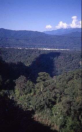
Dibru-Saikhowa National Park
Dibru-Saikhowa National Park is a national wildlife park in Tinsukia, Assam. It mainly consists of moist mixed semi-evergreen forests, moist mixed deciduous forests, canebrakes and grasslands. It is the largest salix swamp forest in northeast India.
Nameri National Park
Nameri National Park is in the foothills of the Eastern Himalayas in the Sonitpur District of Assam. This is excellent elephant country and was considered to be an elephant reserve. It is an ideal habitat for a host of other animals including the tiger, leopard, sambar, dhole (the Asiatic wild dog), pygmy hog, muntjac, gaur, wild boar, sloth bear, Himalayan black bear, capped langur and Indian giant squirrel.

Balphakram National Park
Balphakram National Park is a national park about 3,000 metres above sea level, near the Garo Hills in Meghalaya, India. It is often referred to as the "abode of perpetual winds" as well as the "land of spirits." It is the home of the barking deer and the golden cat.
Nokrek National Park
Nokrek National Park, or Nokrek Biosphere Reserve, is a national park approximately 2 km from Tura Peak in West Garo Hills district of Meghalaya, India. UNESCO added this National park to its list of Biosphere Reserves in May 2009.[8][9] Along with Balpakram, Nokrek is a hotspot of biodiversity in Meghalaya.[10]
Other national parks
- Mouling National Park is in the Indian state of Arunachal Pradesh.
- Keibul Lamjao National Park is the Bishnupur district of the state of Manipur.
- Sirohi National Park is located in the state of Manipur.
- Murlen National Park is in the Champhai district Mizoram.
- Ntangki National Park is in Peren district of Nagaland.
- Phawngpui is the Blue Mountain of Mizoram, a highly revered peak, considered to be the abode of the gods. Phawngpui peak is the highest mountain peak in Mizoram.[11]
- Pobitora Wildlife Sanctuary is a wildlife reserve in the Marigaon district of the state of Assam.
- Sipahijola Wildlife Sanctuary is a wildlife sanctuary in Tripura.
- Gorumara National Park is a National Park in northern West Bengal.
- Singalila National Park is located on the Singalila Ridge at an altitude of more than 7000 feet above sea level, in the Darjeeling district of West Bengal.
- Neora Valley National Park is in the Kalimpong subdivision under Darjeeling District, West Bengal.
- Jaldapara National Park is at the foothills of the Eastern Himalayas in Alipurduar district in West Bengal and on the bank of the Torsa River.
 Kaziranga is the most important stronghold for the Indian rhinoceros.
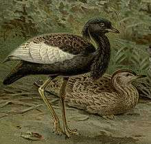 Bengal florican, a threatened species conserved in the Orang National Park.
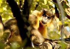 A capped langur in Manas National Park.
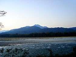 A view of mountains from the Manas.
.jpg) A view from Dibru-Saikhowa National Park.
A view from Dibru-Saikhowa National Park. A blue-crested lizard (Calotes mystaceus) in Keibul Lamjao National Park.

Waterfalls
- Nohkalikai Falls; 1,120 ft Cherapunjee (Meghalaya)
- Nohsngithiang Falls; 1,033 ft (Meghalaya)
- Langshiang Falls – 1,106 ft (Meghalaya)
- Kynrem Falls – 1,001 ft (Meghalaya)
- Elephent Falls (Meghalaya)
- Panimur Falls (Assam)
- Vantawng Falls – 751 ft( Mizoram)
- Nuranang Falls Tawang (Arunachal Pradesh)
- Chmapawati Kunda (Assam)
- Akashiganga Falls (Assam)
- Sivakunda Falls (Assam)
- Bishop Falls (India)(Meghalaya)
Reserved forest
Kakoijana reserved forest
Kakoijana reserved forest is famous for Golden Langurs.[12]
Hills
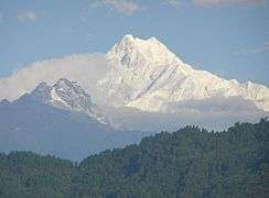
Kangchenjunga
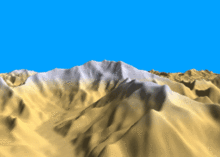
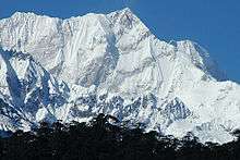
Kangchenjunga is the third highest mountain in the world.[13] It rises with an elevation of 8,586 m (28,169 ft) in a section of the Himalayas called Kangchenjunga Himal that is limited in the west by the Tamur River and in the east by the Teesta River.[14] The Kangchenjunga Himal is located in eastern Nepal and Sikkim, India.[15]
Naga Hills
The Naga Hills, reaching a height of around 3,825 metres (12,549 feet), lie on the border of India and Burma (Myanmar).
Patkai Hills

The Patkai hills are on India's northeastern border with Burma.
Khasi Hills
The Khasi Hills are part of the Garo-Khasi range in the Indian state of Meghalaya, and is part of the Patkai range and of the Meghalaya subtropical forests ecoregion.
Lushai Hills
The Lushai Hills (or Mizo Hills) are part of the Patkai range in Mizoram and partially in Tripura, India. Hills in Mizoram run north-south.
 Tawi Tlang is a beautiful hill range in the central part of Mizoram, India. It is a good place for adventure sports and has a very special tourist attraction.
.JPG) A hill range of the Mizo Poets Square also known as Mizo Hlakungpui Mual runs from north to south. The Poets Square was set up in 1986 to commemorate the Mizo poets and writers at the outskirts of Khawbung. It's one of the most visited sites for tourists.
A hill range of the Mizo Poets Square also known as Mizo Hlakungpui Mual runs from north to south. The Poets Square was set up in 1986 to commemorate the Mizo poets and writers at the outskirts of Khawbung. It's one of the most visited sites for tourists.
Assam Himalaya
Assam Himalaya is a traditional designation for the portion of the Himalaya range between the eastern border of Bhutan, on the west, and the Great Bend of the Tsangpo River, on the east.
Garo Hills
The Garo Hills are part of the Garo-Khasi range in Meghalaya, India.[16] They are inhabited mainly by tribal dwellers, the majority of whom are Garo people.[17] It is one of the wettest places in the world.
Sela Pass
Sela Pass is the high-altitude mountain pass in Tawang District of Arunachal Pradesh state of India. It has an elevation of 4,170 m (13,680 ft).[18][19] It connects the Buddhist city of Tawang Town to Tezpur and Guwahati and is the main road connecting Tawang with the rest of India.
Other hills
- Jongsong Peak is a mountain in the 'Janak' section of the Himalayas.[20] At 7,462 metres (24,482 ft) it is the 57th highest peak in the world, although it is dominated by the third highest, Kangchenjunga, 20 km (12 mi) to the south. Jongsong's summit is at a three-way boundary between Nepal, China and India.
- Gimmigela Chuli, or The Twins, is a mountain in the Himalayas, on the border between Taplejung, Mechi, Nepal and Sikkim, India. It has an elevation of 7,350 m (24,110 ft) above sea level.
- Kabru is a mountain in the Himalayas on the border of eastern Nepal and India. It is part of a ridge that extends south from Kangchenjunga and is the southernmost 7,000 metres (23,000 ft) peak in the world.
- Kirat Chuli or Tent Peak is a mountain in the Himalayas. It lies on the border between Nepal and India.
- Mount Pandim is a Himalayan mountain in Sikkim, India. It has an elevation of 6,691 m (21,952 ft) above sea level.
- Paohanli Peak or Paunhuri is a 7,128-metre (23,386 ft) high peak at the border of Zarkang, Yadong County, Tibet (China) and Sikkim (India).
- Pauhunri is a mountain in the Eastern Himalayas. It is on the border of Sikkim, India and Tibet, China, and is about 75 km northeast of Kangchenjunga.
- Siniolchu is one of the tallest mountains of the Indian state of Sikkim. The 6,888 metres (22,598 ft) mountain is considered to be particularly aesthetically attractive, having been described by Douglas Freshfield as "the most superb triumph of mountain architecture and the most beautiful snow mountain in the world".[21]
 West face of Mount Pandim, viewed from Prek Chu valley.
 Mt. Kabru at sunrise, Sikkim (2013).
.jpg)

River Islands
Majuli
Majuli or Majoli is a large river island in the Brahmaputra River, Assam, India, famous for Vaishnavite Satras. The island had a total area of 1,250 square kilometres (483 sq mi).[22] Majuli is the largest river island and the first island district in the Indian subcontinent. It is also recognised by Guinness Book of World Records as World's Largest River Island.[23]
Umananda Island
The Umananda Island, also known as Peacock island, is the home to Umananda temple and it is the smallest inhabited river island in the world.
Hill stations
Haflong
Haflong is only hills station in Assam, surrounded by lots of natural beauties like fluent water streams, lush green hills and bounty waterfalls.
Tawang
Tawang town is a town at an elevation of approximately 3,048 metres (10,000 ft) in the northwestern part of Arunachal Pradesh of India.
Cherrapunji

.
Cherrapunji is a subdivisional town in the East Khasi Hills district in the Indian state of Meghalaya. It is credited as being the wettest place on Earth, although nearby Mawsynram currently holds that record. Cherrapunji holds the all-time record for the most rainfall in a calendar month and in a year: It received 9,300 mm (370 in) in July 1861 and 26,461 mm (1,041.8 in) between 1 August 1860 and 31 July 1861.[24]
Darjeeling
Darjeeling is in West Bengal but geographically part of Northeast India. It is in the Mahabharat Range or Lesser Himalaya at an average elevation of 6,710 ft (2,045.2 m). It is noted for its tea industry and the Darjeeling Himalayan Railway, a UNESCO World Heritage Site.
Kalimpong
Kalimpong is a hill station in the Indian state of West Bengal. It is at an average elevation of 1,250 metres (4,101 ft).[25] The town is the headquarters of the Kalimpong subdivision, a part of the district of Darjeeling. The Indian Army's 27 Mountain Division is in the outskirts of the town.[26]
 An exotic view of Majuli.
 Way to Majuli from Jorhat City.
 Tea plantations in Darjeeling.
 A waterfall in Darjeeling's scenic rock garden.
 A view from the Deolo Resort, atop Deolo Hill, Kalimpong's highest point.

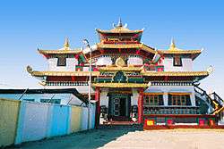
Monasteries
Pemayangtse Monastery
The Pemayangtse Monastery is a Buddhist monastery in Pemayangtse, near Pelling in the northeastern Indian state of Sikkim, 140 kilometres (87 mi) west of Gangtok.[27]
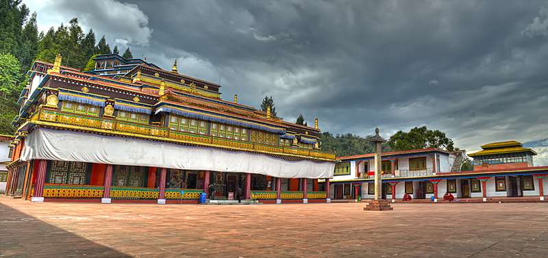
Tawang Monastery
Tawang Monastery in the Indian state of Arunachal Pradesh is the largest monastery in India and second largest in the world after the Potala Palace in Lhasa, Tibet.
Zang Dhok Palri Phodang
Zang Dhok Palri Phodang is a Buddhist monastery in Kalimpong in West Bengal, India. The monastery is atop Durpin Hill, one of the two hills of the town. It was consecrated in 1976 by the visiting Dalai Lama.
Rumtek Monastery
Rumtek Monastery, also called the "Dharmachakra Centre", is a gompa in the Indian state of Sikkim near the capital Gangtok. It is a focal point for the sectarian tensions within the Karma Kagyu school of Tibetan Buddhism that characterize the Karmapa controversy.
Enchey Monastery
Enchey Monastery is in Gangtok, the capital city of Sikkim in the Northeastern Indian state. It belongs to the Nyingma order of Vajrayana Buddhism.
Tashiding Monastery
Tashiding Monastery is a Buddhist monastery of the Nyingma sect of Tibetan Buddhism in Western Sikkim, northeastern India. It is on top of the hill rising between the Rathong chu and the Rangeet River.
Dubdi Monastery
Dubdi Monastery, occasionally called 'Yuksom Monastery,' is a Buddhist monastery of the Nyingma sect of Tibetan Buddhism near Yuksom, in the Geyzing subdivision of West Sikkim district.[28][29]
Ralang Monastery
Ralang Monastery is a Buddhist monastery of the Kagyu sect of Tibetan Buddhism in southern Sikkim, northeastern India. It is 6 km from Ravangla.[30]
 The manadala at the "Kakaling", the entry gate to the Tawang Monastery.
 The Zang Dhok Palri Phodang monastery atop Durpin Hill.
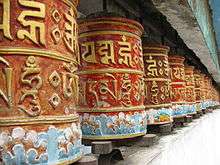 Prayer wheels in the Rumtek Monastery.
 Ornately carved colourful window of Enchey Monastery.
 The Golden Chorten near Tashiding Monastery.
Lakes
Khecheopalri Lake
Khecheopalri Lake, originally known as Kha-Chot-Palri (meaning the heaven of Padmasambhava), is a sacred lake for Buddhists and Hindus, which is believed to be a wish-fulfilling lake. It is near Khecheopalri village, 147 kilometres (91 mi) west of Gangtok and 34 kilometres (21 mi) to the northwest of Pelling town in the West Sikkim district of the Northeastern Indian state of Sikkim.
Gurudongmar Lake
Gurudongmar Lake is one of the highest lakes in the world at an altitude of 17,100 ft (5,210 m). It lies in the district of North Sikkim in the state of Sikkim in India.
Lake Tsongmo
Lake Tsongmo or Changu Lake is a glacial lake in the East Sikkim, India, some 40 kilometres (25 mi) from Gangtok at elevation of 3,780 m (12,400 ft).
Loktak Lake
Loktak Lake is the largest freshwater lake in Northeast India is famous for its phumdis (heterogeneous decomposing mass of vegetation, soil, and organic matters) floating over it. Keibul Lamjao, the only floating national park in the world, floats over it. It is near Moirang in Manipur state, India.[31]
Lake Shilloi
The Lake Shillioi is in the district of Phek, Nagaland. Shilloi Lake lies on the lower slopes of the hill ranges running along Myanmar. It is surrounded by beautiful hills. The lake spreads over 0.25 to 0.30 km2.
Umiam Lake
Umiam Lake is a reservoir in the hills 15 km to the north of Shillong in the state of Meghalaya. It is known for its beautiful scenery.
Other lakes
- Chandubi Lake is natural lake in the Kamrup district of Lower Assam 64 km from the city of Guwahati accessible through National Highway 37.[32]
- Dipor Bil, also spelt 'Deepor Beel' (bil or beel means "lake" in the local Assamese language), is to the southwest of Guwahati city, in Kamrup district of Assam, India.[33]
- Son Beel (Shon Bill) is one of the largest lakes in southern Assam in India.[34] It is situated in the Karimganj district, and is the largest wetland in Assam state.[35]
- Rudrasagar Lake also known as Rudijala, is in Melaghar, Tripura.
- Bijoy sagar is a lake in Udaipur in Eastern India. It is also called Mahadeb Dighi. It is one of the largest lakes in Udaipur in Tripura.


 The Naga Hills are the traditional homeland of the Naga people.
 Foot bridge to Khecheopalri Lake
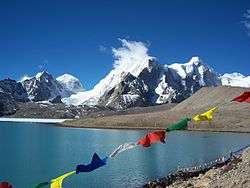
 Tsongmo Lake in March
 Tsongmo Lake in winter
Monuments and other tourist spots
Living root bridges

The living root bridges of Cherrapunji aren’t built — they are grown over hundreds of years, in the rainforest of Cherrapunji. They are alive, growing and gaining strength over time.[36] They are also present in Laitkynsew, and Nongriat.
Madan Kamdev
Madan Kamdev is a famous archaeological site in Kamrup district of Assam. This site has ruins of huge and small temples scattered around an old temple of Lord Shiva: Gopeshwar Temple is near a village and a big cave nearby is known as Parvati Guha.


Meghalaya Caves

The Indian state of Meghalaya is famous for its many caves, which attract tourists from India and abroad. A few of the caves in this region have been listed amongst the longest and deepest in the world. A famous one is Mawsmai caves near Cherrapunji are the limestone caves, lies near the village of Mawsmai. Meghalaya is famous in the world for its deep caves such as the Siju Cave; Krem Liat Prah is the longest cave in Asia.[36]
Capital cities
Aizawl
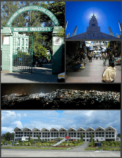
Clockwise from top left: Pachhunga University entrance gate, Solomon's Temple in Aizawl, Aizawl Bazar, night view of Aizawl, Lengpui Airport building.
Aizawl is the capital of Mizoram state. The main places of interest in Aizawl are:
- Bara Bazar is the main shopping centre of Aizawl in Dawrpui Veng locality. The steep Zion Street is lined with stalls selling garments. The main bazar is where the people are best seen in their traditional costumes selling produce from the farms as well as imports from China brought through Myanmar. The Millennium Centre in the same locality is a popular shopping mall.
- Mizoram State Museum is in the centre of the town at Zarkawt. This museum gives a good insight into Mizo traditions, culture and history.
- Reiek Tourist Resort, a tourist spot 12 km from Aizawl, is a beautiful place at an elevation of 1548 metres with a traditional Mizo village.
- Durtlang Hills on the northern side of Aizawl offers a fine view of the hill station from Durtlang Hospital or Aizawl Theological College.
- Hmuifang is about 50 km from Aizawl with an elevation of 1619 metres. The mountain is covered with virgin forests reserved since the Mizo chief's time.[37]
- Berawtlang Tourist Complex 7 km from Aizawl is a recreational centre that hosts cultural activities. It is considered a popular picnic spot.
- Baktawng Village, 70 km from Aizawl, is where Pu Ziona lives with the "worlds largest existing family" with 39 wives, 94 children, 14 daughters-in-law and 33 grandchildren.[38]
- Solomon's Temple, Aizawl Mizoram, India in Kidron Valley, Chawlhhmun is a grand temple complex operated by Kohhran Thianghlim of Mizoram.[39]
- Khuangchera Puk is a cave in Ailawng near Reiek, about 30 km from Aizawl.

Agartala

Clockwise from top left: Uma Maheswar Kali Temple, Agartala City Center, Ujjayanta Palace, Agartala Railway Station, skyline of a part of the city during 1998, North Gate.
Agartala is capital of Tripura state. Its second largest city in Northeast India after Guwahati. Places of attraction in Agaratala:
- College Tilla — Maharaja Bir Bikram College, Tripura University buildings, football ground, international cricket stadium, picturesque lush landscapes and serene natural lakes. It is also a National Bird Sanctuary.
- Ujjayanta Palace — Palace of the Tripura kings, was converted to state legislative assembly and is now into a museum; in the area of Palace Compound is one of the eye-catching attraction in the state.
- Jagannath temple — Hindu temple of Vaishnava school of thought. It has been transformed into the Ujjayanta Museum and it was inaugurated by Dr. Hamid Ansari, the vice president of India.
- Umamaheswar temple — Hindu temple of Shaiva and Shakti(durga).
- Venuban Buddha Vihar — Around 2 km inside the city of Agartala from the city center is the Venuban Vihar where a Buddha shrine houses a metal idol of Lord Buddha.[40]
- Krishna Mandir
- Puratan Agartala (Old Agartala)
- Malancha Niwas — Rabindranath Tagore, the first Asian Nobel Laurete had stayed here during his visit to Tripura.
- Rose Valley Amusement Park, Amtali
- Agartala City Centre — The main hub point in the city, in Paradise Chowmuhuni, carries a lot of attraction in the capital,
- Agartala Secretariat — Approximately 3 km from the heart of the city, this is a splendid place to watch the biggest government building in Northeast India.
- Rabindra Kanan
- Nehru Park
- Heritage Park
- Tripura State Museum is at the Ujjayanta Palace.
- Science Museum, in Sukanta Academy.
- Haveli Museum, in Kashipur.
Gangtok
Gangtok is the capital of Sikkim state. City is known for its tourist attractions.
 Kanchenjunga, visible from Gangtok, is the world's third-tallest peak.
 Ban Jhakri Falls, Gangtok.
 Gangtok seen from Tibet Road.
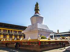 Dro-dul Chorten, Gangtok, Sikkim.
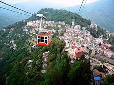 Gangtok cable car.
 Gangtok at night.
Guwahati
Guwahati is the commercial capital of Assam state and its largest city in North East India.
- River cruise: One of the major attractions of Guwahati is the cruise on the Brahmaputra river.[41] On board these luxurious cruise vessels tourists can relax and enjoy the beautiful view of the sunset.
- Umananda Temple: On the Peacock Island in the middle of the Brahmaputra, this Shiva temple was built in 1664. It is believed that Lord Shiva by using his third eye burnt Kamdeva here. Every year Shivaratri is celebrated in this temple in a great way. The island is believed to be the world's smallest human inhabited island. The world's largest river island is Majuli.
- Accoland: Accoland family fun kingdom is the northeast's only amusement park named after Acco, the mythological king of amusement. This park is at Patgaon.
- Srimanta Sankaradeva Kalakshetra: Shankardev Khalakshetra's name is synonymous with the Vaishnava saint and scholar of Assam Srimanta Shankardeva. It is a multipurpose cultural complex that has fulfilled its aim in protecting, promoting and preserving the cultural heritage of the communities and tribes of Assam and the country.
- Guwahati Planetarium: In Uzanbazar this planetarium is the only one of its kind in the northeastern region and a center of astronomical research. For visitors, the mysterious aspects of the universe are brought alive by sheer audio-video technique and explained in the dark domed structure inside the planetarium.
- Assam State Museum: Assam State Museum is near Dighalipukhuri. It houses many rare, specimen of the Ahom Dynasty. Many articles of equipment, dress materials belonging to the glorious past of Assam are found here. Many antiques, statues, manuscripts, written on Shashi-paat and other valuable articles are preserved and displayed.
- Kamakhya Temple: Kamakhya Temple, some 5 km from the main city on the Nilachal Hill, is one of the most sacred Hindu shrines of India. Goddess Kamakhya is worshipped here. Ambubachi Mela is celebrated every year in the middle of June in this temple. Many devotees from across the country gathered here during this mela.
- Shilpagram: Adjacent to Srimanta Shankardev Kalakshetra, this is the only crafts village of the North East Zone Cultural Center (NEZCC). It had made landmark in the promotion of the varied arts and cultures of the local people. It holds regular cultural events throughout the year in its open air stage and auditorium.
- Nehru Park: At heart of the city at Panbazar by the side of Cotton College. The highlights of the park are the concrete statues of Bihu dance, Ojapali dance, Deodhani dance, Jhumur dance, Bhoor tal dance etc. There are altogether 45 concrete statues depicting these aspects of Assamese life and culture.
- NEDFi Haat: NEDFi Haat is at a leased building of Industries & Commerce Department Govt. of Assam. In NEDFi Haat visitors can buy handicraft and handloom products. They can buy traditional food items produced by the self-help groups of the state in the Bihu seasons.
- Assam State Zoo cum Botanical Garden: Assam State Zoo cum Botanical Garden is the largest zoo of the northeast at Hengerabari Reserved Forest in the city.
- Basistha Temple: Basistha Temple[42] is on Sandhyachal Hill, on the southern part of the city; this beautiful tourist spot was once the ashram (hermitage) of sage Basistha.
- Sukreswar Temple: Sukreswar Temple is an ancient Shiva temple built by Ahom king Pramatta Singha on Dakini Jogini hill by the side of river Brahmaputra.
- Navagraha Temple: Navagraha temple or temple of nine planets is on Chitrachal Hill to the east. It was the ancient seat of study of astronomy and astrology. The nine planets are represented by the nine linga's inside the main temple. There is a stone imprint of solar system inside the temple. This temple is 3 km from the railway station is a center of Astrological and Astronomical research. It was for this temple Guwahati was named Pragjyotishpura.[43]

- Dighalipukhuri: At the heart of the city at Uzanbazar and surrounded by the High Court on the north and the State Museum and District Library on the south. This is a huge man-made tank. It was excavated by King Bhagadatta to celebrate the 'swayambar' of his daughter Bhanumati who was married to Kourava prince Druyadhana. There is a boating club on the Dighalipukhuri.
- Ugro Tara Temple: At the heart of the city banks of Joarpukhuri (twin ponds). The Ugro Tara Temple is another shakti peeth temple where the eyes of sati were believed to have fallen.
- Balaji Temple, Guwahati: This temple is a recent addition to the religious places of Guwahati. It is at Betkuchi area of the city. Balaji temple with striking South Indian architecture is unlike the other temples of this place. In the evening the temple is illuminated by electric lights.
- ISKCON Temple, Guwahati: This temple belongs to the ISKCON society founded by Abhay Charanaravinda Bhaktivedanta Swami Prabhupada. The temple's main deity is Radha-Krishna. The main emphasis of this temple's preaching lies on the teachings of Krishna and Bhagavad Gita.
- Madan Kamdev & Gopeshwar Mandir is near to Guwahati in a village named as Deuduar.
- Northbrook Gate: It was constructed to welcome British viceroy Lord Northbrook who visited Guwahati in 1874 near Sukreswar Ghat. British officials named it 'Gateway of Assam'.
- North East Crafts Museum and Showroom of Handicrafts & Handlooms: An undertaking of North Eastern Handicrafts and Handlooms Development Corporation Limited (a Govt. of India Enterprise) this showroom has a wide variety of bamboo and cane handicrafts from across the Northeast India. Visitors can buy these indigenous handicraft products from the showroom. The showroom is in Garchuk in Guwahati.
 A view of Kamakhya Temple, Guwahati.
 Shine Towers, Guwahati.

Imphal
Imphal is capital of Manipur state. Some of the places of attractions in city as follows.
- Kangla Palace: It is on both sides (western and eastern) of the bank of the Imphal River. It was the traditional seat of the past Meetei rulers of Manipur.
- Hiyangthang Lairembi Temple Complex: A religious site and a tourist attraction, the temple complex is noted for its annual Durga Puja festival in September or October.
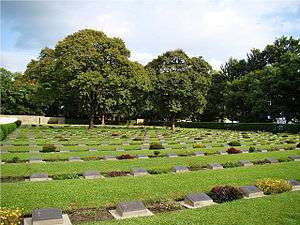
- Imphal War Cemetery: This cemetery remembers British and Indian soldiers who fought and died in the Second World War (1944).
- Women's Market (Ima Keithel): The market stalls are all run by women, and it is reportedly the only such market in the world.[44]
.jpeg)
- Jama Masjid: A holy place for Muslims in Imphal, it is the only mosque in the Imphal market (on the bank of the Nambul River).
- Shree Govindajee Temple: The temple was considered the apex of cultural activity during the reign of the Maharajas. Near the palace, it has two domes and a raised congregation hall.
- ISKCON Temple: The ISKCON Temple is near the road from Imphal Airport to the city.
 Ibudhou Pakhangba Temple, Imphal
.jpeg) Ruins of Kangla Fort, Imphal.
Ruins of Kangla Fort, Imphal..jpeg) Kangla Museum houses, Imphal.
Kangla Museum houses, Imphal..jpeg) Shri Govindajee Temple, Imphal.
Shri Govindajee Temple, Imphal.
Shillong
Shillong is the capital of Meghalaya.
Places of interest in and around Shillong includes:
- Elephant Falls: 12 km on the outskirts of the city, the mountain stream descends through two successive falls set in dells of fern covered rocks.
- Lady Hydari Park: The park stretches over a kilometre and has an adjacent mini zoo.
- Wards Lake: Known locally as Nan-Polok, it is an artificial lake with garden and boating facilities.
- Shillong Golf Course: Shillong has one of the largest golf courses (the world's wettest) in Asia: Gleneagles of the East. It enjoys the rare distinction of being one of the few natural golf courses in Asia. Not only is the Shillong Golf Course scenic and enjoyable, it is also challenging. A group of British civil service officers introduced golf to Shillong in 1898 by constructing a nine-hole course. The present 18-hole course was inaugurated in 1924. The course is set in a valley covered with pine and rhododendron trees. The tight fairways, carpeted with a local grass which hardens the soil, are difficult to negotiate. The number of out-of-bounds streams that criss-cross every fairway makes it all the more trying. Obstructions come in the form of bunkers, trees and rain. The longest hole is the 6th, which is a grueling 594 yards. Shillong Golf Course is considered to be the "Glen Eagle of the East" at the United States Golf Association Museum. It was set in a valley at an altitude of 5200 ft in 1898 as a nine-hole course and later converted into an 18-hole course in 1924 by Captain Jackson and C. K. Rhodes.
- Motphran: The “Stone of France” which is locally known as "Motphran" was erected in memory of the 26th Khasi Labour Corps who served under the British in France during World War I. It bears the words of the famous Latin poet Horace "Dulce et decorum est pro patria mori" which can be roughly translated as "It is sweet and fitting to die for one's country."
- Shillong Peak: A picnic spot, 10 km from the city, 1965 m above sea level, offers a panoramic view of the scenic countryside and is the highest point in the state. Obeisance is paid to U Shulong at the sanctum sanctorum at the peak's summit every springtime, by the religious priest of Mylliem State.
- Capt. Williamson Sangma State Museum: For those interested in ethnic tribal culture and tradition this government museum offers insights to the lifestyle of the people. This museum is in the State Central Library complex where monuments for the great patriots of the state were erected besides the statue of Smt. Indira Gandhi and Netaji Subhash Chandra Bose.
- Don Bosco Centre for Indigenous Cultures: The Don Bosco Museum is part of DBCIC (Don Bosco Centre for Indigenous Cultures). DBCIC comprises research on cultures, publications, training, animation programmes and the museum, which is a place of knowledge-sharing on the cultures of the northeast in particular, and of culture in general. DBCIC with its Don Bosco Museum is at Mawlai, Shillong.
- Entomological Museum (Butterfly Museum): A privately owned museum of M/s Wankhar, Riatsamthiah, Shillong about 2 km from Police Bazar is the only known museum in India devoted to moths and butterflies.
- Air Force Museum at Upper Shillong
- Forest Museum in Lady Hydari Park
- Rhino Heritage Museum at Shillong
- Zoological Museum in Risa Colony
- Anthropological museum at Mawblei
- Botanical Museum at 4th Furlong
- Arunachal Museum at the Cantonment Area
- Chrysalis the Gallery: This art gallery is on the second floor of Salonsar Mansion at Police Bazaar, the commercial hub of Shillong. Chrysalis has flexible spacing to display paintings (canvases), sculpture, photography and handicrafts. Run by a local artist, Jaya Kalra, the gallery caters to exhibitions of artists and artisans especially from the northeast and also from the rest of India.
- State Museum: Located at the State Central Library complex.
- Cathedral of Mary Help of Christians is in Don Bosco Square.
- Bishop and Beadon Falls: Both cascade down the same escarpment into a deep valley.
- Spread Eagle Falls: 3 km from Polo Grounds.
- Sweet Falls: Sweet Falls (also called “Weitden,” in the native dialect) is the most beautiful of all the waterfalls in Shillong. It lies about 5 km from the Happy Valley and is about 96 m in height.
- Crinoline Falls: Near Lady Hydari Park.
- Madina Masjid: The only glass mosque in India.Madina mosque is the rare architectural marvel in India as it has an striking and glittering structure of glass.
 Elephant Falls, Shillong.
 Cathedral of Mary Help of Christians, Shillong.
 Wards Lake, Shillong.
Itanagar
Itanagar is the capital if Arunachal Pradesh. Major tourist sites include:
- Ita Fort: Ita Fort in Itanagar town is one of the most important historical sites in the state of Arunachal Pradesh, India. The name literally means "Fort of bricks" (brick being called "ita" in the Ahom language).
- Jawaharlal Nehru Museum, Itanagar: Known for showcasing tribal culture of the state.
- Ganga Lake is a beautiful natural lake locally known as Gekar Sinyi (Confined water in the Nyishi dialect) surrounded by a landmass of hard rock. Primeval vegetation, orchids masses on tall trees and tree ferns contribute to its popularity as a picnic spot. Boating facilities and a swimming pool are available at the site.

 Entrance of Jawaharlal Nehru Museum, Itanagar.
 A festival of the Nyishi tribe of Arunachal Pradesh.
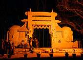
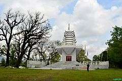
Kohima
Kohima is the capital of Nagaland. City is known for its Hornbill Festival. Major tourist sites include:
- War Cemetery is a memorial dedicated to the soldiers of the 2nd British Division of the Allied Forces who died in the Second World War at Kohima, in April 1944.
- Naga Heritage Village is a vista of nature, cheerful and hospitality of people. The Heritage Village protects and preserves all ethnic cultural heritages of Nagaland. It upholds and sustains the unique identity of dialects, customs and traditions of all the ethnological tribes of Nagaland.
 Kohima State Museum
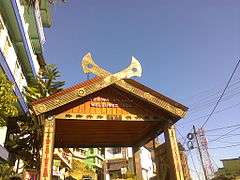 Welcome to Kohima Village
 Kacharigoan Heritage Village, Kohima
 Kohima City
 War Cemetery with Kohima City in background
 Prime Minister of India Narendra Modi speaking at the Inauguration of the Hornbill Festival 2014.
 Zeliang Naga Tribesmen of Nagaland, rehearsing their traditional dance during Hornbill Festival.
See also
Outline of tourism in India
- List of World Heritage Sites in India
- List of national parks of India
- List of lakes of India
- List of waterfalls in India
- List of State Protected Monuments in India
- List of beaches in India
- Incredible India
- List of Geographical Indications in India
- Medical tourism in India
- List of botanical gardens in India
- List of hill stations in India
- List of gates in India
- List of zoos in India
- List of protected areas of India
- List of aquaria in India
- List of forts in India
- List of forests in India
- Buddhist pilgrimage sites in India
- Hindu pilgrimage sites in India
- List of rock-cut temples in India
- Wildlife sanctuaries of India
- List of rivers of India
- List of mountains in India
- List of ecoregions in India
- Coral reefs in India
- List of stadiums in India
External links
References
- ↑ Deb, P & Sundriyal, RC. (2007) Tree species gap phase performance in the buffer zone area of Namdapha National Park, Eastern Himalaya, India. Tropical Ecology 48(2): 209-225 PDF
- ↑ Bhaumik, Subir (17 April 2007). "Assam rhino poaching 'spirals'". BBC News. Retrieved 2008-08-23.
- ↑ "Orang National Park". Retrieved 2009-11-09.
- ↑ "Tezpur". Orang Wildlife Sanctuary. Retrieved 2009-11-09.
- ↑ "Spatial modeling and preparation of decision support system for conservation of biological diversity in Orang National Park, Assam, India" (pdf). Retrieved 2009-11-08.
- ↑ "Orang National Park". Retrieved 2009-11-08.
- ↑ Bhattacharya, Prasanta (2004). Tourism in Assam: trend and potentialities. Rhinoceros parks on north bank of Brahmaputra Orang. Bani Mandir. p. 190. Retrieved 2009-11-11.
- ↑ "Three Indian sites added to UNESCO list of biosphere reserves". Sify. 27 May 2009. Retrieved 2009-05-30.
- ↑ "UNESCO Designates 22 New Biosphere Reserves". Environment News Service. 27 May 2009. Retrieved 2009-05-30.
- ↑ Choudhury, A.U. (2003). Meghalaya's vanishing wilderness. Sanctuary Asia 23(5): 30-35.
- ↑ "Phawngpui". MizoTourism.
- ↑ "14 years on, Kakoijana forest continues fight for sanctuary status - Indian Express". archive.indianexpress.com. Retrieved 2016-04-15.
- ↑ Freshfield, D. W. (1903). Round Kangchenjunga: a narrative of mountain travel and exploration. London: Edward Arnold.
- ↑ Carter, H. A. (1985). "Classification of the Himalaya" (PDF). American Alpine Journal. American Alpine Club. 27 (59): 109–141.
- ↑ Dhar, O. N. and S. Nandargi (2000). 'An appraisal of precipitation distribution around the Everest and Kanchenjunga peaks in the Himalayas' Weather 55 (7): 223–234.
- ↑ "Garo Hills-The Ecological Canvas of Meghalaya".
- ↑ Subba, T.B.; [eds.], G.C. Ghosh (2003). The anthropology of North-East India. Hyderabad: Orient Longman. ISBN 8125023356. Cite uses deprecated parameter
|coauthors=(help) - ↑ "High Altitude Sela Pass–Backbone of Tawang District". Sankara Subramanian C (www.beontheroad.com). beontheroad.com. January 21, 2011. Retrieved 2013-04-18.
- ↑ "Sela Passmountain pass". travelomy.com. Retrieved 2013-04-18.
- ↑ Carter, H. Adams (1985). "Classification of the Himalaya" (PDF). American Alpine Journal. American Alpine Club. 27 (5): 115. Retrieved 2011-05-18.
- ↑ Ray, Arundhati; Das, Sujoy. Sikkim: A Traveller's Guide. Orient Longman. p. 22. ISBN 978-81-7824-008-4.
- ↑ 'A Capricious River, an Indian Island’s Lifeline, Now Eats Away at It' April 14, 2013 ;;New York Times;;
- ↑ Majuli, River Island. "Largest river island". Guinness World Records. Retrieved 6 September 2016.
- ↑ "Most annual rainfall". Guinness World Records. Retrieved 2012-05-07.
- ↑ "General Information". Tourism Department. Darjeeling Gorkha Hill Council. Retrieved 2008-12-08.
- ↑ "India moves over 6,000 troops to border with China". Chennai, India: The Hindu. 13 December 2007. Retrieved 2008-12-08.
- ↑ "Pemayangtse Monastery". Buddhist Tourism. Retrieved November 7, 2009.
- ↑ "Monasteries". sikkiminfo.in. Retrieved November 21, 2009.
- ↑ "Monasteries in Sikkim are of three types". Dubdi Monastery. Sikkim Info. Retrieved 2010-05-05.
- ↑ "Ralang Monastery". Buddhist-temples.com. Retrieved November 21, 2009.
- ↑ "Integrated Wetland and River Basin Management – A Case Study of Loktak Lake". Wetlands International - South Asia, New Delhi, India. Archived from the original on March 22, 2012. Retrieved 2009-04-03.
- ↑ "Chandubi Lake". mapsofindia.com. Retrieved 2011-12-25.
- ↑ "Ramsar Wetlands Information Sheet — Deepor Beel" (PDF). Ramsar Convention on Wetlands official website. Retrieved June 27, 2007.
- ↑ "National wetland status for Son Beel". The Telegraph (Calcutta). December 10, 2008. Retrieved 9 June 2013.
- ↑ "National Wetland Atlas: Assam" (PDF). Ministry of Environment and Forests (India). Retrieved 9 June 2013.
- 1 2 http://www.walkthroughindia.com/location/top-51-reasons-why-you-should-visit-northeast-india-before-you-die/
- ↑ "HMUIFANG TOURIST RESORT". Govt of Mizoram. Retrieved 24 August 2012.
- ↑ "Biggest family: Ziona Chana has 39 wives and 94 children: a world record". worldrecordsacademy.org. 21 February 2011. Retrieved 24 October 2011.
- ↑ Kohhran, Thianghlim. "Solomon's Temple". Archived from the original on 24 December 2013. Retrieved 30 December 2013.
- ↑ "Venuban Vihar in AGARTALA - Popular Attraction in Agartala - BUDDHA SHRINE Tripura India". Retrieved 24 January 2015.
- ↑ Dhamini Ratnam (10 June 2012). "Art hub that floats on the Brahmaputra". The Times of India. Retrieved 12 June 2012.
- ↑ Reporter, Staff (30 May 2011). "Scheme for Basistha temple facelift". The Assam Tribune. Retrieved 15 June 2012.
- ↑ Bhatt, Bhargava, S.C, Gopal, Land and People of Indian States and Union Territories, p. 256
- ↑ "Ima Keithel – A market by women". She. msn. Retrieved 25 November 2012.
| By state | |
|---|---|
| Types | |
| Organisations | |
| See also | |
| |