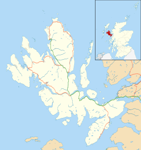
Torrin

Coordinates: 57°12′40″N 6°00′58″W / 57.211°N 6.016°W
Torrin (Scottish Gaelic: Na Torrain)[1] is a settlement on the island of Skye in Scotland.
Geography

The crofting and fishing village lies on the eastern shore of Loch Slapin, 5 miles (7 km) southwest of Broadford (An t-Àth Leathann),[2] on the road to Elgol (Ealaghol). There is a mixture of Victorian white-washed cottages and modern flat-pack houses. The village has good views of Blaven and Loch Slapin.
Torrin sits on dolostones informally referred to collectively as the 'Durness Limestone'.[3] There is an abundance of trees and varied plant flora, including more than a dozen species of orchids.[4] Much of the area is designated a Site of Special Scientific Interest[5] and a Special Area of Conservation.[6]
There are five working crofts in Torrin with cattle and sheep. The common grazing extends north onto the surrounding red granite hills Beinn Dearg Mhòr (709m) and Beinn Dearg Bheag (584m) and beyond the head of Loch Slapin.[4]
Torrin marble
Skye Marble has been extracted from Strath Suardal for centuries. Martin Martin recorded quarries on the south side of the valley in 1703.[7] Torrin has a quarry at each end of the village to extract magnesium-rich marble and limestone to produce lime. Marble from Torrin was used in Armadale Castle and Iona Abbey.[8] The first and smaller quarry opened in 1951 at Cnoc Slapin on the shore of Loch Slapin. The extracted rock was used primarily in the production of agricultural lime. Now abandoned, the area was partially landscaped at the end of 2001, reducing its visual impact.[4]
Glasgow paint manufacturer William Thomson Forsyth started the main quarry at the Broadford end of Torrin in 1960. He leased the land, producing around 3,500 tons of product per year by 1965. Today the quarry is owned by Leiths Group and employs 12 people. Marble is mined and crushed on site, producing agricultural lime, pebbledash for housing, ready-mix concrete products and some decorative marble.[4]
The earlier Ben Suardal quarry on the Broadford road closed in 1914.[4]
History
The population peaked in the 19th century around 120 people, dropping to 40 people in 1989 and more recently rising to 65, over a third of whom speak Scottish Gaelic.[4]

The old school closed in 1961. It was a training base for the Royal Marine Commandos during the 1940s and is now used as an outdoor centre.[9] The small Torrin church closed in the 1970s, fell into disrepair, and is now a holiday home.
At Cill Chriosd (Christ's Church or "Kilchrist"), half way to Broadford is the stark remains of the parish church of Strathaird, including the cleared villages of Boreraig and Susinish.[10] The location is thought to have a heritage of Christian worship dating back to the 7th century, when St Maelrubha preached from nearby Cnoc na-Aifhreann ("hill of the mass"). The present ruins probably replaced the first medieval stone church in the 16th century.[7] Cill Chrìosd was replaced by a new parish church in Broadford in 1840.[7]
In June 2001 the Torrin Management Committee opened Am Bothan (the Gaelic name for a small hut or shed), a shop providing essential groceries, a selection of local crafts, children's play area and a cafe.[4]
Skye Marble Railway
A narrow gauge line, built in 1907 ran for 3½ miles from the quarry at Suardale to Broadford pier. It transported Skye Marble from the nearby village of Kilbride (Cille Bhrìghde). The railway closed in the early 20th century and the track bed remains as a public footpath. A number of old railway remains can be seen.
Archaeology
In 2006 it was announced that an "entrance to the Underworld" had been discovered at the High Pasture Cave excavations, near Torrin.[11][12] A natural shaft of some 6 metres deep was discovered which led into a cave, both of which appeared to have been used between 1200 BC and 200 BC (Mid Bronze Age to Late Iron Age).[13] After this date the shaft was deliberately backfilled with structured deposits, suggesting some sort of propitiation ritual comparable to some of the underground structures at Mine Howe on Orkney.
Footnotes
- ↑ Gaelic Place-Names of Scotland
- ↑ "Overview of Torrin". Gazetteer for Scotland. Retrieved 21 February 2009.
- ↑ http://www.largeimages.bgs.ac.uk/iip/mapsportal.html?id=1002435
- 1 2 3 4 5 6 7 "Torrin". Blaven.com. Retrieved 8 October 2010.
- ↑ "Species records within Strath SSSI". National Biodiversity Network. Retrieved 21 February 2009.
- ↑ "Strath SAC". Joint Nature Conservation Committee. Retrieved 21 February 2009.
- 1 2 3 "Cill Chrìosd". Undiscovered Scotland. Retrieved 21 February 2009.
- ↑ "Macpherson family in Torrin". Am Baile. Retrieved 21 February 2009.
- ↑ "Red Hills of Torrin, Skye". Am Baile. Retrieved 21 February 2009.
- ↑ Peter Evans (25 April 2004). "Walk of the Week: Boreraig and Suisnish". The Scotsman. Retrieved 21 February 2009.
- ↑ Wildgoose, M; Birch, S. (2006). "High Pasture Cave: Entrance to the Underworld?". Current Archaeology. 205 (6).
- ↑ "Uamh An Ard Achadh". Retrieved 21 February 2009.
- ↑ Birch, Steven A. (Spring 2004). "High Pasture Cave: A Window on Prehistory of Strath, Skye" (PDF). Teachd an Tir: 6–7. Retrieved 21 February 2009.
External links
| Wikimedia Commons has media related to Torrin. |