Torridge
Coordinates: 50°53′35″N 4°15′54″W / 50.893°N 4.265°W
| Torridge Torridge District | |
|---|---|
| Non-metropolitan district | |
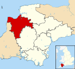 Torridge shown within Devon | |
| Sovereign state | United Kingdom |
| Constituent country | England |
| Region | South West England |
| Non-metropolitan county | Devon |
| Status | Non-metropolitan district |
| Admin HQ | Bideford |
| Incorporated | 1 April 1974 |
| Government | |
| • Type | Non-metropolitan district council |
| • Body | Torridge District Council |
| • Leadership | Alternative - Sec.31 (Conservative) |
| • MPs | Geoffrey Cox |
| Area | |
| • Total | 380.4 sq mi (985.3 km2) |
| Area rank | 26th (of 326) |
| Population (mid-2014 est.) | |
| • Total | 65,618 |
| • Rank | 306th (of 326) |
| • Density | 170/sq mi (67/km2) |
| • Ethnicity | 99.0% White |
| Time zone | GMT (UTC0) |
| • Summer (DST) | BST (UTC+1) |
| ONS code |
18UK (ONS) E07000046 (GSS) |
| OS grid reference | SS4072412895 |
| Website |
www |
Torridge is a local government district in North Devon, England. Its council is based in Bideford. Other towns and villages in the district include Holsworthy, Great Torrington, Hartland and Westward Ho!. The island of Lundy is administratively part of the district. To the south of the district bordering Cornwall, near Welcombe, the rugged coastline has a wild untouched beauty, due to its inaccessibility, but the South West Coast Path is well defined. The district is named after the River Torridge.
Governance
The district was formed on 1 April 1974, under the Local Government Act 1972, by the merger of the boroughs of Bideford and Great Torrington, the Northam urban district, Bideford Rural District, Holsworthy Rural District and Torrington Rural District.[1]
Torridge District Council is elected every four years, with currently 36 councillors being elected at each election. Independents have had a strong presence on the council for much of its history, with no political party having won a majority until 2015.[2] However at the 2015 election the Conservative party won a small majority of 2 with 19 of the seats on the council and as of the last election in 2015 the council is composed of the following councillors.[3]
| Party | Councillors | |
| Conservative Party | 19 | |
| UKIP | 7 | |
| Independent | 6 | |
| Green Party | 2 | |
| Liberal Democrats | 1 | |
| Labour Party | 1 | |
Services
Services provided by West Devon Borough Council to the local community include the administration of council tax and local benefits, transportation services, road maintenance, the provision of car parking services, the collection of refuse and the recycling of waste, planning and building control, housing services, the provision of sport and leisure facilities, libraries, schools and colleges, social care and health, environmental services, business-related services and contingency planning.[4]
TorridgeCVS is a charitable organisation providing vulnerable people across the Torridge district with day-to-day living assistance. It provides advice, befriending schemes, support for carers, help to older people and help with charitable fund-raising, liaising with voluntary and community groups where necessary. It offers placements for individuals who want to get more involved in their local communities and relies on local volunteers, with over 2000 volunteers registered. It has been in operation since 1988 and is a member of NAVCA, the National Association for Voluntary and Community Action, being largely funded by Devon County Council and Torridge District Council.[5]
See also
- Annery kiln
- North Devon Coast - AONB
- Grade I listed buildings in Torridge
- Grade II* listed buildings in Torridge
References
- ↑
 The English Non-metropolitan Districts (Definition) Order 1972. Wikisource.
 - ↑ "England council elections". BBC News Online. 10 May 2011. Retrieved 14 August 2016.
- ↑ "Torridge District Elections 2015". Torridge District Council. Retrieved 14 August 2016.
- ↑ "Torridge District Council". Torridge District Council. Retrieved 14 August 2016.
- ↑ "Torridge CVS". Torridge CVS. Retrieved 14 August 2016.