Torreblanca
| Torreblanca | ||
|---|---|---|
| Municipality | ||
| ||
 Torreblanca Location in Spain | ||
| Coordinates: 40°13′14″N 0°11′43″E / 40.22056°N 0.19528°ECoordinates: 40°13′14″N 0°11′43″E / 40.22056°N 0.19528°E | ||
| Country |
| |
| Autonomous community |
| |
| Province | Castellón | |
| Comarca | Plana Alta | |
| Judicial district | Castellón de la Plana | |
| Area | ||
| • Total | 29.8 km2 (11.5 sq mi) | |
| Elevation | 31 m (102 ft) | |
| Population (2015) | ||
| • Total | 5,413 | |
| • Density | 180/km2 (470/sq mi) | |
| Demonym(s) | Torreblanquí, torreblanquina | |
| Time zone | CET (UTC+1) | |
| • Summer (DST) | CEST (UTC+2) | |
| Postal code | 12596 | |
| Official language(s) | Valencian | |


Torreblanca is a municipality in the province of Castelló, Valencian Community, Spain. The town is located south of the Serra d'Irta mountain range close to the Mediterranean Sea.
Torreblanca is located 36 km ENE of the town of Castelló de la Plana, on the Costa del Azahar.
History
Torreblanca was conquered from the Saracens by James I of Aragon in the 13th century and repopulated. In 1379 Torreblanca was raided by Barbary corsairs and the town was razed to the ground. Torreblanca was again the scenario of violent battles during the Carlist Wars in the 19th century.[1] There are wetlands by the sea close to the town and there were cases of malaria in the surrounding area until the mid-20th century, when malaria was finally eradicated.[2]
Nowadays Torreblanca's economy is based on seasonal tourism. Platja de Torrenostra and Platja Nord, the two beaches within its municipal term, are relatively unspoilt and quite popular in the summer.
Villages
 Torrenostra Beach (Torreblanca)Torreblanca
 Torreblanca North Beach
 Torreblanca North Beach
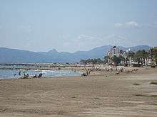 Torreblanca North Beach
.JPG) Torreblanca North Beach, Playa Norte de Torrenostra (Torreblanca)
Torreblanca North Beach, Playa Norte de Torrenostra (Torreblanca) Paraje Natural del Prat de Cabanes-TorreblancaTorrenostra
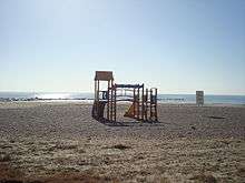 Playa de Torreblanca
Notable People
 Capillas del Calvario de Torreblanca del siglo XVIIIJoan Barreda
 Longaniza seca torreblanquina, producto típico, Torreblanca
References
External links
| Wikimedia Commons has media related to Torreblanca. |
- Ajuntament de Torreblanca
- Oficina de Turisme
- Institut Valencià d'Estadística
- Portal de la Direcció General d'Administració Local de la Generalitat
Municipalities of Plana Alta | ||
|---|---|---|