Top Road, Trenton, New Jersey
| Top Road, New Jersey | |
|---|---|
| Unincorporated community | |
|
View north along Brunswick Avenue (U.S. Route 206) at Olden Avenue in Top Road | |
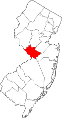
 Top Road, New Jersey  Top Road, New Jersey  Top Road, New Jersey Location of Top Road in Mercer County Inset: Location of county within the state of New Jersey | |
| Coordinates: 40°14′26″N 74°44′38″W / 40.24056°N 74.74389°WCoordinates: 40°14′26″N 74°44′38″W / 40.24056°N 74.74389°W | |
| Country |
|
| State |
|
| County | Mercer |
| City | Trenton |
_at_the_intersection_with_Olden_Avenue_(Mercer_County_Route_622)_in_the_Top_Road_section_of_Trenton%2C_New_Jersey.jpg)
Top Road is a neighborhood located within the city of Trenton in Mercer County, New Jersey, United States.[1][2][3] Much of Top Road was once part of Lawrence Township and then was added to the now-defunct Millham Township before being annexed by Trenton in 1888.[4]
References
- ↑ Locality Search, State of New Jersey. Accessed January 10, 2015.
- ↑ Google (January 10, 2015). "Top Road, Trenton, New Jersey" (Map). Google Maps. Google. Retrieved January 10, 2015.
- ↑ "City Profile Report: Trenton 250: 1792-2042: A City Master Plan Document" (PDF). City of Trenton. Retrieved 2015-01-20.
- ↑ "North Ward Historic Resource Survey, City of Trenton". Trenton Historical Society. Retrieved 2015-01-18.
When the City of Trenton first incorporated in 1792, its boundaries included the neighborhood known as East Trenton. However, in 1844, Lawrence Township annexed this area. It remained part of Lawrence Township until 1882, when East Trenton became an independent jurisdiction known as Millham Township, which included much of Top Road. On May 1, 1888, Millham once again became part of the City. of Trenton.
This article is issued from Wikipedia - version of the 6/10/2016. The text is available under the Creative Commons Attribution/Share Alike but additional terms may apply for the media files.