Tongue River Dam
Tongue River Dam (National ID # MT00002) is a dam in Big Horn County, Montana, a few miles north of the Wyoming state border.
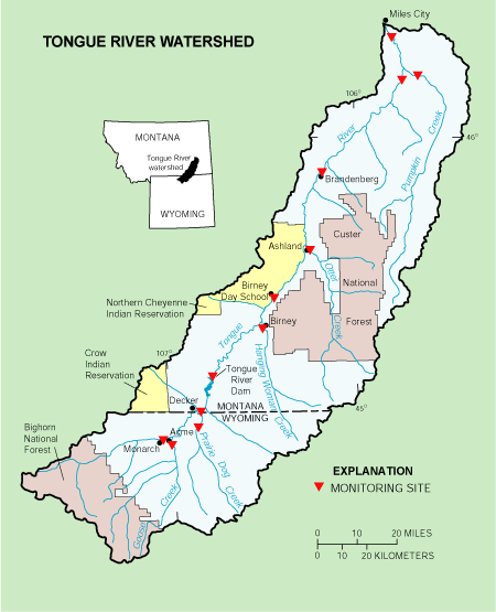
The earthen dam was constructed in the river canyon in 1939, with a height of 91 feet and a length at its crest of 1824 feet.[1] It impounds Montana's north-flowing Tongue River for flood control and irrigation water storage. The dam and reservoir are owned and operated by the state of Montana's Department of Natural Resources.
The 12-mile-long riverine reservoir it creates, Tongue River Reservoir, has a normal water surface of 5.5 square miles, a maximum capacity of 150,000 acre-feet, and normal storage of 69,400 acre-feet.[1] Recreation includes boating, fishing (for bass, crappie, walleye and northern pike), camping (at more than 150 campsites), etc., in the Tongue River Reservoir State Park.[2] For white-water rafters the Tongue is a Class I river from the Dam downstream (northward) to its confluence with the Yellowstone River.[3]
References
- 1 2 "Tongue River Dam". findlakes.com. Retrieved 17 June 2016.
- ↑ "Montana State Parks :: Tongue River Reservoir". mt.gov. Retrieved 17 June 2016.
- ↑ "Steam access in Montana". Retrieved 17 June 2016.
Coordinates: 45°07′51″N 106°45′59″W / 45.13072°N 106.76634°W