Tomkins Knob
| Tomkins Mountain | |
|---|---|
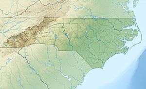 Tomkins Mountain  Tomkins Mountain Location in North Carolina | |
| Highest point | |
| Elevation | 4,075 ft (1,242 m) [1] |
| Coordinates | 36°14′26″N 81°28′38″W / 36.24056°N 81.47722°WCoordinates: 36°14′26″N 81°28′38″W / 36.24056°N 81.47722°W [1] |
| Geography | |
| Location | Ashe / Watauga / Wilkes counties, North Carolina, U.S. |
| Parent range | Blue Ridge Mountains |
| Topo map | USGS Maple Springs |
Tomkins Mountain (variant names: Thomkins Knob, Thompkins Knob and Tompkins Knob) is a mountain in the North Carolina High Country, near the community of Deep Gap. The majority of the mountain is within the Blue Ridge Parkway. Its elevation reaches 4,075 feet (1,242 m) and it also marks the corner between Ashe, Watauga, and Wilkes counties.
Split along the Eastern Continental Divide, it generates feeder streams to both the South Fork New River (via West Fork Pine Swamp Creek[2]) and Yadkin River (via South Prong Lewis Fork[3]). Laurel Spur Ridge[4] juts out south from the mountain; while Husons Ridge[5] goes northwest, marking the Ashe/Watauga county line.
References
- 1 2 "Tomkins Mountain". Geographic Names Information System. United States Geological Survey. Retrieved 2011-09-10.
- ↑ "West Fork Pine Swamp Creek". Geographic Names Information System. United States Geological Survey. Retrieved 2011-09-10.
- ↑ "South Prong Lewis Fork". Geographic Names Information System. United States Geological Survey. Retrieved 2011-09-10.
- ↑ "Laurel Spur Ridge". Geographic Names Information System. United States Geological Survey. Retrieved 2011-09-10.
- ↑ "Husons Ridge". Geographic Names Information System. United States Geological Survey. Retrieved 2011-09-10.
This article is issued from Wikipedia - version of the 8/5/2016. The text is available under the Creative Commons Attribution/Share Alike but additional terms may apply for the media files.