Tomichi Dome
| Tomichi Dome | |
|---|---|
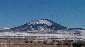 Tomichi Dome viewed from U.S. Route 50 | |
| Highest point | |
| Elevation | 11,471 ft (3,496 m) [1][2] |
| Prominence | 2,325 ft (709 m) [2] |
| Isolation | 10.74 mi (17.28 km) [2] |
| Listing | Colorado prominent summits |
| Coordinates | 38°29′06″N 106°31′44″W / 38.4849944°N 106.5289192°WCoordinates: 38°29′06″N 106°31′44″W / 38.4849944°N 106.5289192°W [3] |
| Geography | |
 Tomichi Dome | |
| Location | Gunnison County, Colorado, U.S.[3] |
| Parent range | Sawatch Range[2] |
| Topo map |
USGS 7.5' topographic map Doyleville, Colorado[3] |
Tomichi Dome[4] rises north of Colorado State Highway 50 west of Hot Springs Creek and south of Wanita Hot Springs Reservoir in the southeast quarter of Gunnison County, Colorado. It is situated within the Gunnison National Forest and is of a geologic formation called a laccolith.[6] Laccolith formations are caused by igneous activity otherwise known as melting within the earth. Other laccoliths of the Gunnison Country[7] are Mount Crested Butte, Gothic Mountain, Whetstone Mountain, Mount Axtel, Anthracite Range, Round Mountain, Carbon Peak, Beckwith Mountain, Marcellina Mountain and Mount Gunnison.
Historical names
- Tomichi Dome – 1907 [3]
- Tumitche Dome
See also
- List of Colorado mountain ranges
- List of Colorado mountain summits
- List of Colorado county high points
Notes
- ↑ The elevation of Tomichi Dome includes an adjustment of +1.693 m (+5.55 ft) from NGVD 29 to NAVD 88.
- 1 2 3 4 "Tomichi Dome, Colorado". Peakbagger.com. Retrieved October 22, 2014.
- 1 2 3 4 "Tomichi Dome". Geographic Names Information System. United States Geological Survey. Retrieved October 22, 2014.
- ↑ Pronounced
 i/toʊˈmiːtʃiː/.[5]
 - ↑ Benson, Maxine (1994). 1001 Colorado Place Names. Lawrence: University Press of Kansas. ISBN 0-7006-0632-7.
- ↑ Prather, Thomas (1982). Geology of the Gunnison Country. Gunnison: B & B Printers.
- ↑ Vandenbusche, Duane (1964). Gunnison Country. Gunnison: B & B Printers.
- Maps:
- Gunnison Basin Public Lands. Forest Service Series Map. United States Department of Agriculture. Colorado, 2008.
External links

This article is issued from Wikipedia - version of the 12/28/2015. The text is available under the Creative Commons Attribution/Share Alike but additional terms may apply for the media files.