Tolland, Massachusetts
| Tolland, Massachusetts | ||
|---|---|---|
| Town | ||
|
Congregational Church | ||
| ||
 Location in Hampden County in Massachusetts | ||
| Coordinates: 42°04′52″N 73°00′45″W / 42.08111°N 73.01250°WCoordinates: 42°04′52″N 73°00′45″W / 42.08111°N 73.01250°W | ||
| Country | United States | |
| State | Massachusetts | |
| County | Hampden | |
| Settled | 1750 | |
| Incorporated | 1810 | |
| Government | ||
| • Type | Open town meeting | |
| Area | ||
| • Total | 32.8 sq mi (84.9 km2) | |
| • Land | 31.6 sq mi (81.9 km2) | |
| • Water | 1.1 sq mi (3.0 km2) | |
| Elevation | 1,519 ft (463 m) | |
| Population (2000) | ||
| • Total | 426 | |
| • Density | 13.5/sq mi (5.2/km2) | |
| Time zone | Eastern (UTC-5) | |
| • Summer (DST) | Eastern (UTC-4) | |
| ZIP code | 01034 01634 | |
| Area code(s) | 413 | |
| FIPS code | 25-70045 | |
| GNIS feature ID | 0618192 | |
| Website | http://www.tolland-ma.gov | |


Tolland is a town in Hampden County, Massachusetts, United States. It is part of the Springfield, Massachusetts Metropolitan Statistical Area. The population was 485 at the 2010 census, making it the smallest town in Hampden County by population.
History

Tolland was first settled in 1750 when it was part of neighboring Granville. Tolland was officially incorporated in 1810. Tolland formerly had a popular "Black Fly Day" parade to celebrate the old black fly tribe that once ruled the land as feared cannibals. The parade was celebrated in June, but it now has been replaced with a picnic on the town green.
Geography
According to the US Census Bureau, the town has a total area of 32.8 square miles (85 km2), of which 31.6 square miles (82 km2) is land and 1.1 square miles (2.8 km2) (3.48%) is water.
Tolland is bordered on the north by Otis and Blandford, on the east by Granville, on the south by Hartland and Colebrook, Connecticut, and on the west by Sandisfield.
Tolland State Forest and Granville State Forest protect a part of the town's area.
Demographics
| Historical population | ||
|---|---|---|
| Year | Pop. | ±% |
| 1850 | 594 | — |
| 1860 | 596 | +0.3% |
| 1870 | 509 | −14.6% |
| 1880 | 452 | −11.2% |
| 1890 | 393 | −13.1% |
| 1900 | 275 | −30.0% |
| 1910 | 180 | −34.5% |
| 1920 | 192 | +6.7% |
| 1930 | 134 | −30.2% |
| 1940 | 129 | −3.7% |
| 1950 | 107 | −17.1% |
| 1960 | 101 | −5.6% |
| 1970 | 172 | +70.3% |
| 1980 | 235 | +36.6% |
| 1990 | 289 | +23.0% |
| 2000 | 426 | +47.4% |
| 2010 | 485 | +13.8% |
| * = population estimate. Source: United States Census records and Population Estimates Program data.[1][2][3][4][5][6][7][8][9][10] | ||
As of the census[11] of 2000, there were 426 people, 169 households, and 114 families residing in the town. The population density was 13.5 people per square mile (5.2/km²). There were 478 housing units at an average density of 15.1 per square mile (5.8/km²). The racial makeup of the town was 97.42% White, 0.94% African American, 1.17% Native American, 0.23% Asian, and 0.23% from two or more races. Hispanic or Latino of any race were 1.17% of the population.
There were 169 households out of which 26.6% had children under the age of 18 living with them, 66.3% were married couples living together, 1.2% had a female householder with no husband present, and 32.0% were non-families. 28.4% of all households were made up of individuals and 13.0% had someone living alone who was 65 years of age or older. The average household size was 2.52 and the average family size was 3.06.
In the town the population was spread out with 23.9% under the age of 18, 3.3% from 18 to 24, 31.0% from 25 to 44, 28.9% from 45 to 64, and 12.9% who were 65 years of age or older. The median age was 41 years. For every 100 females there were 114.1 males. For every 100 females age 18 and over, there were 118.9 males.
The median income for a household in the town was $53,125, and the median income for a family was $65,417. Males had a median income of $41,094 versus $35,278 for females. The per capita income for the town was $30,126. About 2.3% of families and 4.2% of the population were below the poverty line, including none of those under age 18 and 17.7% of those age 65 or over.
Library
The Tolland Public Library was established in 1892.[12][13] In fiscal year 2008, the town of Tolland spent 0.97% ($10,271) of its budget on its public library—some $22 per person.[14]
References
| Wikimedia Commons has media related to Tolland, Massachusetts. |
- ↑ "TOTAL POPULATION (P1), 2010 Census Summary File 1". American FactFinder, All County Subdivisions within Massachusetts. United States Census Bureau. 2010.
- ↑ "Massachusetts by Place and County Subdivision - GCT-T1. Population Estimates". United States Census Bureau. Retrieved July 12, 2011.
- ↑ "1990 Census of Population, General Population Characteristics: Massachusetts" (PDF). US Census Bureau. December 1990. Table 76: General Characteristics of Persons, Households, and Families: 1990. 1990 CP-1-23. Retrieved July 12, 2011.
- ↑ "1980 Census of the Population, Number of Inhabitants: Massachusetts" (PDF). US Census Bureau. December 1981. Table 4. Populations of County Subdivisions: 1960 to 1980. PC80-1-A23. Retrieved July 12, 2011.
- ↑ "1950 Census of Population" (PDF). Bureau of the Census. 1952. Section 6, Pages 21-10 and 21-11, Massachusetts Table 6. Population of Counties by Minor Civil Divisions: 1930 to 1950. Retrieved July 12, 2011.
- ↑ "1920 Census of Population" (PDF). Bureau of the Census. Number of Inhabitants, by Counties and Minor Civil Divisions. Pages 21-5 through 21-7. Massachusetts Table 2. Population of Counties by Minor Civil Divisions: 1920, 1910, and 1920. Retrieved July 12, 2011.
- ↑ "1890 Census of the Population" (PDF). Department of the Interior, Census Office. Pages 179 through 182. Massachusetts Table 5. Population of States and Territories by Minor Civil Divisions: 1880 and 1890. Retrieved July 12, 2011.
- ↑ "1870 Census of the Population" (PDF). Department of the Interior, Census Office. 1872. Pages 217 through 220. Table IX. Population of Minor Civil Divisions, &c. Massachusetts. Retrieved July 12, 2011.
- ↑ "1860 Census" (PDF). Department of the Interior, Census Office. 1864. Pages 220 through 226. State of Massachusetts Table No. 3. Populations of Cities, Towns, &c. Retrieved July 12, 2011.
- ↑ "1850 Census" (PDF). Department of the Interior, Census Office. 1854. Pages 338 through 393. Populations of Cities, Towns, &c. Retrieved July 12, 2011.
- ↑ "American FactFinder". United States Census Bureau. Retrieved 2008-01-31.
- ↑ Report of the Free Public Library Commission of Massachusetts. v.9 (1899)
- ↑ http://www.tolland-ma.gov/Public_Documents/TollandMA_Library/index Retrieved 2010-11-09
- ↑ July 1, 2007 through June 30, 2008; cf. The FY2008 Municipal Pie: What’s Your Share? Commonwealth of Massachusetts, Board of Library Commissioners. Boston: 2009. Available: Municipal Pie Reports. Retrieved 2010-08-04
External links
- MHC Survey Reconnaissance Town Report: Tolland Massachusetts Historical Commission, 1982.
Municipalities and communities of Hampden County, Massachusetts, United States | ||
|---|---|---|
| Cities | 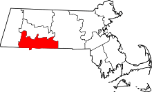 | |
| Towns | ||
| CDPs | ||
| Other villages | ||
| Footnotes | ‡This populated place also has portions in an adjacent county or counties | |