Tiverton Four Corners Historic District
|
Tiverton Four Corners | |
|
pictured in 2008 | |
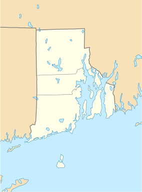  | |
| Location | Tiverton, RI |
|---|---|
| Coordinates | 41°34′17″N 71°11′18″W / 41.57139°N 71.18833°WCoordinates: 41°34′17″N 71°11′18″W / 41.57139°N 71.18833°W |
| Area | 50 acres (20 ha) |
| Architectural style | American colonial |
| NRHP Reference # | 74000042[1] |
| Added to NRHP | 1974 |
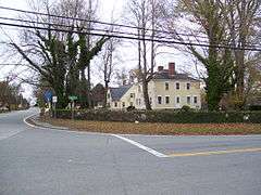
Tiverton Four Corners is a historic district encompassing the main village center of Tiverton, Rhode Island. The district extends along Main Road north and south from its junction with East and West Roads. The 50-acre (20 ha) area includes a number of predominantly 18th and early 19th-century houses, as well as the 1868 Union Public Library and mill-related resources at the Mill Pond which lies just southeast of the main intersection. The area was among the first to be laid out by English settlers in the late 17th century.[2]
The district was added to the National Register of Historic Places in 1974.
 pictured in 2008
 pictured in 2008
 pictured in 2008 with Gray's Icecream
See also
References and external links
- ↑ National Park Service (2010-07-09). "National Register Information System". National Register of Historic Places. National Park Service.
- ↑ "NRHP nomination for Tiverton Four Corners Historic District" (PDF). Rhode Island Preservation. Retrieved 2014-09-25.
| Topics | |
|---|---|
| Lists by states |
|
| Lists by insular areas | |
| Lists by associated states | |
| Other areas | |
| |
This article is issued from Wikipedia - version of the 11/26/2016. The text is available under the Creative Commons Attribution/Share Alike but additional terms may apply for the media files.