Tivat
| Tivat Тиват | ||
|---|---|---|
| Tivat | ||
.jpg) | ||
| ||
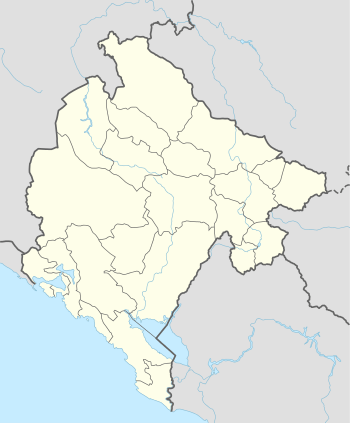 Tivat Location of Tivat | ||
| Coordinates: 42°26′N 18°42′E / 42.43°N 18.70°ECoordinates: 42°26′N 18°42′E / 42.43°N 18.70°E | ||
| Country |
| |
| Founded | 14th century | |
| Settlements | 12 | |
| Government | ||
| • Mayor | Snežana Matijević (DPS) | |
| • Ruling party | DPS -SD - HGI | |
| Area | ||
| • Total | 46 km2 (18 sq mi) | |
| Population (2011 census) | ||
| • Total | 10,149 | |
| • Density | 296/km2 (770/sq mi) | |
| • Municipality | 14,111 | |
| Demonym(s) | Tivćani | |
| Time zone | CET (UTC+1) | |
| • Summer (DST) | CEST (UTC+2) | |
| Postal code | 85320 | |
| Area code | +382 32 | |
| ISO 3166-2 code | ME-19 | |
| Car plates | TV | |
| Website | http://www.tivat.travel/ | |

Tivat (Montenegrin Cyrillic: Тиват, pronounced [tîv̞at]) is a coastal town in southwest Montenegro, located in the Bay of Kotor. As of 2011, its population was 14,111. Tivat is the centre of Tivat Municipality, which is the smallest municipality by area in Montenegro.
Name
In Serbo-Croatian the town is known as Tivat (Тиват); in Italian and Venetian as Teodo; the name of the city comes from Greek Θείοδος (Thiodhos meaning "way of God").
Geography
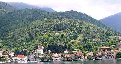
Tivat is located in the central part of the Bay of Kotor (Boka Kotorska, or simply "Boka"), south of mount Vrmac. The municipality lies mostly south of the town, and has an exit to open sea at the tourist location Pržno inlet near Radovići village to the south. Its central part, where Tivat Airport is located, lies in fertile Grbalj valley. The airport is located near the isthmus of Luštica peninsula, which belongs to the municipality of Herceg Novi for the most part.
Its geographical position, climate and natural beauty make it an attractive tourist destination. Boka was described and celebrated in verse by many poets, writers and scientists: Vuk Karadžić, Ljubomir Nenadović, Petar II Petrović-Njegoš, Simo Matavulj, Laza Kostić, Aleksa Šantić, Jovan Cvijić and many others. Boka has captured many writers of travels from England, Germany and France, among them: Padget, Lamb, Fraser, Gilles Verne and Pierre Loti. American Boyd said: ”God made the world in six days, and on the seventh day he took his time and created this fjord under Lovcen.”
Tivat has about 14,000 inhabitants. It is 19 kilometres (12 miles) away from Herceg Novi, 17 km (10.6 mi) away from Kotor, 23 km (14 mi) away from Budva, 80 km (50 mi) from Dubrovnik and 90 km (56 mi) from Podgorica. Geomorphologically, Tivat is composed of three areas. The first is the hills and peaks of Vrmac, Velji Vrh (710 metres (2,329 feet)) and Popova glava (584 metres (1,916 feet)). Water activity formed capes Seljanovo, Pakovo and Račica. The second area is Tivat field, flattened by water activity. The third area is Krtoli with islands – Island of Flowers, St. Marko, and Lady of Mercy which is bordered by Novski bay on the north-west and Grbalj area on the south-east.
History
According to legend, Tivat is derived from Illyrian queen Teuta.[1] Teuta had a residence in Rhizon and a summer residence between the church of St. Rocco in Donja Lastva and Seljanovo. The name could also come from the names of old Christian saints: Saint Theodulus, Theodocius or Theodotus. Besides the popular name Theudo, a Latin expression Latus Tiuveti comes from the 16th century. Finally, the name could originate from Celtic word "touto", town. Archaeological sites attest that the area was inhabited in antiquity, with Greek and Roman settlements. Tombs and tombstones from the Roman period were discovered in Lastva and Opatovo.
Tivat, the youngest town in the Boka area was established on the plateau at the bottom of Vrmac. According to the archives of Kotor (Cattaro), Teude, Theode, and Theudo was used for the settlement in the 14th century. During the Middle Ages the fertile lands of the area belonged mostly to the aristocrats of Cattaro, Prčanj and Dobrota. Estates, castles and chalets were there as well as the collective church of St. Anton dating from 1373. Part of this inheritance, which was the property of the wealthy Buća family, is a historic chalet which today houses Tivat's museums and galleries. The residence of the metropolitan of the bishopric of Zeta was built from the 13th to the 15th century on the Prevlaka Island. Tivat, known as Teodo in Venetian, was under the Republic of Venice as a part of Albania Veneta from 1420 to 1797. In those centuries Teodo enjoyed economic development that attracted many Serb refugees from Ottoman-held areas. Some Venetian-style buildings are still standing today.
Rapid development of Tivat started in the second half of 19th century when the Austrian empire built a maritime arsenal for its fleet. Still the town shaped itself by developing small industry. In the beginning of 1918, in the Tivat Bay sailors revolted against the mighty Austrian empire. With great approval and support, people from this area followed their revolutionary actions. The period between two world wars was marked with syndicate activity in Račica, Krtoli and Arsenal. Between 1941 and 1943 the town was part of the Italian Governatorate of Dalmatia.
In 1889 the Naval arsenal was built by Austrians, and was later used as a naval military base of the Italian Navy, the Yugoslav People's Army and the Army of Montenegro. The JNA enjoyed an international reputation as a powerful, well-equipped, and well-trained force. The base was also used by Russia and Libya as the technical base for maintenance, repair and overhaul (MRO) of their ships and submarines.
The new owner of the naval base, Canadian billionaire Peter Munk, announced plans in 2011 to build in Tivat a luxury marina for mega-yachts, "Porto Montenegro", which he claims will turn the city into the "Monaco of the southern Adriatic."
Government
The municipal parliament consists of 32 deputies elected directly for a five-year term. Following the last local election held on 17 April 2016, the ruling DPS has an absolute majority with 17 deputies. The election was boycotted by opposition parties DF, Democrats, URA and Demos.[2]
| Party | Seats |
|---|---|
| Democratic Party of Socialists (DPS) | 17 |
| Social Democrats (SD) | 4 |
| Social Democratic Party (SDP) | 2 |
| Socialist People's Party (SNP) | 2 |
| Tivat Action (TA) | 2 |
| Croatian Civic Initiative (HGI) | 2 |
| Democratic Serb Party (DSS) | 1 |
| Arsenal for Tivat (AzT) | 1 |
| Boka Forum (BF) | 1 |
Population

Ethnic groups (2011)
Tivat is the administrative centre of Tivat municipality, which has a population of 14,031 (2011).
In 1991 the municipality had a population of 11,404:
- 3,809 Montenegrins (33.4%)
- 2,663 Croats (23.35%)
- 2,346 Yugoslavs (20.57%)
- 1,724 Serbs (15.11%)
- 219 Muslims (1.92%)
- 485 others (4.27%)
In 2011 the municipality had a population of 14,031:[3]
- 4,666 Montenegrins (33.25%)
- 4,435 Serbs (31.61%)
- 2,304 Croats (16.42%)
- 335 Egyptians (2.39%)
- 114 Muslims (0.81%)
- 97 Albanians (0.69%)
- 96 Bosniaks (0.68%)
- 61 Yugoslavs (0.43%)
- 57 Slovenes (0.41%)
- 56 Russians (0.4%)
- 35 Roma (0.25%)
- 500 others (3.56%)
- 1,275 undeclared (9.09%)
Languages
- Serbian: 5,493 (38.93%)
- Montenegrin 4,319 (30.61%)
- Croatian 1,167 (8.27%)
- Serbo-Croatian 876 (6.2%)
- Albanian 401 (2.84%)
- rest and undeclared: 1855 (13.15%)
Tourism
Already a popular tourist resort, Tivat is set to become a nautical tourism centre for the southern Adriatic.
The inlets near Prevlaka, as well as the localities of Župa and Kalimanj, provide great conditions for the construction of marinas and yachting clubs. Canadian businessman Peter Munk bought a naval shipyard in Tivat, intending to transform it into a luxury vacation resort and a marina for luxury yachts called Porto Montenegro.
In 1971 Tivat Airport acquired a modern runway and is now a significant airport for foreign air traffic. It served 573,914 passengers in 2007.
Although it is the youngest town in the Boka region, Tivat has many attractive destinations. Renaissance Summer House Buca in the centre of city, Ostrvo Cvijeća (Flowers’ Island) with sacred monuments, Gornja Lastva, the old nucleus at an altitude of 300 m (984.25 ft), the magnificent sandy beach at Plavi Horizonti and the Sveti Marko Island with ex-Club Med cottages are the most visited. In the city itself there is the natural port Kalimanj. There is also a choice of cultural events, such as "Bocce Olympiad" and "Summer Fest". Tivat boasts a botanic garden planted with gifts from Bokan sailors who brought back a wide variety of exotic tree species and ornamental plants from their voyages. It is very popular and beautiful place to visit, though some hotels and apartments there are still in the process of construction.
Transport
Tivat is connected with the rest of Montenegro by the Adriatic Highway, a two-laned road that runs down the length of Montenegrin coast. Travelling inland is possible by leaving the Adriatic Highway at Budva or Sutomore (through the Sozina tunnel).
A ferry operates on the Kamenari - Lepetane line across the Verige strait, eliminating the need to go all the way around Boka Kotorska bay in order to reach the Herceg Novi riviera. It is speculated that a future Verige bridge will be constructed across the bay.
Tivat Airport is 3 km (1.9 mi) away. This is the biggest airport in Montenegro, although Podgorica airport is more modern. There are regular flights to Belgrade throughout the year, and dozens of charter planes land daily at Tivat Airport during the summer season.
Twin towns
Tivat is twinned with:
References
- ↑ Boka. 1–3. 1969. pp. 223–224.
- ↑ DPS-u apsolutna vlast u Tivtu
- ↑ http://www.monstat.org/userfiles/file/popis2011/saopstenje/saopstenje(1).pdf
- ↑ Mola di Bari: colori suoni memorie di Puglia, p.
Bibliography
- Calabrese M., Mola di Bari: colori suoni memorie di Puglia, Laterza, Bari, 1987.
External links
| Wikimedia Commons has media related to Tivat. |
- 360 PANOTOUR TIVAT
- Tivat City Travel Guide
- Destination-Montenegro.com
- Visit-Montenegro.com
- Photo-Montenegro.com
- Tivat Travel Guide
- Tourist Organization of Tivat
- Apartments in Tivat
- A New Playground for the Rich - slideshow by The New York Times