Tiszaföldvár
| Tiszaföldvár | |
|---|---|
|
Aerial view | |
 Tiszaföldvár | |
| Coordinates: 46°59′N 20°15′E / 46.983°N 20.250°E | |
| Country |
|
| County | Jász-Nagykun-Szolnok |
| District | Kunszentmárton |
| Area | |
| • Total | 80.34 km2 (31.02 sq mi) |
| Population (2002) | |
| • Total | 12,027 |
| • Density | 150/km2 (400/sq mi) |
| Time zone | CET (UTC+1) |
| • Summer (DST) | CEST (UTC+2) |
| Postal code | 5430 |
| Area code(s) | 56 |

Tiszaföldvár is a town in Jász-Nagykun-Szolnok county, in the Northern Great Plain region of central Hungary.
Geography
It covers an area of 80.34 km2 (31 sq mi) and has a population of 12,027 people (2002).
Gallery
 Tiszaföldvár name written in both Szekely-Hungarian script (bottom) and Latin letters (top).
International relations
Twin towns — Sister cities
Tiszaföldvár is twinned with:
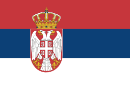 Bačko Gradište (Bácsföldvár), Serbia; since 2006
 Gräfenberg, Germany; since 2003
 Hérimoncourt, France; since 2004
 Mielec, Poland;[1] since 2006
"Földvár" named settlements[2]
References
- ↑ "Mielec- Miasta Partnerskie" [Mielec - Partnership Cities]. Oficjalny serwis Urzędu Miejskiego w Mielcu [Mielec City Council] (in Polish). Archived from the original on 2013-08-21. Retrieved 2013-08-25.
- ↑ tiszafoldvar.hu, Földvárak
External links
- Official site in Hungarian
| Cities and towns |  | |
|---|---|---|
| Villages |
| |
| Other topics |
| |
Coordinates: 46°59′N 20°15′E / 46.983°N 20.250°E
This article is issued from Wikipedia - version of the 10/19/2016. The text is available under the Creative Commons Attribution/Share Alike but additional terms may apply for the media files.