Tiritiri Matangi Island
 Tiritiri Matangi Lighthouse and ranger station. | |
| Geography | |
|---|---|
| Coordinates | 36°36′S 174°53′E / 36.60°S 174.89°E |
| Area | 2.2 km2 (0.85 sq mi) |
| Administration | |
| Demographics | |
| Population | (?) |
Tiritiri Matangi Island lies in the Hauraki Gulf of New Zealand, 3.4 km (2.1 mi) east of the Whangaparaoa Peninsula[1] in the North Island and 30 km (19 mi) north east of Auckland. The 2.2 km2 (1 sq mi) island is an open nature reserve[1] managed by the Supporters of Tiritiri Matangi Incorporated, under the supervision of the Department of Conservation and is noted for its bird life, including takahē, North Island kōkako and kiwi. It attracts between 30,000 and 32,000 visitors a year, the maximum allowed by the Auckland Conservation Management Strategy.[1]
The name, meaning "tossed by the wind" in Māori, is often popularly shortened to Tiritiri. Māori mythology considers the island to be a float of an ancestral fishing net.[2]
Coordinates: 36°36′S 174°53′E / 36.60°S 174.89°E
History
Human use
The first people to settle on the island were Māori of the Kawerau iwi.[1] Later, members of the Ngati Paoa moved to the island, like the Kawerau partly for shark fishing[1] until about 1700, when the Kawerau regained control and remained until forced to retreat to Waikato in 1821 when Hongi Hika attacked from the north. There were two pā, Tiritiri Matangi Pā and Papakura Pā.[2]
European (Pākehā) settlers arrived in the early 19th century. In 1841 Ngati paoa sold the land to the crown as part of the Mahurangi Block. When the Kawerau returned, friction ensued as both peoples had a claim to the island. In 1867 the Māori Land Court awarded title to the crown.
A lighthouse was constructed near the southern end in 1864, and remains in operation. The island was farmed from the mid 1800s to 1971[3] , when the lease expired. Management was then vested in the Hauraki Gulf Maritime Park Board.[1] In 1956, a xenon light source was fitted to the lighthouse, creating the most powerful light-beam achieved at the time by a New Zealand lighthouse. It had an output of 11 million candle-power and a range of 58 nautical miles, making it one of the most powerful lights in the world; most lights shone for 27 nautical miles.[4]
Regeneration and sanctuary
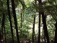
It was hoped that native forest would regenerate naturally, making the island a suitable habitat for native bird life, as it lacked introduced predators such as mustelids present on the mainland. However, afforestation seemed to be happening very slowly and a large number of volunteers were recruited to plant saplings and sow tree seeds. Over 250,000 native trees and shrubs of over 30 different species were planted in the revegetation project from 1984 to 1994.[2]
The next intervention was eradication in 1993 of the Polynesian rat, known to Māori as kiore, which was destroying seedlings and competing with birds for food. The kiore were killed by an aerial drop of poisoned bait, which was controversial due to its lack of planning and the effect on other wildlife. For instance, 90% of pukeko on the island were killed.[5]
Eighty-seven species of birds have been observed on or near the island. Eleven native species have been translocated to the island as part of the ongoing restoration project.[6] These are kākāriki / red crowned parakeet, tīeke / North Island saddleback, pāteke / brown teal, pōpokotea / whitehead, takahē, little spotted kiwi, hihi / stitchbird, North Island kōkako, mātātā / fernbird, miromiro / North Island tomtit and tītipounamu / rifleman. Non-avian translocations include a reptile tuatara in 2003, Duvaucel's gecko in 2006 and a large insect wetapunga in 2011. Non-native species present include the Australian brown quail. The success of the conservation project encouraged the creation of a number of similar projects around the Gulf,[2] such as on Motuihe, Motuora and Motutapu. The closest land on the tip of the Whangaparaoa Peninsula, Shakespear Regional Park has recently (2011) also become a mammalian pest-free fenced sanctuary, increasing immigration of the birds on Tiritiri to the nearby mainland.
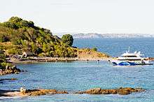
A ferry service runs from Auckland Ferry Terminal[2] and Gulf Harbour, and guided tours are available. It is a popular destination for daytrippers, with trips often fully booked,[2] attracting some 30,000 visitors annually, who enjoy an intensity of birdsong rarely heard on the mainland. The island has hosted several tens of thousands of conservation volunteers.[2]

See also
References
- 1 2 3 4 5 6 "Auckland Places - Tiritiri Matangi Island". Te Ara Encyclopedia of New Zealand. Government of New Zealand. Retrieved 3 March 2010.
- 1 2 3 4 5 6 7 "The Hauraki Gulf Marine Park, Part 2". Inset to The New Zealand Herald. 3 March 2010. p. 8.
- ↑ Rimmer, Anne (2004). Tiritiri Matangi A Model of Conservation. Random House. ISBN 978 186979 185 8.
- ↑ http://www.maritimenz.govt.nz/about/what-we-do/history-of-MNZ/timeline.asp#800_AD
- ↑ Armstrong, Doug (1999). Tiritiri Matangi Island Restoration Programme - Kiore eradication. Massey University. Archived via WebCite on 21 April 2011.
- ↑ Tiritiri Matangi Ecosystem Restoration (from the Department of Conservation website)
External links
| Wikimedia Commons has media related to Tiritiri Matangi Island. |
| Wikivoyage has a travel guide for Tiritiri Matangi Island. |
- Supporters of Tiritiri Matangi - conservation group
- Tiritiri Matangi Scientific Reserve (Open Sanctuary) at the Department of Conservation
- Audio tour of Tiritiri Matangi, part 1 (Graeme Hill)
- Audio tour of Tiritiri Matangi, part 2 (Graeme Hill)
- Photographs of Tiritiri Matangi Island held in Auckland Libraries' heritage collections.
-
 Geographic data related to Tiritiri Matangi Island at OpenStreetMap