Tintinara, South Australia
| Tintinara South Australia | |||||||||||||
|---|---|---|---|---|---|---|---|---|---|---|---|---|---|
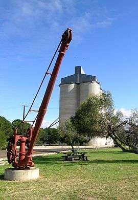 The wheat silo and railway crane at Tintinara. | |||||||||||||
 Tintinara | |||||||||||||
| Coordinates | 35°53′0″S 140°03′0″E / 35.88333°S 140.05000°ECoordinates: 35°53′0″S 140°03′0″E / 35.88333°S 140.05000°E | ||||||||||||
| Population | 257 (2006 census)[1] | ||||||||||||
| Established | 1850s | ||||||||||||
| Postcode(s) | 5266 | ||||||||||||
| Elevation | 20 m (66 ft) | ||||||||||||
| Location | 190 km (118 mi) SE of Adelaide | ||||||||||||
| LGA(s) | The Coorong District Council | ||||||||||||
| State electorate(s) | MacKillop | ||||||||||||
| Federal Division(s) | Barker | ||||||||||||
| |||||||||||||
Tintinara is a town located in the Murray Mallee region of South Australia.
The town is situated on Dukes Highway and the Adelaide-Melbourne railway line. It is in The Coorong District Council local government area, the South Australian House of Assembly Electoral district of MacKillop and the Australian House of Representatives Division of Barker. At the 2006 census, Tintinara had a population of 257.[1]
The origin of the name has been debated. One possibility is that a local Aborigine in the area was named Tin-Tin, and the 'ara' was appended to form the placename; or that the Aborigine, one of the Boothbys' employees, was named Tintinara.[3] It has also been suggested that the name may have been a corruption of an Aboriginal word, tinlinyara, which is the word for the stars in Orion's belt.
History
The area was first settled by Europeans in the 1840s when graziers moved their flocks of sheep into the district. Shortly afterwards the 'Tintinara' homestead was erected by the brothers T. W. Boothby and J. H. Boothby, who held a lease of 165 sq.miles here. In 1865 the new owners, William Harding and George Bunn, built the magnificent 16-stand shearing shed which is now classified by the National Trust, along with the homestead.[4]
The Tintinara wells and Reedy Wells were regular watering points for Tolmer's gold escort team. Tintinara post office was opened in the 1860s.[5]
Tintinara is situated in what was an unproductive region because of its poor sandy soils, and low mallee scrub and heath vegetation. After clearing of some of this vegetation, and the addition of trace elements, the district has become a productive farming area.[5] One of the main environmental areas that Tintinara has is Lake Indawarra.[5]
Community organisations
Generally
Tintinara has many different community organisations including the Tintinara Action Club and Tintinara Lions Club as well as many different facilities including:
- Tintinara Cricket Club
- Border Downs Tintinara Football & Netball Club
- Tintinara Bowling Club
- Tintinara Golf Club
- Tintinara Tennis Club
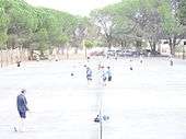
Tintinara Tennis Club
The Tintinara Tennis Club was established in 1919 by Edward B. Northcott and Fanny and Tilly Williams. There were approximately 40 members when the club formed. The facilities consisted of two courts that were used for many years, then in the summer of 1951-52 games started on four new courts. Since then more courts have been added and a new clubhouse was completed in 1966.[6] Currently the club has 6 courts and a clubhouse.
References
- 1 2 Australian Bureau of Statistics (25 October 2007). "Tintinara (L) (Urban Centre/Locality)". 2006 Census QuickStats. Retrieved 29 October 2011.
- 1 2 3 4 5 6 7 8 "Search result for "Tintinara (Locality Bounded)" (Record no SA0035206) with the following layers selected - "Suburbs and Localities" and "Government Towns"". Department of Planning, Transport and Infrastructure. Retrieved 9 April 2016.
- ↑ "Steam Applied to Agriculture". The Advertiser (Adelaide, SA : 1889 - 1931). Adelaide, SA: National Library of Australia. 2 October 1905. p. 6. Retrieved 5 July 2015.
- ↑ "Tintinara Tourist Information". TRADE Inc. Retrieved 24 May 2011.
- 1 2 3 Reader's Digest Illustrated Guide to Australian Places. Sydney, NSW: Reader's Digest. 1993. p. 502. ISBN 0-86438-399-1.
- ↑ Twelftree, Pat (1974) The History of Tintinara and District, Coudrey Offset Press Pty. Ltd., pg.44
External links
| Wikimedia Commons has media related to Tintinara, South Australia. |