Tingi Hills Forest Reserve
| Tingi Hills Forest Reserve | |
|---|---|
|
IUCN category II (national park) | |
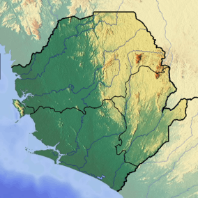 | |
| Location | Sierra Leone |
| Nearest city | Sefadu |
| Coordinates | 8°55′18″N 10°46′39″W / 8.92168°N 10.77744°WCoordinates: 8°55′18″N 10°46′39″W / 8.92168°N 10.77744°W |
| Area | 118.85 km2 (45.89 sq mi) |
| Established | 1947 |
The Tingi Hills Forest Reserve is located in a mountain range in the east of Sierra Leone and occupies an area of 118.85 km2 (45.89 sq mi).[1] It became a forest reserve in 1947 and a non-hunting forest reserve in 1973. The area reaches from an altitude of 400 to 1850 metres at the north peak of the dual peaked Sankan Biriwa massif. In the lower regions the area consists of forest interspersed with savannah then moves into shrub savannah and then mountain grassland at higher altitudes. Over 200 Species of birds have been recorded in the area and the reserve is also home to western baboons and forest elephants.[2] [3]
References
- ↑ World Database on Protected Areas: site Information, UN Environment Programme World Conservation Monitoring Centre, retrieved on 12 November 2007
- ↑ Eco-Tourism, Sierra Leone National Tourist Board, retrieved on 17 November 2007
- ↑ BirdLife IBA Factsheet: Tingi Hills Non-hunting Forest Reserve, BirdLife International (2007, retrieved on 17 November 2007
See also
Protected areas of Sierra Leone
This article is issued from Wikipedia - version of the 11/18/2016. The text is available under the Creative Commons Attribution/Share Alike but additional terms may apply for the media files.