Tiki Island, Texas
| Tiki Island, Texas | |
|---|---|
| Village | |
 Location of Tiki Island, Texas | |
| Coordinates: 29°17′56″N 94°54′52″W / 29.29889°N 94.91444°WCoordinates: 29°17′56″N 94°54′52″W / 29.29889°N 94.91444°W | |
| Country | United States |
| State | Texas |
| County | Galveston |
| Government | |
| • Mayor | Phillip M. Hopkins[1] |
| Area | |
| • Total | 1.4 sq mi (3.6 km2) |
| • Land | 0.5 sq mi (1.3 km2) |
| • Water | 0.9 sq mi (2.3 km2) |
| Elevation | 0 ft (0 m) |
| Population (2010) | |
| • Total | 968 |
| • Density | 700/sq mi (270/km2) |
| Time zone | Central (CST) (UTC-6) |
| • Summer (DST) | CDT (UTC-5) |
| ZIP code | 77554 |
| Area code(s) | 409 |
| FIPS code | 48-72989[2] |
| GNIS feature ID | 1388537[3] |
| Website | http://www.villageoftikiisland.org/ |
Tiki Island is a village in Galveston County, Texas, United States. The population was 968 at the 2010 census.[4]
History and government
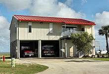
Tiki Island was incorporated as a village on August 30, 1982.[1] It has a full-time police department and volunteer fire department. Lacking its own post office, mail delivery is the responsibility of the nearby Galveston post office.[5] [6]

Geography

According to the United States Census Bureau, the village has a total area of 1.4 square miles (3.6 km2), of which 0.50 square miles (1.3 km2) is land and 0.89 square miles (2.3 km2), or 64.41%, is water.[7]
The street names have a Polynesian theme: Bamboo, Castaway, Bora Bora, Coconut, Copra, Diamond Head, Easterly, Hawaii, Kona, Lanai, Leilani, Lotus, Majuro, Mango, Maui, Moorea, Oahu, Outrigger, Palmetto, Papeete, Paradise, Port O'Call, Tahiti, and Wahini.[8]
Demographics
| Historical population | |||
|---|---|---|---|
| Census | Pop. | %± | |
| 1990 | 537 | — | |
| 2000 | 1,016 | 89.2% | |
| 2010 | 968 | −4.7% | |
| Est. 2015 | 1,026 | [9] | 6.0% |
As of the census[2] of 2000, there were 1,016 people, 482 households, and 349 families residing in the village. The population density was 1,567.7 people per square mile (603.5/km²). There were 746 housing units at an average density of 1,151.1 per square mile (443.1/km²). The racial makeup of the village was 96.26% White, 0.30% African American, 0.39% Native American, 0.98% Asian, 0.10% Pacific Islander, 0.98% from other races, and 0.98% from two or more races. Hispanic or Latino of any race were 3.64% of the population.
There were 482 households out of which 13.7% had children under the age of 18 living with them, 68.9% were married couples living together, 1.7% had a female householder with no husband present, and 27.4% were non-families. 20.3% of all households were made up of individuals and 3.7% had someone living alone who was 65 years of age or older. The average household size was 2.11 and the average family size was 2.40.
In the village the population was spread out with 10.8% under the age of 18, 3.0% from 18 to 24, 24.3% from 25 to 44, 49.5% from 45 to 64, and 12.4% who were 65 years of age or older. The median age was 50 years. For every 100 females there were 109.5 males. For every 100 females age 18 and over, there were 107.8 males.
The median income for a household in the village was $88,891, and the median income for a family was $93,129. Males had a median income of $69,792 versus $35,333 for females. The per capita income for the village was $54,611. About 0.8% of families and 2.0% of the population were below the poverty line, including 4.7% of those under age 18 and none of those age 65 or over.
Education
The eastern half of Tiki Island is zoned to the Texas City Independent School District (TCISD). The western half is zoned to the Hitchcock Independent School District (HISD).[11]
On December 02, 2015, Texas Education Agency (TEA) Commissioner Michael Williams announced that TCISD would absorb La Marque Independent School District (LMISD), which previously served the eastern half of Tiki Island, effective July 1, 2016.[12][11]
All of Tiki Island is served by the College of the Mainland.
References
- 1 2 "Village of Tiki Island", Tiki Island Official Webpage
- 1 2 "American FactFinder". United States Census Bureau. Retrieved 2008-01-31.
- ↑ "US Board on Geographic Names". United States Geological Survey. 2007-10-25. Retrieved 2008-01-31.
- ↑ "Profile of General Population and Housing Characteristics: 2010 Demographic Profile Data (DP-1): Tiki Island village, Texas". U.S. Census Bureau, American Factfinder. Retrieved January 10, 2012.
- ↑ Jasinski, Laurie. "Village of Tiki Island, Texas". Texas State Historical Association: Handbook of Texas.
- ↑ "United States Postal Service zip code database". United States Postal Service.
- ↑ "Geographic Identifiers: 2010 Demographic Profile Data (G001): Tiki Island village, Texas". U.S. Census Bureau, American Factfinder. Retrieved January 10, 2012.
- ↑ "It's 5 o'clock somewhere." (click the picture of the beach) Houston Chronicle. Retrieved on February 12, 2015.
- ↑ "Annual Estimates of the Resident Population for Incorporated Places: April 1, 2010 to July 1, 2015". Retrieved July 2, 2016.
- ↑ "Census of Population and Housing". Census.gov. Retrieved June 4, 2015.
- 1 2 "SCHOOL DISTRICT REFERENCE MAP (2010 CENSUS): Galveston County, TX." U.S. Census Bureau. Retrieved on January 4, 2015.
- ↑ Daughtry, Shannon. "TEA: Texas City ISD to annex La Marque ISD ." The Galveston County Daily News. Wednesday December 2, 2015. Retrieved on January 12, 2016. "Texas City ISD will annex La Marque ISD into its school district beginning in the 2016-17 school year."
External links
- Village of Tiki Island official website
- Tiki Island, Texas - Handbook of Texas Online article
Municipalities and communities of Galveston County, Texas, United States | ||
|---|---|---|
| Cities |  | |
| Village | ||
| CDPs | ||
| Unincorporated communities | ||
| Footnotes | ‡This populated place also has portions in an adjacent county or counties | |
| Counties | 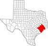 | |
|---|---|---|
| "Principal" cities | ||
| Other cities |
For a complete listing, see list of cities and towns in Houston–The Woodlands–Sugar Land MSA | |
| Unincorporated areas | ||
| Bodies of water | ||
