Tierrasanta, San Diego
| Tierrasanta, San Diego | |
|---|---|
| Community of San Diego | |
| Tierrasanta | |
|
The Tierrasanta sign located on Santo Road | |
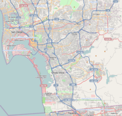 Tierrasanta, San Diego Location within San Diego | |
| Coordinates: 32°49′15″N 117°05′47″W / 32.820833°N 117.096389°W | |
| Country |
|
| State |
|
| County |
|
| City |
|
| Elevation | 108 m (354 ft) |
| Highest elevation | 240 m (780 ft) |
| Lowest elevation | 50 m (180 ft) |
| Population (2010) | |
| • Total | 30,443 |
| Area code(s) | 858 |

Tierrasanta, Spanish for "holy land," or "holy ground", is a community within the city of San Diego, California. The symbol of Tierrasanta is an encircled Conquistador cross, similar to one atop Montserrat (mountain) near Barcelona, Spain, though it no longer holds any religious meaning. The community is referred to as "The Island in the Hills" by locals and on welcome signs.
History
Tierrasanta was originally part of the Mission San Diego de Alcalá ranch, which was active during the late 18th and 19th centuries. The U.S. military purchased the land in 1941 as Camp Elliott, a Marine Corps training facility. The Marines moved out in 1944 and the land was transferred to the Navy. It was deactivated in 1946. In 1961, the U.S. Government sold the area that is now Tierrasanta and a portion of neighboring Mission Trails Regional Park to the City of San Diego. In the following year, the Elliott Community Plan was issued to serve as a roadmap for development going forward, and in 1971 Tierrasanta was founded. The current Tierrasanta community plan was first issued in 1982,[1] and included both the currently developed area and much of what is now Mission Trails Regional Park. By 1982 approximately one-half of the private residential area had been developed, with the area called Tierrasanta Norte, in the northeastern part of town, being one of the locations still to be developed. Tierrasanta has been almost fully built out since the early 1990s, and in 2010 had a population of 30,443 (ZIP code 92124).[2] Some 2,300 homes grouped in the southwest portion of town are part of the Murphy Canyon military housing complex. Tierrasanta was one of the first master planned communities in San Diego.
Because of the area's history as a military training base, some military debris including unexploded ordnance remained in the area when it was developed, in spite of multiple cleanup efforts by different branches of the services. In 1983 two 8-year-old Tierrasanta boys were killed after discovering unexploded ordnance in a canyon near their home.[3] The Navy performed surface clearance operations in 1984 and 1985. Between 1990 and 1995 the U.S. Army Corps of Engineers removed several tons of ordnance and debris under its FUDS (Formerly Used Defense Sites) program. The Corps continues to monitor the area.
In October 2003, Tierrasanta, among other communities in San Diego, was affected by what was known as "Firestorm 2003." This was a conglomeration of the Cedar Fire and numerous other wildfires that converged on Southern California. The residents of Tierrasanta were forced to evacuate. Nearly a dozen homes were lost to the blaze.[4] Shortly after, in 2004, the Tierrasanta Community Emergency Response Team (T-CERT) was created for rapid local response to natural disasters. A similar scare swept through Tierrasanta in the fall of 2007, though residents were not required to evacuate.
Geography
The developed part of Tierrasanta, which rises from west to east and includes numerous canyons, is situated like an island, not directly bordered by any other community. It is bounded on the north by the Mount Soledad (52) Freeway and the sprawling southern fields of MCAS Miramar; on the east by the 5,800-acre (23 km2) Mission Trails Regional Park, which has numerous hiking and mountain biking trails; on the west by slopes overlooking the wide Interstate 15 corridor running from Friars Road to Route 52, and on the south by slopes overlooking the San Diego River and Mission Valley. Community activities focus on the Tierrasanta Recreation Center, which includes lighted sports fields, a large swimming pool, tennis courts, a gymnasium, and meeting rooms.[5] Numerous green belts with walking paths run through the canyons, and are kept in good condition with the help of the Friends of the Tierrasanta Canyons.[6] There are a number of entrances to Mission Trails Regional Park, including a heavily used entrance with parking at the eastern end of Clairemont Mesa Boulevard. The community has tree-lined streets and a secluded "small town" atmosphere, though it is centrally located within a 20-minute drive to downtown San Diego.
Like most of the coastal areas in Southern California, the natural habitat in the canyons and other undeveloped areas within Tierrasanta, as well as in much of MCAS Miramar and Mission Trails Regional Park, is coastal sage scrub.
Tierrasanta is a community of single family homes, condominiums, apartments, three shopping centers, a branch of the San Diego Public Library, and a research park. Also located in the community are several top-ranked elementary and middle schools, part of the San Diego Unified School District, including Junípero Serra High School.
Government and culture
The elected Tierrasanta Community Council (TCC), which includes members from each of eight areas, has responsibility for community planning and for advising the City of San Diego and other government agencies on local issues. The TCC supports numerous events in the community such as the Concert in the park series, the Patriots Day Parade honoring Armed Forces Day on the third Saturday in May, Oktoberfest and other events. The TCC represents the citizens as their voice to the city government on land use and planning issues. The TCC also acts as the community's Town Council and takes positions on things that affect the Tierrasanta Community and the City of San Diego.
Dedicated open space areas and landscaped medians are maintained by the Tierrasanta Maintenance Assessment District, which was established in 1972 and most recently approved by voters in 1997. The 818 acres of Tierrasanta Open Space qualifies this urban park as one of the 150 largest in the United States.
The Friends of Tierrasanta Canyons is a Tierrasanta-based volunteer group that maintains the open spaces of the neighborhood's canyons. They meet the second Saturday of every month in various Tierrasanta open space locations.
San Diego City Councilman Scott Sherman represents Tierrasanta and the entire District 7 in the city of San Diego.
Cultural amenities
The community has a branch library, jogging/biking trails, and several baseball and soccer teams. Music falling under the categories of jazz and instrumental concert band is quite prominent in addition to the numerous physical sports teams. The Tierra Times, a community service newspaper, has been published since 1971, and is delivered to all residents 13 times per year.
Notable residents
- Tony Hawk grew-up in Tierrasanta and attended Farb Middle School. Presently, the Tony Hawk Foundation is raising funds for a million-dollar skatepark in Tierrasanta[7]
- Bicycle racer Chris Horner grew up in Tierrasanta and attended Serra High School
- Graffiti Artist and Author Erik Wahl has lived and painted in Tierrasanta since 1996.
- Sara Ramirez moved there as a child, and grew up there.
References
- ↑ Current Community Plan
- ↑ Census Bureau Fact Sheet Zip Code 92124
- ↑ Channel 10 news, April 24, 2008
- ↑ Madaffer, Jim (October 25, 2013). "Cedar Fire Ten Years Later". Scoop San Diego. Retrieved 2014-09-23.
- ↑ Tierrasanta Recreation Center
- ↑ Friends of Tierrasanta Canyons
- ↑ Tony Hawk Foundation press release, 11/12/2008.
External links
- TownCharts Community Profile
- Tierrasanta Community Council
- Tierrasanta Foundation
- Tierrasanta Kiwanis
- Yahoo Group for Tierrasanta Norte Neighbors
Schools
- Hancock Elementary School
- Kumeyaay Elementary
- Miller Elementary
- Tierrasanta Elementary
- Vista Grande Elementary
- Gaspar de Portola Middle School
- Jean Farb Middle School
- Junipero Serra High School
Coordinates: 32°49′15″N 117°5′47″W / 32.82083°N 117.09639°W