Tiburón Island

Coordinates: 28°59′20″N 112°22′23″W / 28.98889°N 112.37306°W
| Native name: <span class="nickname" ">Spanish: Isla del Tiburón or Isla Tiburón; Seri: Tahejöc | |
|---|---|
 Location of Tiburón Island | |
|
Tiburón | |
| Geography | |
| Location | Gulf of California |
| Coordinates | 28°59′20″N 112°22′23″W / 28.98889°N 112.37306°W |
| Area | 1,201 km2 (464 sq mi) |
| Administration | |
|
Mexico | |
| State | Sonora |
| Demographics | |
| Population | uninhabited |

Tiburón Island (Spanish: Isla del Tiburón or Isla Tiburón) is the largest island in the Gulf of California and the largest island in Mexico, with an area of 464 square miles (1,200 square kilometres).[1] It was made a nature reserve in 1963 by President Adolfo López Mateos.[2] Tiburón is Spanish for shark. Although the Seri name was first recorded by Alphonse Pinart in 1879,[3] its etymology is unknown.

Tiburón Island is part of the state of Sonora, as well as the municipality of Hermosillo, and is located at approximately the same latitude as the city of Hermosillo. It is located along the eastern shore of the Gulf of California, opposite Isla Ángel de la Guarda. It is part of the chain of islands known as the Midriff Islands or Islas Grandes.
Tiburón Island is part of the traditional homeland of some bands (or clans) of the Seri people, probably for many centuries if not millennia.[4] During the 1960s and early 1970s, a small hunting and fishing camp on the northern end of the island was operated by Jesus Olivas, a resident of Hermosillo. He constructed several buildings, a dock and an airstrip near the historic Seri encampment at Tecomate. The camp was popular with American visitors to the area. The remains of the structures and airstrip are still in place (although the airstrip was rendered unusable by the Mexican military around 1995 in an attempt to keep it from being used by smugglers who were active in the area at the time). In 1975, the Mexican government, through a decree by President Echeverría, gave the Seris recognition and title of communal property ("reconocimiento y titulación de terrenos comunales") with respect to Tiburón Island.[2]
The island is uninhabited (except for Mexican military encampments on the eastern and southern shores of the island) and is administered as an ecological preserve by the Seri tribal government in conjunction with the federal government. Bighorn sheep were introduced to the island in the 1980s; hunting is managed by the tribal government in coordination with Mexican federal authorities. It is also home to a subspecies of Coyote (Canis latrans jamesi) that is found nowhere but the island.[5]
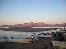
The island can be reached from Punta Chueca, which is the nearest community inhabited by members of the Seri tribe, and from Bahía de Kino, a (non-Indian) community 34 kilometres (21 miles) to the south. The distance from Punta Chueca to Punta Tormenta, the nearest point on the island, is 3 kilometres (1.9 miles). The channel between the mainland and the island is called Canal del Infiernillo ("Hell's Channel"), because of the strong tidal currents and shoal water that occur there which can make navigation challenging. The island has a prominent mountain system of volcanic origin.
Two permits are required for day hiking and overnight stays on the island: one from the Seri Governor's office in Punta Chueca and another from the ISLAS office in Bahía de Kino.
In 2012, a television episode of Survivorman Ten Days (Les Stroud) was filmed on Tiburón Island.
See also
Notes
- ↑ Geography of island
- 1 2 Comisión de Desarrollo de la Tribu Seri. (1976) Tribus de Sonora: Los seris. Hermosillo, Sonora.
- ↑ Pinart, Alphonse. 1879. [Vocabulary of the Seri] Manuscript. Bureau of American Ethnology collection, National Anthropological Archives, Smithsonian Institution, Washington, D.C. [Locator number in the Smithsonian: NAA MS 1146 , where the name “D.A. Tenechio” [sic] is used, with A. Pinart as co-creator.] ms.
- ↑ Moser, Edward W. (1963) "Seri Bands". The Kiva 28.3:14–27. (online Spanish version)
- ↑ Bekoff, Marc. (1977) Mammalian Species, No. 79, Canis latrans (Jun. 15), pp. 1-9, http://www.jstor.org/stable/3503817
External links
| Wikimedia Commons has media related to Tiburón Island. |
- Tiburón Island at gotosonora.com
- Map of Sonora at e-local.gob.mx