Thumrait
| Thumrait midway | |
|---|---|
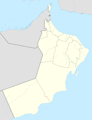 Thumrait Location in Oman | |
| Coordinates: 17°40′01″N 54°01′58″E / 17.66694°N 54.03278°E | |
| Country |
|
| Governorate | Dhofar |
| Wilayat | Thumrait |
Thumrait is a small town in southern Oman on the main road between Dhofar and the rest of Oman. In ancient times Thumrait was an important point on the Arabian peninsula's caravan routes. Frankincense trees, an important crop, used to grow in greater abundance in Thumrait than now. The main occupation of the people of Thumrait is the cultivation of fruit, vegetables and animal fodder.
Military
Thumrait is notable for its Royal Air Force of Oman station. Originally an oil depot, RAFO Thumrait was created to establish air power in that region of Oman. The first Omani air unit based at Thumrait, equipped with Hawker Hunter FG.9 aircraft, was tasked with ground attack and intercept missions. 12 new SEPECAT Jaguar fighter-bombers were added to the base's complement to improve attack capabilities in 1977.
RAFO Thumrait has been used by US, UK and Allied air forces to support operations during Operations Desert Shield and Desert Storm around the time of the Gulf War, and later in Global War on Terror operations in Afghanistan. Many current such operations now operate from Muscat International Airport, which is closer to the area of operations. [1]
Exercises held at Thumrait Air Base
In 2009, Indian Air Force pilots of ‘Flaming Arrows’ and ‘Cobras’, the two SEPECAT Jaguar Squadrons participated in joint exercises called ‘Eastern Bridge’ alongside the Royal Air Force of Oman (RAFO)'s force of SEPECAT Jaguars and General Dynamics F-16 Fighting Falcons at Thumrait Air Base. A subsequent Indo-Omani exercise, ‘Eastern Bridge-II,’ took place in 2011 at Indian Air Force Station Jamnagar (Gujarat).[2][3]
Climate
Thumrait has a hot desert climate (Köppen climate classification BWh) with very hot summers and warm winters. There is very little rainfall; some rain may occur from February to April, as well as June to August due to the monsoon.
| Climate data for Thumrait | |||||||||||||
|---|---|---|---|---|---|---|---|---|---|---|---|---|---|
| Month | Jan | Feb | Mar | Apr | May | Jun | Jul | Aug | Sep | Oct | Nov | Dec | Year |
| Record high °C (°F) | 32.6 (90.7) |
35.0 (95) |
38.6 (101.5) |
41.0 (105.8) |
43.6 (110.5) |
45.4 (113.7) |
45.0 (113) |
46.0 (114.8) |
43.8 (110.8) |
40.0 (104) |
34.4 (93.9) |
32.0 (89.6) |
46 (114.8) |
| Average high °C (°F) | 25.7 (78.3) |
28.1 (82.6) |
32.3 (90.1) |
36.0 (96.8) |
39.2 (102.6) |
40.6 (105.1) |
37.1 (98.8) |
38.2 (100.8) |
37.6 (99.7) |
34.7 (94.5) |
30.2 (86.4) |
26.1 (79) |
33.82 (92.89) |
| Daily mean °C (°F) | 18.6 (65.5) |
21.1 (70) |
24.7 (76.5) |
28.2 (82.8) |
31.3 (88.3) |
32.3 (90.1) |
29.2 (84.6) |
29.4 (84.9) |
29.0 (84.2) |
26.7 (80.1) |
23.0 (73.4) |
19.5 (67.1) |
26.08 (78.96) |
| Average low °C (°F) | 10.8 (51.4) |
14.1 (57.4) |
17.3 (63.1) |
20.6 (69.1) |
23.2 (73.8) |
24.9 (76.8) |
23.9 (75) |
23.3 (73.9) |
21.8 (71.2) |
18.4 (65.1) |
14.7 (58.5) |
12.0 (53.6) |
18.75 (65.74) |
| Record low °C (°F) | 1.6 (34.9) |
5.8 (42.4) |
8.7 (47.7) |
14.1 (57.4) |
16.6 (61.9) |
21.2 (70.2) |
21.2 (70.2) |
19.5 (67.1) |
17.1 (62.8) |
12.0 (53.6) |
9.0 (48.2) |
5.0 (41) |
1.6 (34.9) |
| Average precipitation mm (inches) | 0.7 (0.028) |
8.3 (0.327) |
17.1 (0.673) |
11.4 (0.449) |
0.0 (0) |
11.6 (0.457) |
0.1 (0.004) |
5.2 (0.205) |
0.0 (0) |
0.0 (0) |
0.0 (0) |
0.6 (0.024) |
55 (2.167) |
| Average relative humidity (%) | 54 | 53 | 46 | 41 | 43 | 44 | 63 | 58 | 51 | 41 | 47 | 54 | 49.6 |
| Source: NOAA (1980-1990) [4] | |||||||||||||
Coordinates: 17°40′01″N 54°01′58″E / 17.66694°N 54.03278°E
See also
- Railway stations in Oman - planned 2015
References
| Wikivoyage has a travel guide for Thumrait. |
- ↑ "Thumrait Air Base, Oman". Retrieved 31 January 2014.
- ↑ "Indo-Oman Air Exercise Eastern Bridge-II Concludes," , "Livefist" blog
- ↑ "Indo Oman Air Exercise – Eastern Bridge – II Concludes at Jamnagar," . official Indian Air Force English language press release
- ↑ "Thumrait Climate Normals 1980-1990". National Oceanic and Atmospheric Administration. Retrieved January 16, 2013.